Property Record
8045 S Avenida Del Yaqui, Guadalupe, AZ 85283


NEARBY LISTINGS FOR SALE OR LEASE
Property Detail
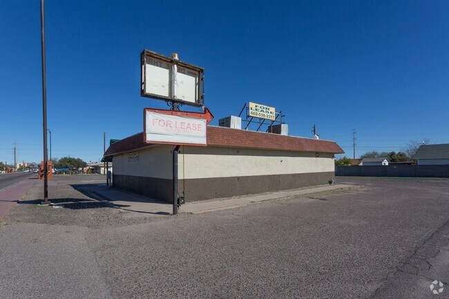
8045 S Avenida Del Yaqui
Phoenix-Mesa-Scottsdale, AZ
Lyndwood Tract
301-08-022
LYNDWOOD TRACT MCR 31/33
Storebuilding
Maricopa
X
Arizona
04013C2705L
4
2025
0.18 AC
2025
Tempe
320002
Phoenix
2,310 SF
DEMOGRAPHICS near 8045 S Avenida Del Yaqui
1 Mile
3 Mile
5 Mile
2024 Total Population
19,432
111,033
293,956
2029 Population
20,899
119,539
316,639
Pop Growth 2024-2029
+ 7.55%
+ 7.66%
+ 7.72%
Average Age
35
37
36
2024 Total Households
7,655
45,376
117,623
HH Growth 2024-2029
+ 7.80%
+ 7.78%
+ 7.99%
Median Household Inc
$64,144
$70,052
$72,878
Avg Household Size
2.50
2.40
2.40
2024 Avg HH Vehicles
2.00
2.00
2.00
Median Home Value
$296,163
$350,579
$380,620
Median Year Built
1984
1981
1985
Nearby Places
Map Layers
Map Styles
 Street
 Aerial
- Restaurants
- Banks
- Shops
- Fitness
- Groceries
PUBLIC TRANSPORTATION
AIRPORT
Phoenix Sky Harbor International
DRIVE
WALK
Distance
Phoenix Sky Harbor International
11 min
7.3 mi
Freight Ports
Port of San Diego
DRIVE
WALK
Distance
Port of San Diego
1 min
304.5 mi
SALE & LEASE HISTORY
LISTING DATE
SALE/LEASE

May 29, 2018
For Lease
Nearby Properties
Address
Land Use
TOTAL SIZE
Lot Size
Zoning
Address
Land Use
TOTAL SIZE
Lot Size
Zoning
12.93 AC
I-P
Address
Land Use
TOTAL SIZE
Lot Size
Zoning
5.13 AC
Address
Land Use
TOTAL SIZE
Lot Size
Zoning
1,479,006 SF
84.96 AC
C-R
Address
Land Use
TOTAL SIZE
Lot Size
Zoning
1,020,776 SF
11.33 AC
I-1
Address
Land Use
TOTAL SIZE
Lot Size
Zoning
331,050 SF
39 AC
I-1
Address
Land Use
TOTAL SIZE
Lot Size
Zoning
32,968 SF
2.10 AC
I-P
Address
Land Use
TOTAL SIZE
Lot Size
Zoning
14.98 AC
I-1
Address
Land Use
TOTAL SIZE
Lot Size
Zoning
656,241 SF
29.09 AC
PAD
Address
Land Use
TOTAL SIZE
Lot Size
Zoning
746,457 SF
20.95 AC
I-1
Address
Land Use
TOTAL SIZE
Lot Size
Zoning
180,690 SF
11.20 AC
I-P
Address
Land Use
TOTAL SIZE
Lot Size
Zoning
442,642 SF
35.15 AC
GID
Address
Land Use
TOTAL SIZE
Lot Size
Zoning
586,083 SF
69.82 AC
Address
Land Use
TOTAL SIZE
Lot Size
Zoning
378,731 SF
8.68 AC
I-1
Address
Land Use
TOTAL SIZE
Lot Size
Zoning
415,228 SF
19.48 AC
I-1
Address
Land Use
TOTAL SIZE
Lot Size
Zoning
756,193 SF
23.40 AC
I-1
Address
Land Use
TOTAL SIZE
Lot Size
Zoning
309.82 AC
R-35
Address
Land Use
TOTAL SIZE
Lot Size
Zoning
283,782 SF
25.29 AC
I-1
Address
Land Use
TOTAL SIZE
Lot Size
Zoning
230,853 SF
23.41 AC
C-R
Address
Land Use
TOTAL SIZE
Lot Size
Zoning
301,102 SF
27.45 AC
Address
Land Use
TOTAL SIZE
Lot Size
Zoning
428,895 SF
14.66 AC
PAD
Address
Land Use
TOTAL SIZE
Lot Size
Zoning
317,115 SF
36.47 AC
R-6
Address
Land Use
TOTAL SIZE
Lot Size
Zoning
282,793 SF
31.08 AC
R-6
Address
Land Use
TOTAL SIZE
Lot Size
Zoning
309,057 SF
7.62 AC
I-1
Address
Land Use
TOTAL SIZE
Lot Size
Zoning
355,299 SF
10.01 AC
I-1
Address
Land Use
TOTAL SIZE
Lot Size
Zoning
569,902 SF
42.47 AC
I-1
Address
Land Use
TOTAL SIZE
Lot Size
Zoning
387,347 SF
18.83 AC
M-H
Address
Land Use
TOTAL SIZE
Lot Size
Zoning
442,003 SF
24.85 AC
M-H
Address
Land Use
TOTAL SIZE
Lot Size
Zoning
39,250 SF
119.46 AC
R1-6
Address
Land Use
TOTAL SIZE
Lot Size
Zoning
369,672 SF
22.28 AC
M-H
Address
Land Use
TOTAL SIZE
Lot Size
Zoning
762,657 SF
42.85 AC
I-1
The World's #1 Commercial Real Estate Marketplace
Connect with us
© 2025 CoStar Group
The information above has been obtained from sources believed reliable. While we do not doubt its accuracy we have not verified it and make no guarantee, warranty or representation about it. It is your responsibility to independently confirm its accuracy and completeness. Any projections, opinions, assumptions, or estimates used are for example only and do not represent the current or future performance of the property. The value of this transaction to you depends on tax and other factors which should be evaluated by your tax, financial, and legal advisors. You and your advisors should conduct a careful, independent investigation of the property to determine to your satisfaction the suitability of the property for your needs.