Property Record
8049 S Us Highway 79, Palestine, TX 75801
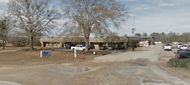

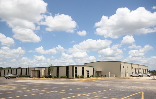
Property Detail
8049 S Us Highway 79
R12139
A0020 EWING, EDLEY BLOCK 1171 TRACT 3
Industrialgeneral
Anderson
B and X Area of moderate flood hazard, usually the area between the limits of the 100-year and 500-year floods.
Texas
2025
23.61 AC
2025
Other Market Areas
950901
Palestine, TX
42,060 SF
NEARBY LISTINGS FOR SALE OR LEASE
DEMOGRAPHICS near 8049 S Us Highway 79
1 mile
3 mile
5 mile
2024 Total Population
360
1,986
7,984
2029 Population
370
2,040
8,170
Pop Growth 2024-2029
+ 2.78%
+ 2.72%
+ 2.33%
Average Age
43
41
41
2024 Total Households
131
725
2,802
HH Growth 2024-2029
+ 2.29%
+ 2.62%
+ 2.36%
Median Household Inc
$55,714
$51,726
$52,566
Avg Household Size
2.60
2.60
2.60
2024 Avg HH Vehicles
2.00
2.00
2.00
Median Home Value
$141,176
$156,225
$178,544
Median Year Built
1997
1982
1983
Nearby Places
Map Layers
Map Styles
 Street
 Aerial
Transit
 Traffic
 Biking
Places
Listings with unknown addresses are not visible on the map
- Restaurants
- Banks
- Shops
- Fitness
- Groceries
SALE & LEASE HISTORY
LISTING DATE
SALE/LEASE

Sep 25, 2016
For Lease
Sep 23, 2016
For Sale
Nearby Properties
Address
Land Use
TOTAL SIZE
Lot Size
Zoning
Address
Land Use
TOTAL SIZE
Lot Size
Zoning
Address
Land Use
TOTAL SIZE
Lot Size
Zoning
1,160,508 SF
247.48 AC
Address
Land Use
TOTAL SIZE
Lot Size
Zoning
1,117.20 AC
Address
Land Use
TOTAL SIZE
Lot Size
Zoning
64,116 SF
2 AC
Address
Land Use
TOTAL SIZE
Lot Size
Zoning
2,378 SF
240.15 AC
Address
Land Use
TOTAL SIZE
Lot Size
Zoning
17,872 SF
15 AC
Address
Land Use
TOTAL SIZE
Lot Size
Zoning
244.11 AC
Address
Land Use
TOTAL SIZE
Lot Size
Zoning
29.05 AC
Address
Land Use
TOTAL SIZE
Lot Size
Zoning
167.29 AC
Address
Land Use
TOTAL SIZE
Lot Size
Zoning
10,700 SF
4 AC
Address
Land Use
TOTAL SIZE
Lot Size
Zoning
13,940 SF
48.66 AC
Address
Land Use
TOTAL SIZE
Lot Size
Zoning
150.47 AC
Address
Land Use
TOTAL SIZE
Lot Size
Zoning
2,242 SF
131.98 AC
Address
Land Use
TOTAL SIZE
Lot Size
Zoning
5,440 SF
3.35 AC
Address
Land Use
TOTAL SIZE
Lot Size
Zoning
2,376 SF
81.59 AC
Address
Land Use
TOTAL SIZE
Lot Size
Zoning
18,585 SF
2.59 AC
Address
Land Use
TOTAL SIZE
Lot Size
Zoning
1,990 SF
99.73 AC
Address
Land Use
TOTAL SIZE
Lot Size
Zoning
6,780 SF
16.34 AC
Address
Land Use
TOTAL SIZE
Lot Size
Zoning
Address
Land Use
TOTAL SIZE
Lot Size
Zoning
4,800 SF
6.88 AC
Address
Land Use
TOTAL SIZE
Lot Size
Zoning
3,200 SF
8 AC
Address
Land Use
TOTAL SIZE
Lot Size
Zoning
2,620 SF
1.06 AC
Address
Land Use
TOTAL SIZE
Lot Size
Zoning
5,600 SF
2.96 AC
Address
Land Use
TOTAL SIZE
Lot Size
Zoning
98.59 AC
Address
Land Use
TOTAL SIZE
Lot Size
Zoning
2,298 SF
39.67 AC
Address
Land Use
TOTAL SIZE
Lot Size
Zoning
1,568 SF
65.98 AC
Address
Land Use
TOTAL SIZE
Lot Size
Zoning
166.19 AC
Address
Land Use
TOTAL SIZE
Lot Size
Zoning
2,351 SF
20 AC
Address
Land Use
TOTAL SIZE
Lot Size
Zoning
79.08 AC
The World's #1 Commercial Real Estate Marketplace
Connect with us
© 2026 CoStar Group
The information above has been obtained from sources believed reliable. While we do not doubt its accuracy we have not verified it and make no guarantee, warranty or representation about it. It is your responsibility to independently confirm its accuracy and completeness. Any projections, opinions, assumptions, or estimates used are for example only and do not represent the current or future performance of the property. The value of this transaction to you depends on tax and other factors which should be evaluated by your tax, financial, and legal advisors. You and your advisors should conduct a careful, independent investigation of the property to determine to your satisfaction the suitability of the property for your needs.