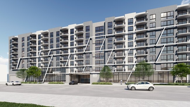
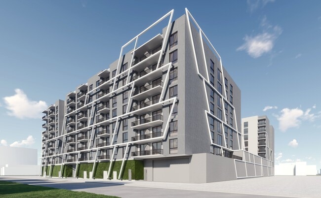
Property Record
835 W Flagler St, Miami, FL 33130
Current Lease Availabilities
Property Detail
835 W Flagler St
Miami-Miami Beach-Kendall, FL
38 54 41 BRICKELLS RIVERVIEW PB 5-43 LOT 16 BLK 3 LOT SIZE 50.000 X 150 OR 18439-1123 1198 4 COC 23396-1373 05 2005 2
01-4138-003-3210
MIAMI/DADE
Commercialacreage
Florida
6110
16
AE The base floodplain where base flood elevations are provided. AE Zones are now used on new format FIRMs instead of A1-A30 Zones.
0.17 AC
2024
Little Havana
2025
South Florida
005202
NEARBY LISTINGS FOR SALE OR LEASE
DEMOGRAPHICS near 835 W Flagler St
1 mile
3 mile
5 mile
2025 Total Population
67,708
331,884
580,063
2030 Population
73,496
359,828
630,059
Pop Growth 2025-2030
+ 8.55%
+ 8.42%
+ 8.62%
Average Age
41
41
41
2025 Total Households
29,536
145,083
250,877
HH Growth 2025-2030
+ 8.70%
+ 8.72%
+ 8.94%
Median Household Inc
$45,897
$71,127
$68,772
Avg Household Size
2.20
2.20
2.20
2025 Avg HH Vehicles
1.00
1.00
1.00
Median Home Value
$537,733
$623,638
$642,268
Median Year Built
1978
1987
1977
Nearby Places
Map Layers
Map Styles
 Street
 Aerial
Layers
 Traffic
 Biking
Places
Listings with unknown addresses are not visible on the map
- Restaurants
- Banks
- Shops
- Fitness
- Groceries
PUBLIC TRANSPORTATION
TRANSIT/SUBWAY
Culmer (Metrorail Green Line - Miami-Dade Transit (Metrorail/Metromover))
Drive
Walk
Distance
Culmer (Metrorail Green Line - Miami-Dade Transit (Metrorail/Metromover))
4 min
16 min
0.9 mi
Government Center (Metromover Brickell Loop - Miami-Dade Transit (Metrorail/Metromover), Metromover Downtown Loop - Miami-Dade Transit (Metrorail/Metromover), Metromover Omni Loop - Miami-Dade Transit (Metrorail/Metromover), Metrorail Green Line - Miami-Dade Transit (Metrorail/Metromover))
Drive
Walk
Distance
Government Center (Metromover Brickell Loop - Miami-Dade Transit (Metrorail/Metromover), Metromover Downtown Loop - Miami-Dade Transit (Metrorail/Metromover), Metromover Omni Loop - Miami-Dade Transit (Metrorail/Metromover), Metrorail Green Line - Miami-Dade Transit (Metrorail/Metromover))
3 min
16 min
0.9 mi
Miami Avenue (Metromover Downtown Loop - Miami-Dade Transit (Metrorail/Metromover))
Drive
Walk
Distance
Miami Avenue (Metromover Downtown Loop - Miami-Dade Transit (Metrorail/Metromover))
3 min
19 min
1.0 mi
COMMUTER RAIL
Miami Airport (Tri-County Commuter - South Florida Regional Transportation Authority (Tri-Rail))
Drive
Walk
Distance
Miami Airport (Tri-County Commuter - South Florida Regional Transportation Authority (Tri-Rail))
14 min
6.4 mi
Hialeah Market (Tri-County Commuter - South Florida Regional Transportation Authority (Tri-Rail))
Drive
Walk
Distance
Hialeah Market (Tri-County Commuter - South Florida Regional Transportation Authority (Tri-Rail))
12 min
7.4 mi
AIRPORT
Miami International
Drive
Walk
Distance
Miami International
24 min
10.4 mi
Fort Lauderdale/Hollywood International
Drive
Walk
Distance
Fort Lauderdale/Hollywood International
34 min
23.9 mi
Freight Ports
Port of Miami
Drive
Walk
Distance
Port of Miami
1 min
1.9 mi
Nearby Properties
Address
Land Use
TOTAL SIZE
Lot Size
Zoning
Address
Land Use
TOTAL SIZE
Lot Size
Zoning
1,050,691 SF
0.83 AC
6408
Address
Land Use
TOTAL SIZE
Lot Size
Zoning
4,758,614 SF
810.91 AC
8000
Address
Land Use
TOTAL SIZE
Lot Size
Zoning
955,966 SF
38.91 AC
9600
Address
Land Use
TOTAL SIZE
Lot Size
Zoning
2,559,318 SF
2.21 AC
6407
Address
Land Use
TOTAL SIZE
Lot Size
Zoning
2,039,308 SF
2.46 AC
6401
Address
Land Use
TOTAL SIZE
Lot Size
Zoning
928,000 SF
14.30 AC
8000
Address
Land Use
TOTAL SIZE
Lot Size
Zoning
1,110,657 SF
3.83 AC
6407
Address
Land Use
TOTAL SIZE
Lot Size
Zoning
16.13 AC
6100
Address
Land Use
TOTAL SIZE
Lot Size
Zoning
1,346,294 SF
1.89 AC
6408
Address
Land Use
TOTAL SIZE
Lot Size
Zoning
2,403,353 SF
7.37 AC
6100
Address
Land Use
TOTAL SIZE
Lot Size
Zoning
1,938,271 SF
6.62 AC
6402
Address
Land Use
TOTAL SIZE
Lot Size
Zoning
1,162,113 SF
1.92 AC
6407
Address
Land Use
TOTAL SIZE
Lot Size
Zoning
1,075,124 SF
1.61 AC
6405
Address
Land Use
TOTAL SIZE
Lot Size
Zoning
1,544,491 SF
0.97 AC
6401
Address
Land Use
TOTAL SIZE
Lot Size
Zoning
782,686 SF
0.06 AC
6401
Address
Land Use
TOTAL SIZE
Lot Size
Zoning
1,657,362 SF
1.15 AC
6401
Address
Land Use
TOTAL SIZE
Lot Size
Zoning
1,072,012 SF
1.78 AC
6407
Address
Land Use
TOTAL SIZE
Lot Size
Zoning
244,533 SF
3.53 AC
6600
Address
Land Use
TOTAL SIZE
Lot Size
Zoning
694,863 SF
1.90 AC
6407
Address
Land Use
TOTAL SIZE
Lot Size
Zoning
656,821 SF
2.06 AC
6407
Address
Land Use
TOTAL SIZE
Lot Size
Zoning
303,989 SF
1.47 AC
6600
Address
Land Use
TOTAL SIZE
Lot Size
Zoning
416,675 SF
6.48 AC
6401
Address
Land Use
TOTAL SIZE
Lot Size
Zoning
1,004,006 SF
0.92 AC
6401
Address
Land Use
TOTAL SIZE
Lot Size
Zoning
2.50 AC
6407
Address
Land Use
TOTAL SIZE
Lot Size
Zoning
585,775 SF
1.86 AC
6101
Address
Land Use
TOTAL SIZE
Lot Size
Zoning
868,860 SF
2.14 AC
6402
Address
Land Use
TOTAL SIZE
Lot Size
Zoning
491,308 SF
0.14 AC
6401
Address
Land Use
TOTAL SIZE
Lot Size
Zoning
903,993 SF
0.60 AC
6412
Address
Land Use
TOTAL SIZE
Lot Size
Zoning
872,245 SF
0.56 AC
6401
Address
Land Use
TOTAL SIZE
Lot Size
Zoning
727,757 SF
0.64 AC
6408
The World's #1 Commercial Real Estate Marketplace
Connect with us
© 2026 CoStar Group
The information above has been obtained from sources believed reliable. While we do not doubt its accuracy we have not verified it and make no guarantee, warranty or representation about it. It is your responsibility to independently confirm its accuracy and completeness. Any projections, opinions, assumptions, or estimates used are for example only and do not represent the current or future performance of the property. The value of this transaction to you depends on tax and other factors which should be evaluated by your tax, financial, and legal advisors. You and your advisors should conduct a careful, independent investigation of the property to determine to your satisfaction the suitability of the property for your needs.