Property Record
805 Gateway Dr, Ripon, WI 54971
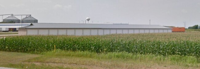

Property Detail
805 Gateway Dr
Fond du Lac, WI
UNPL LAND S15 T16N R14E THAT PT E 1/2 SW 1/4 LYG S & E OF OUTLOT 1 CSM #7289-52-94 EXC PARCEL 5 OF TPP 6110-05-20-4.01
RIP-16-14-15-12-016-00
FOND DU LAC
Commercialnec
Wisconsin
B and X Area of moderate flood hazard, usually the area between the limits of the 100-year and 500-year floods.
1
2025
1.21 AC
2025
Fond du Lac
041600
Milwaukee/Madison
9,040 SF
NEARBY LISTINGS FOR SALE OR LEASE
DEMOGRAPHICS near 805 Gateway Dr
1 mile
3 mile
5 mile
2025 Total Population
1,299
8,816
9,898
2030 Population
1,292
8,783
9,871
Pop Growth 2025-2030
(0.54%)
(0.37%)
(0.27%)
Average Age
43
41
42
2025 Total Households
569
3,623
4,066
HH Growth 2025-2030
(0.70%)
(0.36%)
(0.27%)
Median Household Inc
$69,038
$62,685
$64,184
Avg Household Size
2.30
2.20
2.20
2025 Avg HH Vehicles
2.00
2.00
2.00
Median Home Value
$168,156
$185,008
$191,371
Median Year Built
1959
1964
1964
Nearby Places
Map Layers
Map Styles
 Street
 Aerial
Transit
 Traffic
 Biking
Places
Listings with unknown addresses are not visible on the map
- Restaurants
- Banks
- Shops
- Fitness
- Groceries
SALE & LEASE HISTORY
LISTING DATE
SALE/LEASE

Jan 13, 2020
For Sale
Nearby Properties
Address
Land Use
TOTAL SIZE
Lot Size
Zoning
Address
Land Use
TOTAL SIZE
Lot Size
Zoning
198,328 SF
10.69 AC
Address
Land Use
TOTAL SIZE
Lot Size
Zoning
3,424 SF
9.74 AC
6
Address
Land Use
TOTAL SIZE
Lot Size
Zoning
115,613 SF
19.86 AC
Address
Land Use
TOTAL SIZE
Lot Size
Zoning
25.98 AC
6
Address
Land Use
TOTAL SIZE
Lot Size
Zoning
10,390 SF
6.99 AC
8
Address
Land Use
TOTAL SIZE
Lot Size
Zoning
61,294 SF
9.13 AC
Address
Land Use
TOTAL SIZE
Lot Size
Zoning
301,247 SF
37.75 AC
6
Address
Land Use
TOTAL SIZE
Lot Size
Zoning
9.93 AC
6
Address
Land Use
TOTAL SIZE
Lot Size
Zoning
39,282 SF
4.76 AC
3
Address
Land Use
TOTAL SIZE
Lot Size
Zoning
14,740 SF
2.12 AC
Address
Land Use
TOTAL SIZE
Lot Size
Zoning
51,437 SF
1.54 AC
3
Address
Land Use
TOTAL SIZE
Lot Size
Zoning
10.25 AC
6
Address
Land Use
TOTAL SIZE
Lot Size
Zoning
13,630 SF
6.27 AC
Address
Land Use
TOTAL SIZE
Lot Size
Zoning
4.56 AC
Address
Land Use
TOTAL SIZE
Lot Size
Zoning
2.32 AC
6
Address
Land Use
TOTAL SIZE
Lot Size
Zoning
26,154 SF
3.26 AC
8
Address
Land Use
TOTAL SIZE
Lot Size
Zoning
46,990 SF
6.51 AC
8
Address
Land Use
TOTAL SIZE
Lot Size
Zoning
13.93 AC
6
Address
Land Use
TOTAL SIZE
Lot Size
Zoning
14,664 SF
2.80 AC
2
Address
Land Use
TOTAL SIZE
Lot Size
Zoning
5.01 AC
6
Address
Land Use
TOTAL SIZE
Lot Size
Zoning
14,030 SF
6.61 AC
Address
Land Use
TOTAL SIZE
Lot Size
Zoning
14 AC
6
Address
Land Use
TOTAL SIZE
Lot Size
Zoning
10.22 AC
6
Address
Land Use
TOTAL SIZE
Lot Size
Zoning
14,030 SF
8.49 AC
Address
Land Use
TOTAL SIZE
Lot Size
Zoning
9.31 AC
Address
Land Use
TOTAL SIZE
Lot Size
Zoning
14,201 SF
2.75 AC
3
Address
Land Use
TOTAL SIZE
Lot Size
Zoning
10.72 AC
Address
Land Use
TOTAL SIZE
Lot Size
Zoning
38,192 SF
2.28 AC
10
Address
Land Use
TOTAL SIZE
Lot Size
Zoning
12,280 SF
2.70 AC
3
The World's #1 Commercial Real Estate Marketplace
Connect with us
© 2026 CoStar Group
The information above has been obtained from sources believed reliable. While we do not doubt its accuracy we have not verified it and make no guarantee, warranty or representation about it. It is your responsibility to independently confirm its accuracy and completeness. Any projections, opinions, assumptions, or estimates used are for example only and do not represent the current or future performance of the property. The value of this transaction to you depends on tax and other factors which should be evaluated by your tax, financial, and legal advisors. You and your advisors should conduct a careful, independent investigation of the property to determine to your satisfaction the suitability of the property for your needs.