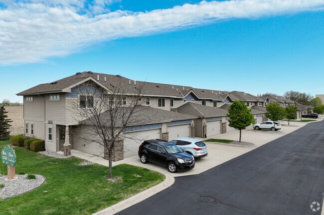
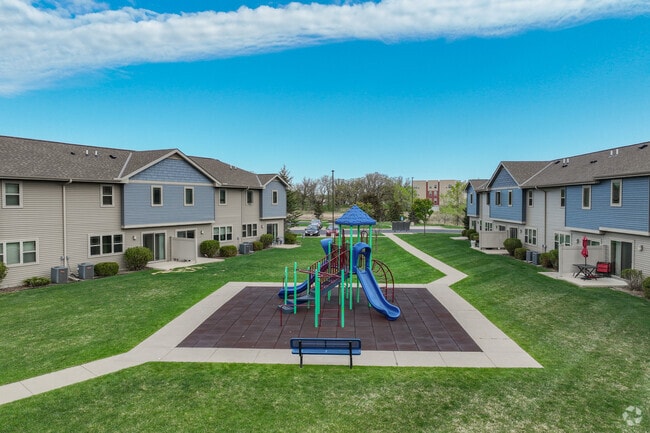
Property Record
805 Roberts Rd, Sartell, MN 56377
NEARBY LISTINGS FOR SALE OR LEASE
-
-
View all Sartell listings for sale on LoopNet.com
Property Detail
805 Roberts Rd
St. Cloud, MN
Heritage Place Three
92.56705.0087
LOT 001 BLK 002 HERITAGE PLACE THREE SECTION 28 TOWNSHIP 125 RANGE 028 SECTION 28 TOWNSHIP 125 RANGE 028
Multifamilydwelling
Stearns
X
Minnesota
27145C0627E
1
2025
6.48 AC
2025
Outlying Stearns County
010104
Minneapolis/St Paul
12,004 SF
DEMOGRAPHICS near 805 Roberts Rd
1 Mile
3 Mile
5 Mile
2024 Total Population
5,758
46,935
101,214
2029 Population
5,986
48,109
103,993
Pop Growth 2024-2029
+ 3.96%
+ 2.50%
+ 2.75%
Average Age
35
39
37
2024 Total Households
2,315
19,186
40,294
HH Growth 2024-2029
+ 4.10%
+ 2.55%
+ 2.83%
Median Household Inc
$58,521
$63,292
$57,974
Avg Household Size
2.40
2.40
2.40
2024 Avg HH Vehicles
2.00
2.00
2.00
Median Home Value
$240,926
$215,964
$202,695
Median Year Built
2007
1991
1985
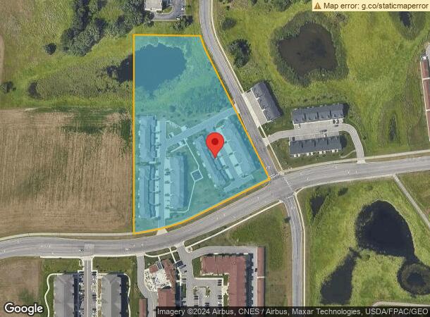
Nearby Places
Map Layers
Map Styles
 Street
 Aerial
- Restaurants
- Banks
- Shops
- Fitness
- Groceries
PUBLIC TRANSPORTATION
COMMUTER RAIL
St. Cloud Amtrak Station (Empire Builder - Amtrak)
DRIVE
WALK
Distance
St. Cloud Amtrak Station (Empire Builder - Amtrak)
12 min
5.6 mi
Freight Ports
Port Milwaukee
DRIVE
WALK
Distance
Port Milwaukee
457 min
409.1 mi
Nearby Properties
Address
Land Use
TOTAL SIZE
Lot Size
Zoning
Address
Land Use
TOTAL SIZE
Lot Size
Zoning
639,000 SF
216.67 AC
PUD28
Address
Land Use
TOTAL SIZE
Lot Size
Zoning
250,584 SF
77.75 AC
Address
Land Use
TOTAL SIZE
Lot Size
Zoning
183,964 SF
39.05 AC
Address
Land Use
TOTAL SIZE
Lot Size
Zoning
10,800 SF
24.94 AC
Address
Land Use
TOTAL SIZE
Lot Size
Zoning
11.82 AC
Address
Land Use
TOTAL SIZE
Lot Size
Zoning
70,971 SF
11.40 AC
PUD57
Address
Land Use
TOTAL SIZE
Lot Size
Zoning
30,096 SF
8.47 AC
Address
Land Use
TOTAL SIZE
Lot Size
Zoning
365,299 SF
28.68 AC
R1
Address
Land Use
TOTAL SIZE
Lot Size
Zoning
10.46 AC
Address
Land Use
TOTAL SIZE
Lot Size
Zoning
149,778 SF
7.86 AC
Address
Land Use
TOTAL SIZE
Lot Size
Zoning
344,031 SF
64.88 AC
PUD28
Address
Land Use
TOTAL SIZE
Lot Size
Zoning
184,285 SF
13.37 AC
Address
Land Use
TOTAL SIZE
Lot Size
Zoning
88,000 SF
37.63 AC
Address
Land Use
TOTAL SIZE
Lot Size
Zoning
628,000 SF
40.51 AC
PUD16
Address
Land Use
TOTAL SIZE
Lot Size
Zoning
113,268 SF
12 AC
PUD32
Address
Land Use
TOTAL SIZE
Lot Size
Zoning
15.78 AC
Address
Land Use
TOTAL SIZE
Lot Size
Zoning
105,123 SF
36.87 AC
R1
Address
Land Use
TOTAL SIZE
Lot Size
Zoning
555,652 SF
26.04 AC
PUD16
Address
Land Use
TOTAL SIZE
Lot Size
Zoning
25,608 SF
6.96 AC
R5
Address
Land Use
TOTAL SIZE
Lot Size
Zoning
36,393 SF
6.28 AC
Address
Land Use
TOTAL SIZE
Lot Size
Zoning
135,964 SF
57.06 AC
PUD28
Address
Land Use
TOTAL SIZE
Lot Size
Zoning
9.75 AC
Address
Land Use
TOTAL SIZE
Lot Size
Zoning
197,115 SF
18.23 AC
Address
Land Use
TOTAL SIZE
Lot Size
Zoning
18,554 SF
8.41 AC
Address
Land Use
TOTAL SIZE
Lot Size
Zoning
43,302 SF
5.67 AC
Address
Land Use
TOTAL SIZE
Lot Size
Zoning
3.89 AC
Address
Land Use
TOTAL SIZE
Lot Size
Zoning
11,700 SF
71.99 AC
Address
Land Use
TOTAL SIZE
Lot Size
Zoning
10.96 AC
Address
Land Use
TOTAL SIZE
Lot Size
Zoning
22,425 SF
5.54 AC
The World's #1 Commercial Real Estate Marketplace
Connect with us
© 2025 CoStar Group
The information above has been obtained from sources believed reliable. While we do not doubt its accuracy we have not verified it and make no guarantee, warranty or representation about it. It is your responsibility to independently confirm its accuracy and completeness. Any projections, opinions, assumptions, or estimates used are for example only and do not represent the current or future performance of the property. The value of this transaction to you depends on tax and other factors which should be evaluated by your tax, financial, and legal advisors. You and your advisors should conduct a careful, independent investigation of the property to determine to your satisfaction the suitability of the property for your needs.