Property Record
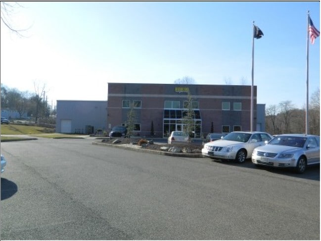
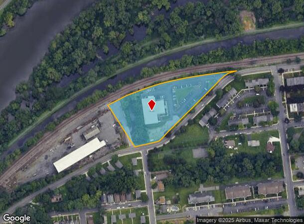
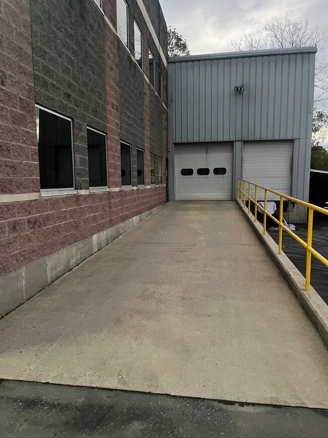
805 W Canal St, Easton, PA 18042

Current Lease Availabilities
NEARBY LISTINGS FOR SALE OR LEASE
Property Detail
805 W Canal St
Manufacturinglight
Northampton
X
Pennsylvania
42095C0286E
3.31 AC
2025
Lehigh Valley
2025
Philadelphia
014600
Allentown-Bethlehem-Easton, PA-NJ
19,500 SF
L9SE4D-2-2B-0310
DEMOGRAPHICS near 805 W Canal St
1 Mile
3 Mile
5 Mile
2024 Total Population
26,210
86,573
130,242
2029 Population
26,278
87,450
131,845
Pop Growth 2024-2029
+ 0.26%
+ 1.01%
+ 1.23%
Average Age
38
40
41
2024 Total Households
9,703
32,564
49,311
HH Growth 2024-2029
+ 0.15%
+ 1.05%
+ 1.32%
Median Household Inc
$59,643
$73,324
$82,695
Avg Household Size
2.50
2.40
2.50
2024 Avg HH Vehicles
2.00
2.00
2.00
Median Home Value
$152,616
$224,090
$257,011
Median Year Built
1946
1954
1968
Nearby Places
- Restaurants
- Banks
- Shops
- Fitness
- Groceries
PUBLIC TRANSPORTATION
AIRPORT
Lehigh Valley International
DRIVE
WALK
Distance
Lehigh Valley International
26 min
15.3 mi
Freight Ports
Port of Philadelphia
DRIVE
WALK
Distance
Port of Philadelphia
99 min
61.1 mi
Nearby Properties
Address
Land Use
TOTAL SIZE
Lot Size
Zoning
Address
Land Use
TOTAL SIZE
Lot Size
Zoning
330,000 SF
121.88 AC
R150
Address
Land Use
TOTAL SIZE
Lot Size
Zoning
48.27 AC
I2RA
Address
Land Use
TOTAL SIZE
Lot Size
Zoning
9.80 AC
B-1
Address
Land Use
TOTAL SIZE
Lot Size
Zoning
27.73 AC
RA-7
Address
Land Use
TOTAL SIZE
Lot Size
Zoning
87,508 SF
40.79 AC
CCE
Address
Land Use
TOTAL SIZE
Lot Size
Zoning
14.60 AC
RA-7
Address
Land Use
TOTAL SIZE
Lot Size
Zoning
13,916 SF
9.47 AC
RLD
Address
Land Use
TOTAL SIZE
Lot Size
Zoning
17.06 AC
R-75
Address
Land Use
TOTAL SIZE
Lot Size
Zoning
17.65 AC
I-1
Address
Land Use
TOTAL SIZE
Lot Size
Zoning
127,731 SF
56.29 AC
R12
Address
Land Use
TOTAL SIZE
Lot Size
Zoning
7.43 AC
R-50
Address
Land Use
TOTAL SIZE
Lot Size
Zoning
6,966 SF
8.86 AC
RMD
Address
Land Use
TOTAL SIZE
Lot Size
Zoning
20.75 AC
B-1
Address
Land Use
TOTAL SIZE
Lot Size
Zoning
84,805 SF
12.20 AC
CHDD
Address
Land Use
TOTAL SIZE
Lot Size
Zoning
2.67 AC
R-75
Address
Land Use
TOTAL SIZE
Lot Size
Zoning
162,960 SF
16.26 AC
HDR
Address
Land Use
TOTAL SIZE
Lot Size
Zoning
5.77 AC
B-2
Address
Land Use
TOTAL SIZE
Lot Size
Zoning
15.20 AC
B2R5
Address
Land Use
TOTAL SIZE
Lot Size
Zoning
2.55 AC
R-50
Address
Land Use
TOTAL SIZE
Lot Size
Zoning
176,397 SF
45.38 AC
HI
Address
Land Use
TOTAL SIZE
Lot Size
Zoning
0.56 AC
B-1
Address
Land Use
TOTAL SIZE
Lot Size
Zoning
26,714 SF
33.71 AC
RI
Address
Land Use
TOTAL SIZE
Lot Size
Zoning
4.19 AC
R-75
Address
Land Use
TOTAL SIZE
Lot Size
Zoning
10.40 AC
R-50
Address
Land Use
TOTAL SIZE
Lot Size
Zoning
94,794 SF
17.51 AC
GB
Address
Land Use
TOTAL SIZE
Lot Size
Zoning
14.03 AC
I-2
Address
Land Use
TOTAL SIZE
Lot Size
Zoning
6.28 AC
B-2
Address
Land Use
TOTAL SIZE
Lot Size
Zoning
2.57 AC
R-75
Address
Land Use
TOTAL SIZE
Lot Size
Zoning
21.80 AC
I-1
Address
Land Use
TOTAL SIZE
Lot Size
Zoning
107,028 SF
3.31 AC
R2
The World's #1 Commercial Real Estate Marketplace
Connect with us
© 2025 CoStar Group
The information above has been obtained from sources believed reliable. While we do not doubt its accuracy we have not verified it and make no guarantee, warranty or representation about it. It is your responsibility to independently confirm its accuracy and completeness. Any projections, opinions, assumptions, or estimates used are for example only and do not represent the current or future performance of the property. The value of this transaction to you depends on tax and other factors which should be evaluated by your tax, financial, and legal advisors. You and your advisors should conduct a careful, independent investigation of the property to determine to your satisfaction the suitability of the property for your needs.