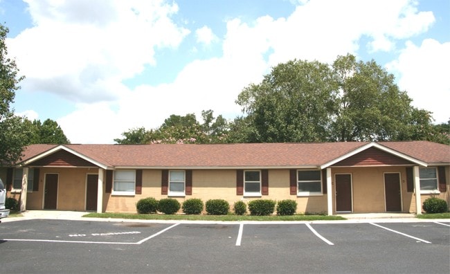
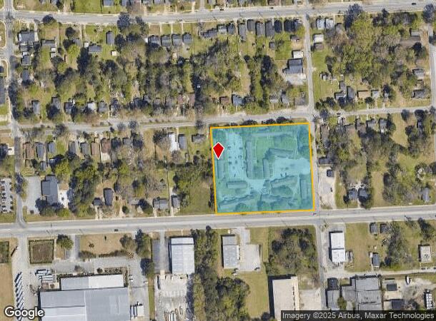
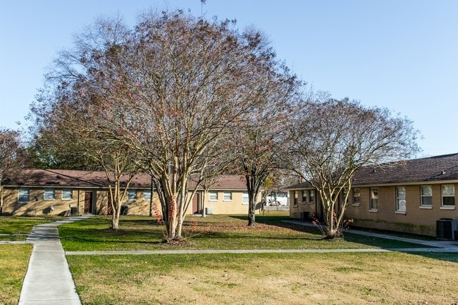
Property Record
805 W Darlington St, Florence, SC 29501
NEARBY LISTINGS FOR SALE OR LEASE
Property Detail
805 W Darlington St
90060-12-009
Prepared For Merriman Llc
Apartmenthouse5plusunits
BON-AIRE APTS
X
Florence
45041C0134E
South Carolina
2024
4.07 AC
2024
Florence/Dillon
000900
Other Market Areas
3,703 SF
Florence, SC
DEMOGRAPHICS near 805 W Darlington St
1 Mile
3 Mile
5 Mile
2024 Total Population
7,684
33,564
69,001
2029 Population
7,797
33,574
68,718
Pop Growth 2024-2029
+ 1.47%
+ 0.03%
(0.41%)
Average Age
39
40
40
2024 Total Households
3,296
14,114
28,472
HH Growth 2024-2029
+ 1.61%
+ 0.09%
(0.41%)
Median Household Inc
$22,845
$39,940
$53,845
Avg Household Size
2.20
2.30
2.30
2024 Avg HH Vehicles
1.00
2.00
2.00
Median Home Value
$114,683
$159,817
$168,150
Median Year Built
1964
1972
1982
Nearby Places
- Restaurants
- Banks
- Shops
- Fitness
- Groceries
PUBLIC TRANSPORTATION
COMMUTER RAIL
Florence Amtrak Station (Palmetto - Amtrak, Silver Meteor - Amtrak)
DRIVE
WALK
Distance
Florence Amtrak Station (Palmetto - Amtrak, Silver Meteor - Amtrak)
5 min
2.0 mi
Freight Ports
North Charleston Terminal
DRIVE
WALK
Distance
North Charleston Terminal
142 min
125.1 mi
SALE & LEASE HISTORY
LISTING DATE
SALE/LEASE

Sep 07, 2017
For Sale
Sep 01, 2017
For Sale
Oct 28, 2020
For Sale
Apr 01, 2020
For Sale
Nearby Properties
Address
Land Use
TOTAL SIZE
Lot Size
Zoning
Address
Land Use
TOTAL SIZE
Lot Size
Zoning
218,850 SF
7.54 AC
B3
Address
Land Use
TOTAL SIZE
Lot Size
Zoning
194,083 SF
27.70 AC
B3
Address
Land Use
TOTAL SIZE
Lot Size
Zoning
97,000 SF
50.87 AC
Address
Land Use
TOTAL SIZE
Lot Size
Zoning
8,416 SF
2.10 AC
B4
Address
Land Use
TOTAL SIZE
Lot Size
Zoning
125,000 SF
6.84 AC
B1
Address
Land Use
TOTAL SIZE
Lot Size
Zoning
1,347.68 AC
Address
Land Use
TOTAL SIZE
Lot Size
Zoning
218,026 SF
27.49 AC
Address
Land Use
TOTAL SIZE
Lot Size
Zoning
86,950 SF
6.82 AC
B2
Address
Land Use
TOTAL SIZE
Lot Size
Zoning
179,000 SF
16.53 AC
Address
Land Use
TOTAL SIZE
Lot Size
Zoning
422,500 SF
92 AC
Address
Land Use
TOTAL SIZE
Lot Size
Zoning
133,616 SF
10.98 AC
Address
Land Use
TOTAL SIZE
Lot Size
Zoning
26.36 AC
B1
Address
Land Use
TOTAL SIZE
Lot Size
Zoning
92,451 SF
2.82 AC
Address
Land Use
TOTAL SIZE
Lot Size
Zoning
79,263 SF
1.34 AC
B4
Address
Land Use
TOTAL SIZE
Lot Size
Zoning
1,920 SF
13.25 AC
R5
Address
Land Use
TOTAL SIZE
Lot Size
Zoning
4,000 SF
6.22 AC
Address
Land Use
TOTAL SIZE
Lot Size
Zoning
72,270 SF
3.80 AC
PDD
Address
Land Use
TOTAL SIZE
Lot Size
Zoning
35,770 SF
6.40 AC
B3
Address
Land Use
TOTAL SIZE
Lot Size
Zoning
135,620 SF
12.97 AC
B3
Address
Land Use
TOTAL SIZE
Lot Size
Zoning
29,521 SF
7.84 AC
Address
Land Use
TOTAL SIZE
Lot Size
Zoning
58,314 SF
5.27 AC
Address
Land Use
TOTAL SIZE
Lot Size
Zoning
18,500 SF
3.55 AC
Address
Land Use
TOTAL SIZE
Lot Size
Zoning
135,000 SF
10.76 AC
Address
Land Use
TOTAL SIZE
Lot Size
Zoning
50,490 SF
2.10 AC
Address
Land Use
TOTAL SIZE
Lot Size
Zoning
71,400 SF
3.71 AC
B3
Address
Land Use
TOTAL SIZE
Lot Size
Zoning
14,820 SF
0.88 AC
B3
Address
Land Use
TOTAL SIZE
Lot Size
Zoning
14,438 SF
1.88 AC
Address
Land Use
TOTAL SIZE
Lot Size
Zoning
47,600 SF
4.57 AC
R4
Address
Land Use
TOTAL SIZE
Lot Size
Zoning
25,560 SF
1.40 AC
B3
The World's #1 Commercial Real Estate Marketplace
Connect with us
© 2025 CoStar Group
The information above has been obtained from sources believed reliable. While we do not doubt its accuracy we have not verified it and make no guarantee, warranty or representation about it. It is your responsibility to independently confirm its accuracy and completeness. Any projections, opinions, assumptions, or estimates used are for example only and do not represent the current or future performance of the property. The value of this transaction to you depends on tax and other factors which should be evaluated by your tax, financial, and legal advisors. You and your advisors should conduct a careful, independent investigation of the property to determine to your satisfaction the suitability of the property for your needs.