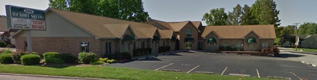
Property Record
805 W Deyoung St, Marion, IL 62959


NEARBY LISTINGS FOR SALE OR LEASE
Property Detail
805 W Deyoung St
Carbondale-Marion, IL
Charles Hollands Second Add
06-13-254-014
HOLLANDS, CHARLES 2ND ADDN LOTS 7 & 8 EX RD ROW & ALL OF LOT 9
Commercialnec
Williamson
X
Illinois
17199C0181D
9
2024
0.50 AC
2025
Marion/I-64 & South
021001
Other Market Areas
DEMOGRAPHICS near 805 W Deyoung St
1 Mile
3 Mile
5 Mile
2024 Total Population
6,699
18,858
22,985
2029 Population
6,701
18,858
22,927
Pop Growth 2024-2029
+ 0.03%
0.00%
(0.25%)
Average Age
42
42
43
2024 Total Households
3,133
8,396
10,074
HH Growth 2024-2029
+ 0.03%
+ 0.02%
(0.21%)
Median Household Inc
$39,974
$47,270
$49,994
Avg Household Size
2.00
2.20
2.20
2024 Avg HH Vehicles
1.00
2.00
2.00
Median Home Value
$114,856
$140,546
$152,460
Median Year Built
1978
1978
1981
Nearby Places
Map Layers
Map Styles
 Street
 Aerial
- Restaurants
- Banks
- Shops
- Fitness
- Groceries
SALE & LEASE HISTORY
LISTING DATE
SALE/LEASE

Nov 11, 2020
For Sale
Nearby Properties
Address
Land Use
TOTAL SIZE
Lot Size
Zoning
Address
Land Use
TOTAL SIZE
Lot Size
Zoning
37.88 AC
Address
Land Use
TOTAL SIZE
Lot Size
Zoning
Address
Land Use
TOTAL SIZE
Lot Size
Zoning
21.42 AC
Address
Land Use
TOTAL SIZE
Lot Size
Zoning
16.06 AC
Address
Land Use
TOTAL SIZE
Lot Size
Zoning
2.47 AC
Address
Land Use
TOTAL SIZE
Lot Size
Zoning
9.14 AC
Address
Land Use
TOTAL SIZE
Lot Size
Zoning
Address
Land Use
TOTAL SIZE
Lot Size
Zoning
Address
Land Use
TOTAL SIZE
Lot Size
Zoning
6.22 AC
Address
Land Use
TOTAL SIZE
Lot Size
Zoning
4.82 AC
Address
Land Use
TOTAL SIZE
Lot Size
Zoning
12.22 AC
Address
Land Use
TOTAL SIZE
Lot Size
Zoning
1.18 AC
Address
Land Use
TOTAL SIZE
Lot Size
Zoning
Address
Land Use
TOTAL SIZE
Lot Size
Zoning
9.04 AC
Address
Land Use
TOTAL SIZE
Lot Size
Zoning
1.18 AC
Address
Land Use
TOTAL SIZE
Lot Size
Zoning
15.51 AC
Address
Land Use
TOTAL SIZE
Lot Size
Zoning
1.50 AC
Address
Land Use
TOTAL SIZE
Lot Size
Zoning
1.36 AC
Address
Land Use
TOTAL SIZE
Lot Size
Zoning
Address
Land Use
TOTAL SIZE
Lot Size
Zoning
17.55 AC
Address
Land Use
TOTAL SIZE
Lot Size
Zoning
1.90 AC
Address
Land Use
TOTAL SIZE
Lot Size
Zoning
3.83 AC
Address
Land Use
TOTAL SIZE
Lot Size
Zoning
2.67 AC
Address
Land Use
TOTAL SIZE
Lot Size
Zoning
0.94 AC
Address
Land Use
TOTAL SIZE
Lot Size
Zoning
2.26 AC
Address
Land Use
TOTAL SIZE
Lot Size
Zoning
Address
Land Use
TOTAL SIZE
Lot Size
Zoning
1.90 AC
Address
Land Use
TOTAL SIZE
Lot Size
Zoning
10.82 AC
The World's #1 Commercial Real Estate Marketplace
Connect with us
© 2025 CoStar Group
The information above has been obtained from sources believed reliable. While we do not doubt its accuracy we have not verified it and make no guarantee, warranty or representation about it. It is your responsibility to independently confirm its accuracy and completeness. Any projections, opinions, assumptions, or estimates used are for example only and do not represent the current or future performance of the property. The value of this transaction to you depends on tax and other factors which should be evaluated by your tax, financial, and legal advisors. You and your advisors should conduct a careful, independent investigation of the property to determine to your satisfaction the suitability of the property for your needs.