Property Record
8050 103Rd St, Jacksonville, FL 32210
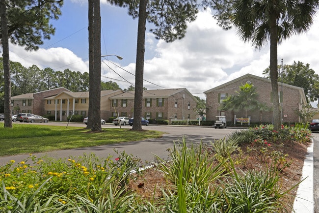


Property Detail
8050 103Rd St
013524-0010
3-50 15-3S-25E 10.1 JACKSONVILLE HEIGHTS TOWNSITE PT BLKS 65,81,BLK 80,PT CL ALLEYS, RECD O/R 20306-738 BEING THE JACKSONVILLE HEIGHTS PARCEL
Multifamilydwelling
Duval
RMD-D
Florida
B and X Area of moderate flood hazard, usually the area between the limits of the 100-year and 500-year floods.
10.13 AC
2025
Jacksonville Heights
2026
Jacksonville (Florida)
013504
Jacksonville, FL
193,478 SF
NEARBY LISTINGS FOR SALE OR LEASE
DEMOGRAPHICS near 8050 103Rd St
1 mile
3 mile
5 mile
2025 Total Population
15,812
75,172
196,183
2030 Population
16,744
79,682
208,511
Pop Growth 2025-2030
+ 5.89%
+ 6.00%
+ 6.28%
Average Age
37
37
38
2025 Total Households
5,852
27,441
74,285
HH Growth 2025-2030
+ 6.15%
+ 6.28%
+ 6.57%
Median Household Inc
$48,651
$60,564
$66,099
Avg Household Size
2.70
2.60
2.60
2025 Avg HH Vehicles
2.00
2.00
2.00
Median Home Value
$199,999
$226,155
$266,393
Median Year Built
1985
1988
1989
Nearby Places
Map Layers
Map Styles
 Street
 Aerial
Layers
 Traffic
 Biking
Places
Listings with unknown addresses are not visible on the map
- Restaurants
- Banks
- Shops
- Fitness
- Groceries
Nearby Properties
Address
Land Use
TOTAL SIZE
Lot Size
Zoning
Address
Land Use
TOTAL SIZE
Lot Size
Zoning
221,429 SF
15.42 AC
PUD
Address
Land Use
TOTAL SIZE
Lot Size
Zoning
307,960 SF
18.52 AC
PUD
Address
Land Use
TOTAL SIZE
Lot Size
Zoning
375,127 SF
18.65 AC
PUD
Address
Land Use
TOTAL SIZE
Lot Size
Zoning
179,916 SF
12.19 AC
RMD-D
Address
Land Use
TOTAL SIZE
Lot Size
Zoning
188,666 SF
17.76 AC
PUD
Address
Land Use
TOTAL SIZE
Lot Size
Zoning
139,435 SF
7.15 AC
CCG-2
Address
Land Use
TOTAL SIZE
Lot Size
Zoning
272,076 SF
54.84 AC
PUD
Address
Land Use
TOTAL SIZE
Lot Size
Zoning
137,636 SF
9.73 AC
RMD-D
Address
Land Use
TOTAL SIZE
Lot Size
Zoning
171,412 SF
16.44 AC
RMD-D
Address
Land Use
TOTAL SIZE
Lot Size
Zoning
169,084 SF
13 AC
CCG-1
Address
Land Use
TOTAL SIZE
Lot Size
Zoning
229,441 SF
17.48 AC
PUD
Address
Land Use
TOTAL SIZE
Lot Size
Zoning
209,238 SF
10.31 AC
RMD-D
Address
Land Use
TOTAL SIZE
Lot Size
Zoning
160,634 SF
16.36 AC
RMD-D
Address
Land Use
TOTAL SIZE
Lot Size
Zoning
57,762 SF
11.90 AC
CCG-2
Address
Land Use
TOTAL SIZE
Lot Size
Zoning
73,769 SF
8.87 AC
CCG-1
Address
Land Use
TOTAL SIZE
Lot Size
Zoning
141,403 SF
11.36 AC
PUD
Address
Land Use
TOTAL SIZE
Lot Size
Zoning
197,792 SF
17.56 AC
RMD-D
Address
Land Use
TOTAL SIZE
Lot Size
Zoning
89,408 SF
11.24 AC
CCG-1
Address
Land Use
TOTAL SIZE
Lot Size
Zoning
131,247 SF
5.68 AC
PBF-2
Address
Land Use
TOTAL SIZE
Lot Size
Zoning
80,512 SF
4.05 AC
PUD
Address
Land Use
TOTAL SIZE
Lot Size
Zoning
112,361 SF
11.23 AC
CCG-1
Address
Land Use
TOTAL SIZE
Lot Size
Zoning
205,645 SF
35.39 AC
PBF-1
Address
Land Use
TOTAL SIZE
Lot Size
Zoning
66,892 SF
9.62 AC
PUD
Address
Land Use
TOTAL SIZE
Lot Size
Zoning
16,988 SF
4.65 AC
CCG-1
Address
Land Use
TOTAL SIZE
Lot Size
Zoning
95,621 SF
8.13 AC
CCG-1
Address
Land Use
TOTAL SIZE
Lot Size
Zoning
119,755 SF
14.77 AC
PUD
Address
Land Use
TOTAL SIZE
Lot Size
Zoning
71,072 SF
16.92 AC
RR-ACRE
Address
Land Use
TOTAL SIZE
Lot Size
Zoning
125,053 SF
33.33 AC
RMD-D
Address
Land Use
TOTAL SIZE
Lot Size
Zoning
74,633 SF
8.74 AC
CCG-1
The World's #1 Commercial Real Estate Marketplace
Connect with us
© 2026 CoStar Group
The information above has been obtained from sources believed reliable. While we do not doubt its accuracy we have not verified it and make no guarantee, warranty or representation about it. It is your responsibility to independently confirm its accuracy and completeness. Any projections, opinions, assumptions, or estimates used are for example only and do not represent the current or future performance of the property. The value of this transaction to you depends on tax and other factors which should be evaluated by your tax, financial, and legal advisors. You and your advisors should conduct a careful, independent investigation of the property to determine to your satisfaction the suitability of the property for your needs.