Property Record
8050 147Th Ave Nw, Anoka, MN 55303
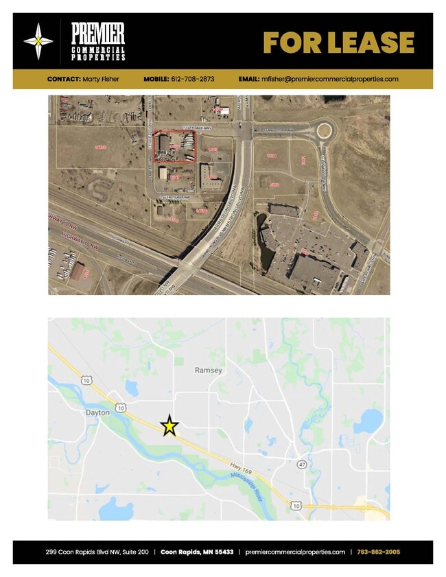
Current Lease Availabilities
NEARBY LISTINGS FOR SALE OR LEASE
Property Detail
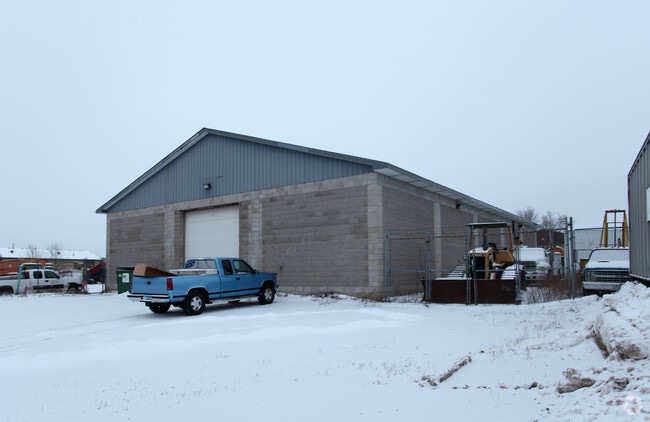
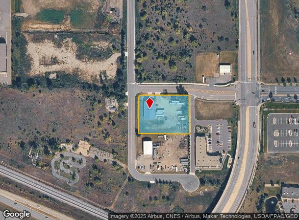
8050 147Th Ave Nw
Minneapolis-St. Paul-Bloomington, MN-WI
Hy-10 Ramsey
29-32-25-14-0008
LOT 1 BLK 2 HY-10 RAMSEY SUBJ TO EASE OF REC
Industrialgeneral
Anoka
X
Minnesota
27053C0051F
1
2025
1.43 AC
2025
North Central
050223
Minneapolis/St Paul
12,000 SF
DEMOGRAPHICS near 8050 147Th Ave Nw
1 Mile
3 Mile
5 Mile
2024 Total Population
4,394
21,969
63,848
2029 Population
4,767
23,137
66,841
Pop Growth 2024-2029
+ 8.49%
+ 5.32%
+ 4.69%
Average Age
35
38
39
2024 Total Households
1,647
7,685
23,149
HH Growth 2024-2029
+ 8.50%
+ 5.34%
+ 4.75%
Median Household Inc
$81,722
$102,748
$103,322
Avg Household Size
2.60
2.80
2.70
2024 Avg HH Vehicles
2.00
2.00
2.00
Median Home Value
$257,047
$333,525
$336,023
Median Year Built
2010
1999
1995
Nearby Places
- Restaurants
- Banks
- Shops
- Fitness
- Groceries
PUBLIC TRANSPORTATION
COMMUTER RAIL
Ramsey Station & Platform (Northstar Commuter Rail - Metro Transit)
DRIVE
WALK
Distance
Ramsey Station & Platform (Northstar Commuter Rail - Metro Transit)
3 min
16 min
0.8 mi
Elk River Station (Northstar Corridor - Northstar Commuter Rail)
DRIVE
WALK
Distance
Elk River Station (Northstar Corridor - Northstar Commuter Rail)
9 min
6.0 mi
AIRPORT
Minneapolis-St Paul International/Wold-Chamberlain
DRIVE
WALK
Distance
Minneapolis-St Paul International/Wold-Chamberlain
53 min
37.9 mi
Freight Ports
Port Milwaukee
DRIVE
WALK
Distance
Port Milwaukee
398 min
360.1 mi
Nearby Properties
Address
Land Use
TOTAL SIZE
Lot Size
Zoning
Address
Land Use
TOTAL SIZE
Lot Size
Zoning
3,491 SF
3.03 AC
Address
Land Use
TOTAL SIZE
Lot Size
Zoning
68,362 SF
Address
Land Use
TOTAL SIZE
Lot Size
Zoning
382,508 SF
Address
Land Use
TOTAL SIZE
Lot Size
Zoning
229,457 SF
16.04 AC
Address
Land Use
TOTAL SIZE
Lot Size
Zoning
153,964 SF
3.90 AC
Address
Land Use
TOTAL SIZE
Lot Size
Zoning
140,288 SF
5.12 AC
Address
Land Use
TOTAL SIZE
Lot Size
Zoning
319,019 SF
17.14 AC
Address
Land Use
TOTAL SIZE
Lot Size
Zoning
147,000 SF
Address
Land Use
TOTAL SIZE
Lot Size
Zoning
147,000 SF
Address
Land Use
TOTAL SIZE
Lot Size
Zoning
190,285 SF
12.98 AC
Address
Land Use
TOTAL SIZE
Lot Size
Zoning
Address
Land Use
TOTAL SIZE
Lot Size
Zoning
201,859 SF
9.21 AC
Address
Land Use
TOTAL SIZE
Lot Size
Zoning
111,300 SF
Address
Land Use
TOTAL SIZE
Lot Size
Zoning
Address
Land Use
TOTAL SIZE
Lot Size
Zoning
83,357 SF
5.35 AC
Address
Land Use
TOTAL SIZE
Lot Size
Zoning
84,201 SF
1.87 AC
Address
Land Use
TOTAL SIZE
Lot Size
Zoning
151,524 SF
18.10 AC
Address
Land Use
TOTAL SIZE
Lot Size
Zoning
102,938 SF
Address
Land Use
TOTAL SIZE
Lot Size
Zoning
166,230 SF
36.66 AC
Address
Land Use
TOTAL SIZE
Lot Size
Zoning
Address
Land Use
TOTAL SIZE
Lot Size
Zoning
59,298 SF
9.58 AC
Address
Land Use
TOTAL SIZE
Lot Size
Zoning
108,542 SF
4.71 AC
M-1
Address
Land Use
TOTAL SIZE
Lot Size
Zoning
79,443 SF
2.02 AC
Address
Land Use
TOTAL SIZE
Lot Size
Zoning
125,349 SF
Address
Land Use
TOTAL SIZE
Lot Size
Zoning
122,762 SF
53.05 AC
Address
Land Use
TOTAL SIZE
Lot Size
Zoning
64,000 SF
4.52 AC
Address
Land Use
TOTAL SIZE
Lot Size
Zoning
77,104 SF
9.25 AC
Address
Land Use
TOTAL SIZE
Lot Size
Zoning
67,500 SF
6.28 AC
Address
Land Use
TOTAL SIZE
Lot Size
Zoning
93,340 SF
6.39 AC
Address
Land Use
TOTAL SIZE
Lot Size
Zoning
60,800 SF
5.74 AC
The World's #1 Commercial Real Estate Marketplace
Connect with us
© 2025 CoStar Group
The information above has been obtained from sources believed reliable. While we do not doubt its accuracy we have not verified it and make no guarantee, warranty or representation about it. It is your responsibility to independently confirm its accuracy and completeness. Any projections, opinions, assumptions, or estimates used are for example only and do not represent the current or future performance of the property. The value of this transaction to you depends on tax and other factors which should be evaluated by your tax, financial, and legal advisors. You and your advisors should conduct a careful, independent investigation of the property to determine to your satisfaction the suitability of the property for your needs.