Property Record
8053 Chestnut St, Hereford, PA 18056

NEARBY LISTINGS FOR SALE OR LEASE
Property Detail
8053 Chestnut St
Storebuilding
Berks
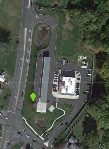
X
Pennsylvania
42091C0010G
4.16 AC
2025
Berks County
2025
Philadelphia
013301
Reading, PA
5,590 SF
52-0000-00-00-0018
DEMOGRAPHICS near 8053 Chestnut St
1 Mile
3 Mile
5 Mile
2024 Total Population
1,207
5,893
32,862
2029 Population
1,208
5,915
33,103
Pop Growth 2024-2029
+ 0.08%
+ 0.37%
+ 0.73%
Average Age
45
44
41
2024 Total Households
525
2,309
12,475
HH Growth 2024-2029
+ 0.19%
+ 0.35%
+ 0.66%
Median Household Inc
$80,172
$97,893
$87,906
Avg Household Size
2.30
2.50
2.60
2024 Avg HH Vehicles
2.00
3.00
2.00
Median Home Value
$293,477
$347,607
$295,778
Median Year Built
1973
1975
1978
Nearby Places
Map Layers
Map Styles
 Street
 Aerial
- Restaurants
- Banks
- Shops
- Fitness
- Groceries
PUBLIC TRANSPORTATION
AIRPORT
Lehigh Valley International
DRIVE
WALK
Distance
Lehigh Valley International
35 min
18.7 mi
Freight Ports
Port of Philadelphia
DRIVE
WALK
Distance
Port of Philadelphia
76 min
44.9 mi
SALE & LEASE HISTORY
LISTING DATE
SALE/LEASE

Sep 24, 2016
For Sale
Mar 31, 2017
For Sale
Apr 04, 2017
For Sale
Nearby Properties
Address
Land Use
TOTAL SIZE
Lot Size
Zoning
Address
Land Use
TOTAL SIZE
Lot Size
Zoning
326,512 SF
51.39 AC
LI
Address
Land Use
TOTAL SIZE
Lot Size
Zoning
419,340 SF
20.99 AC
LI
Address
Land Use
TOTAL SIZE
Lot Size
Zoning
427,573 SF
37.69 AC
LI
Address
Land Use
TOTAL SIZE
Lot Size
Zoning
2,827 SF
6.39 AC
R-A
Address
Land Use
TOTAL SIZE
Lot Size
Zoning
81,423 SF
4.70 AC
LI
Address
Land Use
TOTAL SIZE
Lot Size
Zoning
94,597 SF
25.62 AC
Address
Land Use
TOTAL SIZE
Lot Size
Zoning
60,237 SF
5.31 AC
LI
Address
Land Use
TOTAL SIZE
Lot Size
Zoning
27,844 SF
8.11 AC
LIC
Address
Land Use
TOTAL SIZE
Lot Size
Zoning
2,538 SF
124.66 AC
AC
Address
Land Use
TOTAL SIZE
Lot Size
Zoning
12,080 SF
30.66 AC
R-A
Address
Land Use
TOTAL SIZE
Lot Size
Zoning
5,946 SF
1 AC
R-A
Address
Land Use
TOTAL SIZE
Lot Size
Zoning
16,000 SF
4.31 AC
R-A
Address
Land Use
TOTAL SIZE
Lot Size
Zoning
9,034 SF
6.65 AC
R-A
Address
Land Use
TOTAL SIZE
Lot Size
Zoning
11.92 AC
RR1
Address
Land Use
TOTAL SIZE
Lot Size
Zoning
5,952 SF
31.60 AC
Address
Land Use
TOTAL SIZE
Lot Size
Zoning
2,560 SF
31.04 AC
R-A
Address
Land Use
TOTAL SIZE
Lot Size
Zoning
3,472 SF
16.40 AC
R
Address
Land Use
TOTAL SIZE
Lot Size
Zoning
48.40 AC
AC
Address
Land Use
TOTAL SIZE
Lot Size
Zoning
1,378 SF
11.91 AC
R-A
Address
Land Use
TOTAL SIZE
Lot Size
Zoning
24.67 AC
RR1
Address
Land Use
TOTAL SIZE
Lot Size
Zoning
3,034 SF
85.60 AC
R2
Address
Land Use
TOTAL SIZE
Lot Size
Zoning
20,500 SF
1.56 AC
C
Address
Land Use
TOTAL SIZE
Lot Size
Zoning
7,351 SF
122.05 AC
Address
Land Use
TOTAL SIZE
Lot Size
Zoning
1,840 SF
17 AC
R-A
Address
Land Use
TOTAL SIZE
Lot Size
Zoning
118.65 AC
R2
Address
Land Use
TOTAL SIZE
Lot Size
Zoning
14,773 SF
20.93 AC
R1
Address
Land Use
TOTAL SIZE
Lot Size
Zoning
7,728 SF
6.35 AC
Address
Land Use
TOTAL SIZE
Lot Size
Zoning
134.41 AC
I
Address
Land Use
TOTAL SIZE
Lot Size
Zoning
14,317 SF
34.13 AC
The World's #1 Commercial Real Estate Marketplace
Connect with us
© 2026 CoStar Group
The information above has been obtained from sources believed reliable. While we do not doubt its accuracy we have not verified it and make no guarantee, warranty or representation about it. It is your responsibility to independently confirm its accuracy and completeness. Any projections, opinions, assumptions, or estimates used are for example only and do not represent the current or future performance of the property. The value of this transaction to you depends on tax and other factors which should be evaluated by your tax, financial, and legal advisors. You and your advisors should conduct a careful, independent investigation of the property to determine to your satisfaction the suitability of the property for your needs.