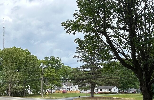
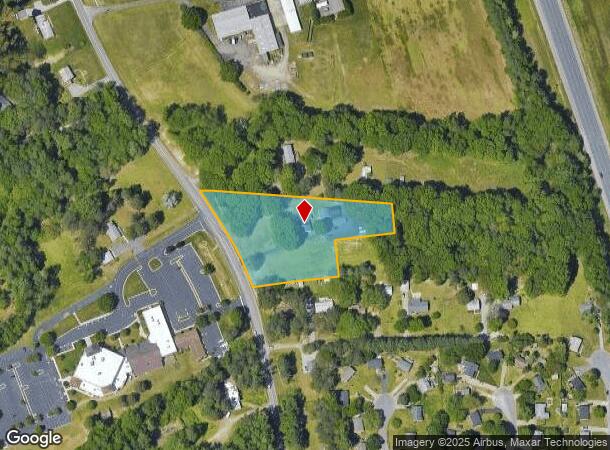
Property Record
8054 Shady Grove Rd, Mechanicsville, VA 23111


This Property Is For Sale
NEARBY LISTINGS FOR SALE OR LEASE
Property Detail
8054 Shady Grove Rd
Richmond, VA
Hanover
8715-01-2191
Virginia
Sfr
2.55 AC
X
Mechanicsville
51085C0426C
Richmond VA
2,038 SF
DEMOGRAPHICS near 8054 Shady Grove Rd
1 Mile
3 Mile
5 Mile
2024 Total Population
4,301
38,255
113,734
2029 Population
4,877
42,648
121,542
Pop Growth 2024-2029
+ 13.39%
+ 11.48%
+ 6.87%
Average Age
47
43
42
2024 Total Households
1,910
15,138
46,022
HH Growth 2024-2029
+ 13.77%
+ 11.86%
+ 6.81%
Median Household Inc
$65,125
$86,004
$71,754
Avg Household Size
2.20
2.50
2.40
2024 Avg HH Vehicles
2.00
2.00
2.00
Median Home Value
$274,422
$278,377
$267,973
Median Year Built
1982
1988
1980
Nearby Places
Map Layers
Map Styles
 Street
 Aerial
- Restaurants
- Banks
- Shops
- Fitness
- Groceries
PUBLIC TRANSPORTATION
COMMUTER RAIL
Richmond Main Street Amtrak Station (Northeast Regional - Amtrak)
DRIVE
WALK
Distance
Richmond Main Street Amtrak Station (Northeast Regional - Amtrak)
13 min
7.9 mi
Richmond Staples Mill Road Amtrak Station (Carolinian - Amtrak, Northeast Regional - Amtrak, Palmetto - Amtrak, Silver Meteor - Amtrak)
DRIVE
WALK
Distance
Richmond Staples Mill Road Amtrak Station (Carolinian - Amtrak, Northeast Regional - Amtrak, Palmetto - Amtrak, Silver Meteor - Amtrak)
18 min
8.9 mi
AIRPORT
Richmond International
DRIVE
WALK
Distance
Richmond International
20 min
13.3 mi
Freight Ports
Virginia Port Authority - Richmond
DRIVE
WALK
Distance
Virginia Port Authority - Richmond
24 min
14.2 mi
Nearby Properties
Address
Land Use
TOTAL SIZE
Lot Size
Zoning
Address
Land Use
TOTAL SIZE
Lot Size
Zoning
2,645,407 SF
116.30 AC
M2-C
Address
Land Use
TOTAL SIZE
Lot Size
Zoning
436,148 SF
12.73 AC
B-1
Address
Land Use
TOTAL SIZE
Lot Size
Zoning
1.37 AC
A-1
Address
Land Use
TOTAL SIZE
Lot Size
Zoning
23.50 AC
A-1
Address
Land Use
TOTAL SIZE
Lot Size
Zoning
14.41 AC
A-1
Address
Land Use
TOTAL SIZE
Lot Size
Zoning
2,630 SF
39.79 AC
M-2
Address
Land Use
TOTAL SIZE
Lot Size
Zoning
18.50 AC
RM
Address
Land Use
TOTAL SIZE
Lot Size
Zoning
1,249,190 SF
139.90 AC
M-2
Address
Land Use
TOTAL SIZE
Lot Size
Zoning
29.95 AC
A-1
Address
Land Use
TOTAL SIZE
Lot Size
Zoning
2,145 SF
4.54 AC
B-1
Address
Land Use
TOTAL SIZE
Lot Size
Zoning
160,000 SF
25 AC
M-1
Address
Land Use
TOTAL SIZE
Lot Size
Zoning
112,893 SF
58.52 AC
MIXE
Address
Land Use
TOTAL SIZE
Lot Size
Zoning
Address
Land Use
TOTAL SIZE
Lot Size
Zoning
23.23 AC
M-1
Address
Land Use
TOTAL SIZE
Lot Size
Zoning
23.60 AC
R-1
Address
Land Use
TOTAL SIZE
Lot Size
Zoning
214,583 SF
32.67 AC
B-3
Address
Land Use
TOTAL SIZE
Lot Size
Zoning
133,200 SF
15.50 AC
R-5
Address
Land Use
TOTAL SIZE
Lot Size
Zoning
84,240 SF
18.48 AC
R-4
Address
Land Use
TOTAL SIZE
Lot Size
Zoning
93,484 SF
14.81 AC
M-1
Address
Land Use
TOTAL SIZE
Lot Size
Zoning
142,560 SF
17.90 AC
R-5
Address
Land Use
TOTAL SIZE
Lot Size
Zoning
107,488 SF
9.89 AC
R-5
Address
Land Use
TOTAL SIZE
Lot Size
Zoning
63,635 SF
4.24 AC
B-1
Address
Land Use
TOTAL SIZE
Lot Size
Zoning
138,484 SF
12.01 AC
R-5
Address
Land Use
TOTAL SIZE
Lot Size
Zoning
423,887 SF
63.71 AC
M-1
Address
Land Use
TOTAL SIZE
Lot Size
Zoning
129,887 SF
12.31 AC
B-2
Address
Land Use
TOTAL SIZE
Lot Size
Zoning
92,190 SF
8.61 AC
R-5
Address
Land Use
TOTAL SIZE
Lot Size
Zoning
130,179 SF
2.88 AC
UMUC
Address
Land Use
TOTAL SIZE
Lot Size
Zoning
93,692 SF
4.61 AC
B-1
Address
Land Use
TOTAL SIZE
Lot Size
Zoning
Address
Land Use
TOTAL SIZE
Lot Size
Zoning
137,933 SF
14.72 AC
B-3
The World's #1 Commercial Real Estate Marketplace
Connect with us
© 2025 CoStar Group
The information above has been obtained from sources believed reliable. While we do not doubt its accuracy we have not verified it and make no guarantee, warranty or representation about it. It is your responsibility to independently confirm its accuracy and completeness. Any projections, opinions, assumptions, or estimates used are for example only and do not represent the current or future performance of the property. The value of this transaction to you depends on tax and other factors which should be evaluated by your tax, financial, and legal advisors. You and your advisors should conduct a careful, independent investigation of the property to determine to your satisfaction the suitability of the property for your needs.