Property Record
8055 Highland Pointe Pkwy, Macedonia, OH 44056


NEARBY LISTINGS FOR SALE OR LEASE
Property Detail
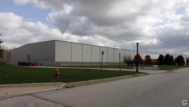
8055 Highland Pointe Pkwy
Akron, OH
Highland Pointe Parkway Subd
33-10735
HIGHLAND POINTE PARKWAY SUBD LOT 1 ALL ABMT TERMINATED FOR 2001
Warehouse
Summit
X
Ohio
39035C0345E
1
2023
20 AC
2025
Twinsburg/Aurora
532701
Cleveland
254,000 SF
DEMOGRAPHICS near 8055 Highland Pointe Pkwy
1 Mile
3 Mile
5 Mile
2024 Total Population
2,391
30,149
71,006
2029 Population
2,356
29,546
69,807
Pop Growth 2024-2029
(1.46%)
(2.00%)
(1.69%)
Average Age
46
44
44
2024 Total Households
1,003
12,155
28,439
HH Growth 2024-2029
(1.50%)
(2.06%)
(1.72%)
Median Household Inc
$92,800
$96,101
$99,325
Avg Household Size
2.40
2.40
2.40
2024 Avg HH Vehicles
2.00
2.00
2.00
Median Home Value
$324,641
$251,585
$273,424
Median Year Built
2000
1984
1985
Nearby Places
Map Layers
Map Styles
 Street
 Aerial
- Restaurants
- Banks
- Shops
- Fitness
- Groceries
PUBLIC TRANSPORTATION
COMMUTER RAIL
DRIVE
WALK
Distance
15 min
6.2 mi
DRIVE
WALK
Distance
14 min
7.1 mi
AIRPORT
Cleveland-Hopkins International
DRIVE
WALK
Distance
Cleveland-Hopkins International
42 min
28.2 mi
Akron-Canton Regional
DRIVE
WALK
Distance
Akron-Canton Regional
40 min
30.2 mi
Nearby Properties
Address
Land Use
TOTAL SIZE
Lot Size
Zoning
Address
Land Use
TOTAL SIZE
Lot Size
Zoning
Address
Land Use
TOTAL SIZE
Lot Size
Zoning
315,935 SF
44.94 AC
Address
Land Use
TOTAL SIZE
Lot Size
Zoning
Address
Land Use
TOTAL SIZE
Lot Size
Zoning
325,774 SF
57.80 AC
Address
Land Use
TOTAL SIZE
Lot Size
Zoning
1,020,250 SF
63.69 AC
Address
Land Use
TOTAL SIZE
Lot Size
Zoning
Address
Land Use
TOTAL SIZE
Lot Size
Zoning
Address
Land Use
TOTAL SIZE
Lot Size
Zoning
270,968 SF
21.68 AC
Address
Land Use
TOTAL SIZE
Lot Size
Zoning
230,501 SF
39.59 AC
Address
Land Use
TOTAL SIZE
Lot Size
Zoning
155,897 SF
19.81 AC
Address
Land Use
TOTAL SIZE
Lot Size
Zoning
254,828 SF
15.41 AC
Address
Land Use
TOTAL SIZE
Lot Size
Zoning
44,697 SF
17.83 AC
Address
Land Use
TOTAL SIZE
Lot Size
Zoning
418,992 SF
27.87 AC
Address
Land Use
TOTAL SIZE
Lot Size
Zoning
290,113 SF
15.05 AC
Address
Land Use
TOTAL SIZE
Lot Size
Zoning
210,136 SF
21.69 AC
Address
Land Use
TOTAL SIZE
Lot Size
Zoning
353,200 SF
25.60 AC
Address
Land Use
TOTAL SIZE
Lot Size
Zoning
111,145 SF
39.21 AC
Address
Land Use
TOTAL SIZE
Lot Size
Zoning
Address
Land Use
TOTAL SIZE
Lot Size
Zoning
130,822 SF
17.50 AC
Address
Land Use
TOTAL SIZE
Lot Size
Zoning
136,800 SF
7.86 AC
Address
Land Use
TOTAL SIZE
Lot Size
Zoning
300,900 SF
10.39 AC
Address
Land Use
TOTAL SIZE
Lot Size
Zoning
60,908 SF
46.85 AC
Address
Land Use
TOTAL SIZE
Lot Size
Zoning
204,490 SF
14.52 AC
Address
Land Use
TOTAL SIZE
Lot Size
Zoning
99,400 SF
3.96 AC
Address
Land Use
TOTAL SIZE
Lot Size
Zoning
85,808 SF
10.20 AC
Address
Land Use
TOTAL SIZE
Lot Size
Zoning
263,607 SF
14.69 AC
Address
Land Use
TOTAL SIZE
Lot Size
Zoning
Address
Land Use
TOTAL SIZE
Lot Size
Zoning
Address
Land Use
TOTAL SIZE
Lot Size
Zoning
211,548 SF
14.01 AC
Address
Land Use
TOTAL SIZE
Lot Size
Zoning
41,480 SF
7.09 AC
The World's #1 Commercial Real Estate Marketplace
Connect with us
© 2026 CoStar Group
The information above has been obtained from sources believed reliable. While we do not doubt its accuracy we have not verified it and make no guarantee, warranty or representation about it. It is your responsibility to independently confirm its accuracy and completeness. Any projections, opinions, assumptions, or estimates used are for example only and do not represent the current or future performance of the property. The value of this transaction to you depends on tax and other factors which should be evaluated by your tax, financial, and legal advisors. You and your advisors should conduct a careful, independent investigation of the property to determine to your satisfaction the suitability of the property for your needs.