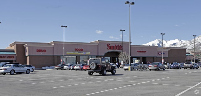
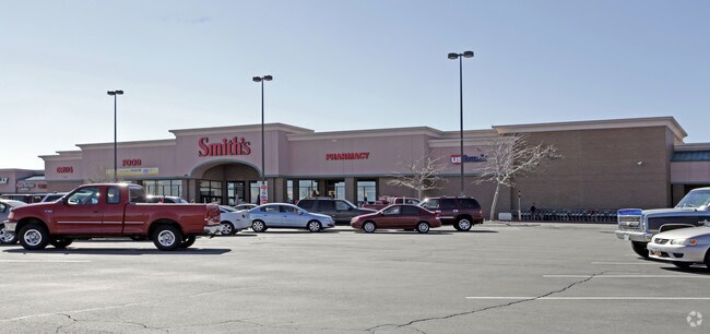
Property Record
8055 W 3500 S, Magna, UT 84044

NEARBY LISTINGS FOR SALE OR LEASE
Property Detail
8055 W 3500 S
14-32-230-022-0000
BEG S 00420 W 620 FT & N 894924 W 33 FT FR NE COR SEC 32, T1S, R2W, SLM; N 894924 W 553.13 FT; N 99.76 FT; E 6 FT; N 467.22 FT; S 894924 E 137.86 FT M OR L; S 01036 W 1.79 FT; S 894924 E 115.07 FT; N 01036 E 1.79 FT; S 894924 E 162.48 FT M OR L; S 30
Storebuilding
Salt Lake
X
Utah
49035C0275G
5.24 AC
2024
West Valley/Lake Park
2025
Salt Lake City
113905
Salt Lake City, UT
51,718 SF
DEMOGRAPHICS near 8055 W 3500 S
1 Mile
3 Mile
5 Mile
2024 Total Population
18,773
54,849
119,015
2029 Population
18,851
55,076
119,531
Pop Growth 2024-2029
+ 0.42%
+ 0.41%
+ 0.43%
Average Age
34
34
35
2024 Total Households
5,244
15,155
32,312
HH Growth 2024-2029
+ 0.29%
+ 0.28%
+ 0.31%
Median Household Inc
$77,715
$81,321
$81,973
Avg Household Size
3.50
3.50
3.60
2024 Avg HH Vehicles
2.00
2.00
3.00
Median Home Value
$322,052
$338,394
$339,162
Median Year Built
1985
1989
1984
Nearby Places
Map Layers
Map Styles
 Street
 Aerial
- Restaurants
- Banks
- Shops
- Fitness
- Groceries
PUBLIC TRANSPORTATION
AIRPORT
Salt Lake City International
DRIVE
WALK
Distance
Salt Lake City International
17 min
11.0 mi
Freight Ports
Port of Stockton
DRIVE
WALK
Distance
Port of Stockton
703 min
687.2 mi
Nearby Properties
Address
Land Use
TOTAL SIZE
Lot Size
Zoning
Address
Land Use
TOTAL SIZE
Lot Size
Zoning
613,674 SF
1,309.05 AC
M
Address
Land Use
TOTAL SIZE
Lot Size
Zoning
634,402 SF
32.29 AC
IP-M
Address
Land Use
TOTAL SIZE
Lot Size
Zoning
479,807 SF
13.13 AC
P-C
Address
Land Use
TOTAL SIZE
Lot Size
Zoning
832,383 SF
19.61 AC
IP-M
Address
Land Use
TOTAL SIZE
Lot Size
Zoning
89,037 SF
11.79 AC
C-2
Address
Land Use
TOTAL SIZE
Lot Size
Zoning
480,159 SF
56.52 AC
M-1
Address
Land Use
TOTAL SIZE
Lot Size
Zoning
404,800 SF
24.62 AC
M
Address
Land Use
TOTAL SIZE
Lot Size
Zoning
496,431 SF
23.89 AC
IP-M
Address
Land Use
TOTAL SIZE
Lot Size
Zoning
172,016 SF
622.03 AC
M-2
Address
Land Use
TOTAL SIZE
Lot Size
Zoning
418,984 SF
21.65 AC
IP-M
Address
Land Use
TOTAL SIZE
Lot Size
Zoning
159,381 SF
18.82 AC
1106
Address
Land Use
TOTAL SIZE
Lot Size
Zoning
856,805 SF
782.87 AC
A-20
Address
Land Use
TOTAL SIZE
Lot Size
Zoning
374,120 SF
22.16 AC
IP-M
Address
Land Use
TOTAL SIZE
Lot Size
Zoning
54,033 SF
7.28 AC
R-M
Address
Land Use
TOTAL SIZE
Lot Size
Zoning
231,694 SF
20.73 AC
1206
Address
Land Use
TOTAL SIZE
Lot Size
Zoning
328,000 SF
18.04 AC
IP-M
Address
Land Use
TOTAL SIZE
Lot Size
Zoning
58,759 SF
9.82 AC
RM/ZC
Address
Land Use
TOTAL SIZE
Lot Size
Zoning
99,064 SF
5.65 AC
1P-M
Address
Land Use
TOTAL SIZE
Lot Size
Zoning
319,200 SF
18.64 AC
M
Address
Land Use
TOTAL SIZE
Lot Size
Zoning
342.97 AC
M
Address
Land Use
TOTAL SIZE
Lot Size
Zoning
640 AC
M-2
Address
Land Use
TOTAL SIZE
Lot Size
Zoning
32,500 SF
480 AC
IP-M-2
Address
Land Use
TOTAL SIZE
Lot Size
Zoning
183,638 SF
17.27 AC
1206
Address
Land Use
TOTAL SIZE
Lot Size
Zoning
480 AC
M-2
Address
Land Use
TOTAL SIZE
Lot Size
Zoning
480 AC
M-2
Address
Land Use
TOTAL SIZE
Lot Size
Zoning
338,399 SF
355 AC
M
Address
Land Use
TOTAL SIZE
Lot Size
Zoning
126,060 SF
7.35 AC
1P-M
Address
Land Use
TOTAL SIZE
Lot Size
Zoning
126,060 SF
7.01 AC
1P-M
Address
Land Use
TOTAL SIZE
Lot Size
Zoning
211.48 AC
M
Address
Land Use
TOTAL SIZE
Lot Size
Zoning
103,056 SF
5.35 AC
LI
The World's #1 Commercial Real Estate Marketplace
Connect with us
© 2026 CoStar Group
The information above has been obtained from sources believed reliable. While we do not doubt its accuracy we have not verified it and make no guarantee, warranty or representation about it. It is your responsibility to independently confirm its accuracy and completeness. Any projections, opinions, assumptions, or estimates used are for example only and do not represent the current or future performance of the property. The value of this transaction to you depends on tax and other factors which should be evaluated by your tax, financial, and legal advisors. You and your advisors should conduct a careful, independent investigation of the property to determine to your satisfaction the suitability of the property for your needs.