Property Record
8063 Decatur St, Detroit, MI 48228


NEARBY LISTINGS FOR SALE OR LEASE
Property Detail
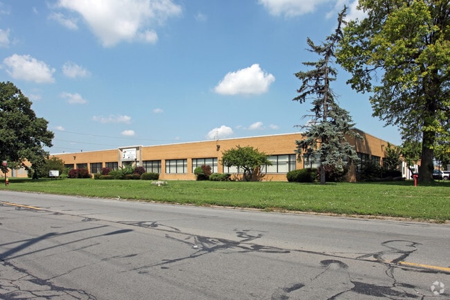
8063 Decatur St
22-00-193-60-02L
More Than One Legal Involved
Industrialgeneral
N TIREMAN PT OF N E 1/4 OF SEC 6 T 2 S R 11 E DESC AS FOLS BEG AT INTSEC OF W LINE OF DECATUR 50 FT WD & N LINE TIREMAN AS WD TH S 89D 54M 10S W 581.83 FT TH N 0D 18M 30S W 830.41 FT TH N 890D 54M 10S E 584.50 FT TH S 0D 7M 30S E 832.87 FT TO P O B 2
X
Wayne
26163C0260E
Michigan
2025
11.18 AC
2025
Dearborn
547200
Detroit
230,170 SF
Detroit-Warren-Dearborn, MI
DEMOGRAPHICS near 8063 Decatur St
1 Mile
3 Mile
5 Mile
2024 Total Population
22,052
167,195
387,159
2029 Population
21,276
165,051
382,611
Pop Growth 2024-2029
(3.52%)
(1.28%)
(1.17%)
Average Age
35
35
36
2024 Total Households
7,048
56,861
140,832
HH Growth 2024-2029
(3.12%)
(0.97%)
(0.91%)
Median Household Inc
$41,250
$35,588
$36,489
Avg Household Size
3.00
2.80
2.60
2024 Avg HH Vehicles
2.00
1.00
1.00
Median Home Value
$122,507
$84,931
$91,602
Median Year Built
1948
1948
1948
Nearby Places
Map Layers
Map Styles
 Street
 Aerial
- Restaurants
- Banks
- Shops
- Fitness
- Groceries
PUBLIC TRANSPORTATION
COMMUTER RAIL
DRIVE
WALK
Distance
14 min
5.8 mi
DRIVE
WALK
Distance
16 min
7.4 mi
AIRPORT
Detroit Metro Wayne County
DRIVE
WALK
Distance
Detroit Metro Wayne County
32 min
18.3 mi
Windsor International
DRIVE
WALK
Distance
Windsor International
38 min
18.7 mi
Freight Ports
DRIVE
WALK
Distance
78 min
58.6 mi
Nearby Properties
Address
Land Use
TOTAL SIZE
Lot Size
Zoning
Address
Land Use
TOTAL SIZE
Lot Size
Zoning
830,075 SF
167.21 AC
BC
Address
Land Use
TOTAL SIZE
Lot Size
Zoning
475,972 SF
42.17 AC
RD
Address
Land Use
TOTAL SIZE
Lot Size
Zoning
1,043,110 SF
35.36 AC
RE
Address
Land Use
TOTAL SIZE
Lot Size
Zoning
153,040 SF
2.13 AC
BC
Address
Land Use
TOTAL SIZE
Lot Size
Zoning
324,414 SF
18.68 AC
RD
Address
Land Use
TOTAL SIZE
Lot Size
Zoning
1,211,148 SF
69.13 AC
M4
Address
Land Use
TOTAL SIZE
Lot Size
Zoning
783,976 SF
52.57 AC
M4
Address
Land Use
TOTAL SIZE
Lot Size
Zoning
429,654 SF
49.81 AC
TR
Address
Land Use
TOTAL SIZE
Lot Size
Zoning
228,519 SF
6.16 AC
BC
Address
Land Use
TOTAL SIZE
Lot Size
Zoning
551,788 SF
31.52 AC
BC
Address
Land Use
TOTAL SIZE
Lot Size
Zoning
562,922 SF
30 AC
BC
Address
Land Use
TOTAL SIZE
Lot Size
Zoning
80,861 SF
1.17 AC
BC
Address
Land Use
TOTAL SIZE
Lot Size
Zoning
111,008 SF
26.62 AC
IB
Address
Land Use
TOTAL SIZE
Lot Size
Zoning
365,040 SF
382 AC
M4
Address
Land Use
TOTAL SIZE
Lot Size
Zoning
520,522 SF
51.78 AC
M4
Address
Land Use
TOTAL SIZE
Lot Size
Zoning
192,813 SF
28.92 AC
TR
Address
Land Use
TOTAL SIZE
Lot Size
Zoning
145,702 SF
16.35 AC
TR
Address
Land Use
TOTAL SIZE
Lot Size
Zoning
148,491 SF
11.34 AC
BC
Address
Land Use
TOTAL SIZE
Lot Size
Zoning
303,705 SF
17.28 AC
ID
Address
Land Use
TOTAL SIZE
Lot Size
Zoning
72,326 SF
0.74 AC
BB
Address
Land Use
TOTAL SIZE
Lot Size
Zoning
637,820 SF
10.87 AC
BC
Address
Land Use
TOTAL SIZE
Lot Size
Zoning
331,121 SF
21.01 AC
BC
Address
Land Use
TOTAL SIZE
Lot Size
Zoning
102,920 SF
10.72 AC
BB
Address
Land Use
TOTAL SIZE
Lot Size
Zoning
57,139 SF
35 AC
BC
Address
Land Use
TOTAL SIZE
Lot Size
Zoning
95,908 SF
1.12 AC
BB
Address
Land Use
TOTAL SIZE
Lot Size
Zoning
207,081 SF
8.80 AC
B5
Address
Land Use
TOTAL SIZE
Lot Size
Zoning
189,338 SF
18.10 AC
BB
Address
Land Use
TOTAL SIZE
Lot Size
Zoning
115,159 SF
10.49 AC
BB
Address
Land Use
TOTAL SIZE
Lot Size
Zoning
80,871 SF
4.98 AC
BB
Address
Land Use
TOTAL SIZE
Lot Size
Zoning
83,552 SF
20.32 AC
IC
The World's #1 Commercial Real Estate Marketplace
Connect with us
© 2026 CoStar Group
The information above has been obtained from sources believed reliable. While we do not doubt its accuracy we have not verified it and make no guarantee, warranty or representation about it. It is your responsibility to independently confirm its accuracy and completeness. Any projections, opinions, assumptions, or estimates used are for example only and do not represent the current or future performance of the property. The value of this transaction to you depends on tax and other factors which should be evaluated by your tax, financial, and legal advisors. You and your advisors should conduct a careful, independent investigation of the property to determine to your satisfaction the suitability of the property for your needs.