Property Record
807 S Main St, Oregon, WI 53575


Save to a Folder
{{folder.Name}}
{{folder.ListingIds.length}} Properties
{{folder.ListingIds.length}} Property
Create a New Folder
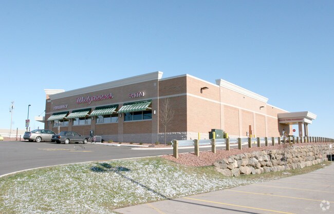
Property Detail
807 S Main St
Madison, WI
LOT 1 CSM 11339 CS68/310&313-2/28/2005 F/K/A LOT 1 CSM 9411 CS53/243&244-8/17/99 F/K/A LOT 1 CSM 9349 CS53/83&85 F/K/A LOTS 1, 2 & 3 CSM 2587 CSM 10/175&176 & A LSO INCL & DESCR AS SEC 20-9-10 PRT NW1/4NW1/4 (1.788 ACRES) SUBJ TO & TOG W/DRI VEWAY ES
0910-202-8620-1
DANE
Commercialnec
Wisconsin
B and X Area of moderate flood hazard, usually the area between the limits of the 100-year and 500-year floods.
1
2025
1.79 AC
2025
Outlying Dane East
012501
Milwaukee/Madison
NEARBY LISTINGS FOR SALE OR LEASE
-
-
View all Oregon listings for sale on LoopNet.com
DEMOGRAPHICS near 807 S Main St
1 mile
3 mile
5 mile
2025 Total Population
7,441
19,685
25,787
2030 Population
7,708
20,594
26,915
Pop Growth 2025-2030
+ 3.59%
+ 4.62%
+ 4.37%
Average Age
39
39
39
2025 Total Households
2,794
7,421
9,617
HH Growth 2025-2030
+ 3.83%
+ 4.92%
+ 4.65%
Median Household Inc
$101,531
$105,000
$108,832
Avg Household Size
2.70
2.60
2.70
2025 Avg HH Vehicles
2.00
2.00
2.00
Median Home Value
$378,627
$396,744
$407,185
Median Year Built
1989
1990
1991
Nearby Places
Map Layers
Map Styles
 Street
 Aerial
Layers
 Traffic
 Biking
Places
Listings with unknown addresses are not visible on the map
- Restaurants
- Banks
- Shops
- Fitness
- Groceries
PUBLIC TRANSPORTATION
AIRPORT
Dane County Regional/Truax Field
Drive
Walk
Distance
Dane County Regional/Truax Field
19 min
10.0 mi
Nearby Properties
Address
Land Use
TOTAL SIZE
Lot Size
Zoning
Address
Land Use
TOTAL SIZE
Lot Size
Zoning
48.24 AC
Address
Land Use
TOTAL SIZE
Lot Size
Zoning
37.54 AC
Address
Land Use
TOTAL SIZE
Lot Size
Zoning
24.70 AC
Address
Land Use
TOTAL SIZE
Lot Size
Zoning
26.50 AC
Address
Land Use
TOTAL SIZE
Lot Size
Zoning
Address
Land Use
TOTAL SIZE
Lot Size
Zoning
Address
Land Use
TOTAL SIZE
Lot Size
Zoning
3.77 AC
Address
Land Use
TOTAL SIZE
Lot Size
Zoning
16.64 AC
Address
Land Use
TOTAL SIZE
Lot Size
Zoning
15.91 AC
Address
Land Use
TOTAL SIZE
Lot Size
Zoning
8.19 AC
Address
Land Use
TOTAL SIZE
Lot Size
Zoning
21.88 AC
Address
Land Use
TOTAL SIZE
Lot Size
Zoning
18.31 AC
Address
Land Use
TOTAL SIZE
Lot Size
Zoning
5.57 AC
Address
Land Use
TOTAL SIZE
Lot Size
Zoning
13.40 AC
Address
Land Use
TOTAL SIZE
Lot Size
Zoning
3.60 AC
Address
Land Use
TOTAL SIZE
Lot Size
Zoning
2.60 AC
Address
Land Use
TOTAL SIZE
Lot Size
Zoning
20.59 AC
C2
Address
Land Use
TOTAL SIZE
Lot Size
Zoning
19.56 AC
Address
Land Use
TOTAL SIZE
Lot Size
Zoning
33.67 AC
Address
Land Use
TOTAL SIZE
Lot Size
Zoning
3.76 AC
R-4
Address
Land Use
TOTAL SIZE
Lot Size
Zoning
11.62 AC
Address
Land Use
TOTAL SIZE
Lot Size
Zoning
9.10 AC
Address
Land Use
TOTAL SIZE
Lot Size
Zoning
14.75 AC
Address
Land Use
TOTAL SIZE
Lot Size
Zoning
12.30 AC
C2
Address
Land Use
TOTAL SIZE
Lot Size
Zoning
Address
Land Use
TOTAL SIZE
Lot Size
Zoning
1.82 AC
Address
Land Use
TOTAL SIZE
Lot Size
Zoning
Address
Land Use
TOTAL SIZE
Lot Size
Zoning
2.49 AC
Address
Land Use
TOTAL SIZE
Lot Size
Zoning
1.50 AC
Address
Land Use
TOTAL SIZE
Lot Size
Zoning
38.60 AC
The World's #1 Commercial Real Estate Marketplace
Connect with us
© 2026 CoStar Group
The information above has been obtained from sources believed reliable. While we do not doubt its accuracy we have not verified it and make no guarantee, warranty or representation about it. It is your responsibility to independently confirm its accuracy and completeness. Any projections, opinions, assumptions, or estimates used are for example only and do not represent the current or future performance of the property. The value of this transaction to you depends on tax and other factors which should be evaluated by your tax, financial, and legal advisors. You and your advisors should conduct a careful, independent investigation of the property to determine to your satisfaction the suitability of the property for your needs.