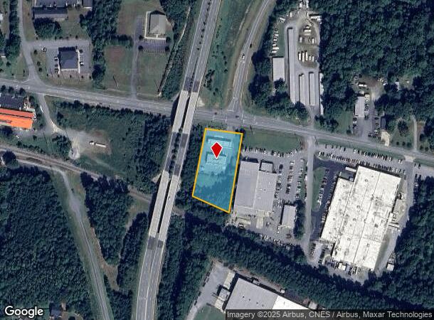
Property Record
807 W Haggard Ave, Elon, NC 27244

NEARBY LISTINGS FOR SALE OR LEASE
Property Detail
807 W Haggard Ave
Burlington, NC
Final Property Mcdonald L
108966
W HAGGARD AVE LT 4 3-32-5
Conveniencestore
Alamance
X
North Carolina
3710884500L
4
2025
1.46 AC
2025
NW Alamance County
021702
Greensboro/Winston-Salem
3,344 SF
DEMOGRAPHICS near 807 W Haggard Ave
1 Mile
3 Mile
5 Mile
2024 Total Population
6,926
36,842
76,032
2029 Population
7,371
39,308
81,147
Pop Growth 2024-2029
+ 6.43%
+ 6.69%
+ 6.73%
Average Age
38
40
40
2024 Total Households
2,213
13,852
30,020
HH Growth 2024-2029
+ 6.60%
+ 6.97%
+ 6.92%
Median Household Inc
$80,611
$75,132
$62,630
Avg Household Size
2.50
2.30
2.30
2024 Avg HH Vehicles
2.00
2.00
2.00
Median Home Value
$238,206
$244,668
$219,529
Median Year Built
1993
1995
1989
Nearby Places
Map Layers
Map Styles
 Street
 Aerial
- Restaurants
- Banks
- Shops
- Fitness
- Groceries
PUBLIC TRANSPORTATION
COMMUTER RAIL
Burlington Station (Piedmont - North Carolina by Train (NC Train))
DRIVE
WALK
Distance
Burlington Station (Piedmont - North Carolina by Train (NC Train))
9 min
5.8 mi
AIRPORT
Piedmont Triad International
DRIVE
WALK
Distance
Piedmont Triad International
46 min
29.3 mi
Nearby Properties
Address
Land Use
TOTAL SIZE
Lot Size
Zoning
Address
Land Use
TOTAL SIZE
Lot Size
Zoning
3,339 SF
58.37 AC
PI
Address
Land Use
TOTAL SIZE
Lot Size
Zoning
9,120 SF
83.53 AC
PI
Address
Land Use
TOTAL SIZE
Lot Size
Zoning
32,192 SF
28.12 AC
PI
Address
Land Use
TOTAL SIZE
Lot Size
Zoning
81,153 SF
62.10 AC
X 1
Address
Land Use
TOTAL SIZE
Lot Size
Zoning
128,458 SF
70.20 AC
IO CI
Address
Land Use
TOTAL SIZE
Lot Size
Zoning
26,280 SF
14.34 AC
R 15
Address
Land Use
TOTAL SIZE
Lot Size
Zoning
70,346 SF
8.94 AC
PI
Address
Land Use
TOTAL SIZE
Lot Size
Zoning
154,450 SF
28.40 AC
PI
Address
Land Use
TOTAL SIZE
Lot Size
Zoning
146,080 SF
22.15 AC
X 1
Address
Land Use
TOTAL SIZE
Lot Size
Zoning
26,280 SF
11.24 AC
CR
Address
Land Use
TOTAL SIZE
Lot Size
Zoning
51,381 SF
34.69 AC
CB
Address
Land Use
TOTAL SIZE
Lot Size
Zoning
10,368 SF
13.60 AC
MFA
Address
Land Use
TOTAL SIZE
Lot Size
Zoning
8,090 SF
12.97 AC
TOWN CEN
Address
Land Use
TOTAL SIZE
Lot Size
Zoning
27,803 SF
8.80 AC
CR
Address
Land Use
TOTAL SIZE
Lot Size
Zoning
47,520 SF
6.10 AC
B 2
Address
Land Use
TOTAL SIZE
Lot Size
Zoning
141,600 SF
18 AC
X 1
Address
Land Use
TOTAL SIZE
Lot Size
Zoning
23,265 SF
20.45 AC
MF A
Address
Land Use
TOTAL SIZE
Lot Size
Zoning
36,900 SF
16.07 AC
PI
Address
Land Use
TOTAL SIZE
Lot Size
Zoning
399,195 SF
24.84 AC
RM-12
Address
Land Use
TOTAL SIZE
Lot Size
Zoning
33,616 SF
11.20 AC
CI
Address
Land Use
TOTAL SIZE
Lot Size
Zoning
154,450 SF
29.50 AC
PI
Address
Land Use
TOTAL SIZE
Lot Size
Zoning
135,186 SF
15.60 AC
CR
Address
Land Use
TOTAL SIZE
Lot Size
Zoning
28,812 SF
15.63 AC
MFA
Address
Land Use
TOTAL SIZE
Lot Size
Zoning
84,783 SF
32.88 AC
CB
Address
Land Use
TOTAL SIZE
Lot Size
Zoning
29,120 SF
56.82 AC
X 1
Address
Land Use
TOTAL SIZE
Lot Size
Zoning
203,832 SF
36.10 AC
B 2
Address
Land Use
TOTAL SIZE
Lot Size
Zoning
10,384 SF
16.51 AC
B2
Address
Land Use
TOTAL SIZE
Lot Size
Zoning
14,760 SF
13.07 AC
MFA
Address
Land Use
TOTAL SIZE
Lot Size
Zoning
18,545 SF
634.86 AC
PI
Address
Land Use
TOTAL SIZE
Lot Size
Zoning
10,604 SF
24.43 AC
R 9
The World's #1 Commercial Real Estate Marketplace
Connect with us
© 2025 CoStar Group
The information above has been obtained from sources believed reliable. While we do not doubt its accuracy we have not verified it and make no guarantee, warranty or representation about it. It is your responsibility to independently confirm its accuracy and completeness. Any projections, opinions, assumptions, or estimates used are for example only and do not represent the current or future performance of the property. The value of this transaction to you depends on tax and other factors which should be evaluated by your tax, financial, and legal advisors. You and your advisors should conduct a careful, independent investigation of the property to determine to your satisfaction the suitability of the property for your needs.