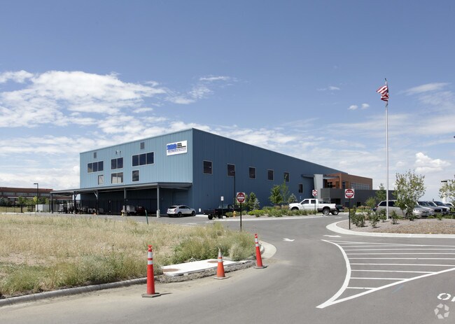
Property Record
8073 S Wallace Ct, Englewood, CO 80112
NEARBY LISTINGS FOR SALE OR LEASE
Property Detail
8073 S Wallace Ct
Denver-Aurora-Lakewood, CO
SECTION 36 TOWNSHIP 05 RANGE 67 W 1/2 W 1/2 & E 1/2 SW 1/4 & S 1/2 SE 1/4 NW 1/4 & S 1/2 SW 1/4 NE 1/4 & SE 1/4 EX N 1/2 NE 1/4 SE 1/4 TOG WITH VAC ST ADJ EX ROAD & EX ALL LAND & IMPROVEMENTS LEASED TO OTHERS SEC 36-5-67
2075-36-3-00-013
Arapahoe
Officebuilding
Colorado
0
308.89 AC
2025
Centennial
006864
Denver
29,070 SF
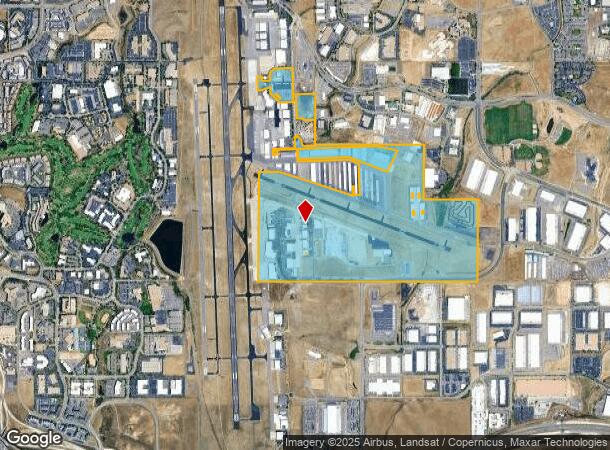
DEMOGRAPHICS near 8073 S Wallace Ct
1 Mile
3 Mile
5 Mile
2024 Total Population
431
63,031
206,079
2029 Population
511
67,641
219,413
Pop Growth 2024-2029
+ 18.56%
+ 7.31%
+ 6.47%
Average Age
33
38
39
2024 Total Households
249
27,146
80,936
HH Growth 2024-2029
+ 18.88%
+ 7.78%
+ 6.69%
Median Household Inc
$55,795
$100,736
$116,202
Avg Household Size
1.70
2.30
2.50
2024 Avg HH Vehicles
1.00
2.00
2.00
Median Home Value
$350,000
$592,851
$648,360
Median Year Built
2011
2003
1996
Nearby Places
Map Layers
Map Styles
 Street
 Aerial
- Restaurants
- Banks
- Shops
- Fitness
- Groceries
PUBLIC TRANSPORTATION
AIRPORT
Denver International
DRIVE
WALK
Distance
Denver International
37 min
32.9 mi
SALE & LEASE HISTORY
LISTING DATE
SALE/LEASE

Feb 27, 2017
For Sale
Feb 19, 2018
For Sale
Nearby Properties
Address
Land Use
TOTAL SIZE
Lot Size
Zoning
Address
Land Use
TOTAL SIZE
Lot Size
Zoning
709,725 SF
15.21 AC
Address
Land Use
TOTAL SIZE
Lot Size
Zoning
709,725 SF
29.14 AC
Address
Land Use
TOTAL SIZE
Lot Size
Zoning
260,667 SF
19.72 AC
Address
Land Use
TOTAL SIZE
Lot Size
Zoning
1,630,979 SF
32.01 AC
Address
Land Use
TOTAL SIZE
Lot Size
Zoning
637,459 SF
4.94 AC
AMU
Address
Land Use
TOTAL SIZE
Lot Size
Zoning
1,210,850 SF
13.65 AC
AMU
Address
Land Use
TOTAL SIZE
Lot Size
Zoning
305,198 SF
34.41 AC
PUD
Address
Land Use
TOTAL SIZE
Lot Size
Zoning
284,862 SF
23.37 AC
PUD
Address
Land Use
TOTAL SIZE
Lot Size
Zoning
162,758 SF
11.21 AC
Address
Land Use
TOTAL SIZE
Lot Size
Zoning
246,768 SF
12.37 AC
PUD
Address
Land Use
TOTAL SIZE
Lot Size
Zoning
134,316 SF
26.52 AC
Address
Land Use
TOTAL SIZE
Lot Size
Zoning
247,689 SF
26.15 AC
AMU
Address
Land Use
TOTAL SIZE
Lot Size
Zoning
621,565 SF
32.64 AC
PDU
Address
Land Use
TOTAL SIZE
Lot Size
Zoning
139,291 SF
8.63 AC
AMU
Address
Land Use
TOTAL SIZE
Lot Size
Zoning
216,853 SF
5.42 AC
PUD
Address
Land Use
TOTAL SIZE
Lot Size
Zoning
163,443 SF
14.39 AC
Address
Land Use
TOTAL SIZE
Lot Size
Zoning
650,416 SF
33.37 AC
LI
Address
Land Use
TOTAL SIZE
Lot Size
Zoning
661,139 SF
Address
Land Use
TOTAL SIZE
Lot Size
Zoning
224,978 SF
18.99 AC
Address
Land Use
TOTAL SIZE
Lot Size
Zoning
304,620 SF
23.95 AC
AMU
Address
Land Use
TOTAL SIZE
Lot Size
Zoning
231,715 SF
5.58 AC
Address
Land Use
TOTAL SIZE
Lot Size
Zoning
107,760 SF
5.41 AC
AMU
Address
Land Use
TOTAL SIZE
Lot Size
Zoning
279,884 SF
14.72 AC
Address
Land Use
TOTAL SIZE
Lot Size
Zoning
418,258 SF
14.46 AC
PDU
Address
Land Use
TOTAL SIZE
Lot Size
Zoning
222,000 SF
16.26 AC
AMU
Address
Land Use
TOTAL SIZE
Lot Size
Zoning
355,326 SF
12.27 AC
PUD
Address
Land Use
TOTAL SIZE
Lot Size
Zoning
253,296 SF
16.41 AC
Address
Land Use
TOTAL SIZE
Lot Size
Zoning
494,862 SF
30.59 AC
PDU
Address
Land Use
TOTAL SIZE
Lot Size
Zoning
441,689 SF
25.31 AC
The World's #1 Commercial Real Estate Marketplace
Connect with us
© 2026 CoStar Group
The information above has been obtained from sources believed reliable. While we do not doubt its accuracy we have not verified it and make no guarantee, warranty or representation about it. It is your responsibility to independently confirm its accuracy and completeness. Any projections, opinions, assumptions, or estimates used are for example only and do not represent the current or future performance of the property. The value of this transaction to you depends on tax and other factors which should be evaluated by your tax, financial, and legal advisors. You and your advisors should conduct a careful, independent investigation of the property to determine to your satisfaction the suitability of the property for your needs.