Property Record
8078 Stringfellow Rd, Saint James City, FL 33956
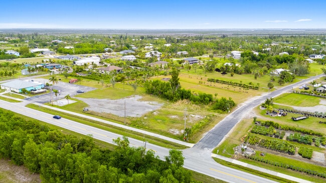

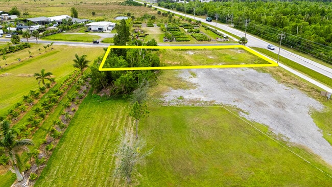
Property Detail
8078 Stringfellow Rd
Cape Coral-Fort Myers, FL
GULF SHORES ESTATES UNREC OR 469 PG 174 LOTS 62 THRU 65
03-45-22-01-00000.0620
LEE
Commercialacreage
Florida
CIA
62-65
AE The base floodplain where base flood elevations are provided. AE Zones are now used on new format FIRMs instead of A1-A30 Zones.
0.62 AC
2024
The Islands
2025
Southwest Florida
070202
NEARBY LISTINGS FOR SALE OR LEASE
DEMOGRAPHICS near 8078 Stringfellow Rd
1 mile
3 mile
5 mile
2025 Total Population
1,271
2,471
11,326
2030 Population
1,428
2,760
12,699
Pop Growth 2025-2030
+ 12.35%
+ 11.70%
+ 12.12%
Average Age
60
57
53
2025 Total Households
672
1,255
5,150
HH Growth 2025-2030
+ 11.61%
+ 11.08%
+ 11.50%
Median Household Inc
$50,851
$54,548
$73,651
Avg Household Size
1.80
1.90
2.10
2025 Avg HH Vehicles
2.00
2.00
2.00
Median Home Value
$336,000
$355,499
$481,257
Median Year Built
1983
1983
1994
Nearby Places
Map Layers
Map Styles
 Street
 Aerial
Transit
 Traffic
 Biking
Places
Listings with unknown addresses are not visible on the map
- Restaurants
- Banks
- Shops
- Fitness
- Groceries
PUBLIC TRANSPORTATION
AIRPORT
Punta Gorda
Drive
Walk
Distance
Punta Gorda
51 min
29.4 mi
Southwest Florida International
Drive
Walk
Distance
Southwest Florida International
57 min
33.3 mi
SALE & LEASE HISTORY
LISTING DATE
SALE/LEASE

Jan 23, 2025
For Sale
Nearby Properties
Address
Land Use
TOTAL SIZE
Lot Size
Zoning
Address
Land Use
TOTAL SIZE
Lot Size
Zoning
207.51 AC
AG-2
Address
Land Use
TOTAL SIZE
Lot Size
Zoning
69,398 SF
10.01 AC
C-1
Address
Land Use
TOTAL SIZE
Lot Size
Zoning
780.48 AC
AG-2
Address
Land Use
TOTAL SIZE
Lot Size
Zoning
53,681 SF
14.43 AC
TFC2
Address
Land Use
TOTAL SIZE
Lot Size
Zoning
34,250 SF
5.84 AC
CPD
Address
Land Use
TOTAL SIZE
Lot Size
Zoning
784 SF
4,603.99 AC
AG-2
Address
Land Use
TOTAL SIZE
Lot Size
Zoning
30,439 SF
5.06 AC
AG-2
Address
Land Use
TOTAL SIZE
Lot Size
Zoning
22.89 AC
RM-2
Address
Land Use
TOTAL SIZE
Lot Size
Zoning
175.30 AC
AG-2
Address
Land Use
TOTAL SIZE
Lot Size
Zoning
9,152 SF
1.32 AC
C-1
Address
Land Use
TOTAL SIZE
Lot Size
Zoning
17,400 SF
51.01 AC
AG-2
Address
Land Use
TOTAL SIZE
Lot Size
Zoning
16.96 AC
RM-2
Address
Land Use
TOTAL SIZE
Lot Size
Zoning
4,569 SF
2.82 AC
CPD
Address
Land Use
TOTAL SIZE
Lot Size
Zoning
5,000 SF
1.07 AC
IG
Address
Land Use
TOTAL SIZE
Lot Size
Zoning
20.48 AC
RM-2
Address
Land Use
TOTAL SIZE
Lot Size
Zoning
25.84 AC
RS-1
Address
Land Use
TOTAL SIZE
Lot Size
Zoning
259 SF
2.48 AC
PORT
Address
Land Use
TOTAL SIZE
Lot Size
Zoning
2,648 SF
7.19 AC
AG-2
Address
Land Use
TOTAL SIZE
Lot Size
Zoning
21,050 SF
1.35 AC
IL
Address
Land Use
TOTAL SIZE
Lot Size
Zoning
23,006 SF
1.68 AC
CG
Address
Land Use
TOTAL SIZE
Lot Size
Zoning
13,373 SF
0.60 AC
AG-2
Address
Land Use
TOTAL SIZE
Lot Size
Zoning
9,343 SF
1.07 AC
CC
Address
Land Use
TOTAL SIZE
Lot Size
Zoning
8,581 SF
0.87 AC
C-1
Address
Land Use
TOTAL SIZE
Lot Size
Zoning
8,750 SF
3.69 AC
AG-2
Address
Land Use
TOTAL SIZE
Lot Size
Zoning
8,689 SF
1.23 AC
C-1
Address
Land Use
TOTAL SIZE
Lot Size
Zoning
9,822 SF
0.89 AC
CC
Address
Land Use
TOTAL SIZE
Lot Size
Zoning
6,373 SF
4.60 AC
C1A
Address
Land Use
TOTAL SIZE
Lot Size
Zoning
9,622 SF
2.74 AC
TFC2
Address
Land Use
TOTAL SIZE
Lot Size
Zoning
1.64 AC
IG
Address
Land Use
TOTAL SIZE
Lot Size
Zoning
1.24 AC
CPD
The World's #1 Commercial Real Estate Marketplace
Connect with us
© 2026 CoStar Group
The information above has been obtained from sources believed reliable. While we do not doubt its accuracy we have not verified it and make no guarantee, warranty or representation about it. It is your responsibility to independently confirm its accuracy and completeness. Any projections, opinions, assumptions, or estimates used are for example only and do not represent the current or future performance of the property. The value of this transaction to you depends on tax and other factors which should be evaluated by your tax, financial, and legal advisors. You and your advisors should conduct a careful, independent investigation of the property to determine to your satisfaction the suitability of the property for your needs.