Property Record
808 E Mckellips Rd, Mesa, AZ 85203


Property Detail
808 E Mckellips Rd
136-08-012G
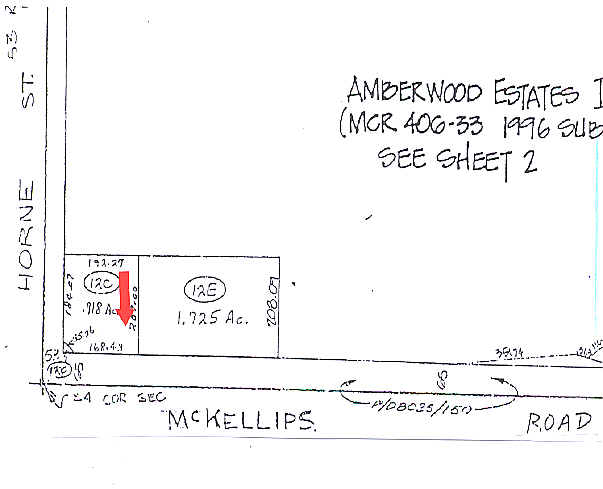
PT SE4 SEC 2 DAF COM S4 COR SD SEC TH E 238.43F TH N 65F TO TPOB TH W 168.43F TH N 44D 50M W 35.26F TH N 184.07F TH E 192.27F TH S 209.00F TO TPOB P/F 95-0614999 EX ANY POR LY W/I WLY 53F RD TOG WI TH POR OF HORNE ST ABAND BY RESOL NO 6825 DAF BEG S4
Storebuilding
Maricopa
X
Arizona
04013C2255L
0.92 AC
2025
Red Mountain/Mesa
2025
Phoenix
420401
Phoenix-Mesa-Chandler, AZ
3,938 SF
NEARBY LISTINGS FOR SALE OR LEASE
DEMOGRAPHICS near 808 E Mckellips Rd
1 mile
3 mile
5 mile
2024 Total Population
14,273
100,975
256,782
2029 Population
15,313
109,110
277,679
Pop Growth 2024-2029
+ 7.29%
+ 8.06%
+ 8.14%
Average Age
38
36
37
2024 Total Households
5,119
35,707
94,984
HH Growth 2024-2029
+ 7.35%
+ 8.22%
+ 8.45%
Median Household Inc
$67,675
$61,979
$57,083
Avg Household Size
2.70
2.70
2.60
2024 Avg HH Vehicles
2.00
2.00
2.00
Median Home Value
$369,213
$363,848
$309,164
Median Year Built
1984
1981
1981
Nearby Places
Map Layers
Map Styles
 Street
 Aerial
Transit
 Traffic
 Biking
Places
Listings with unknown addresses are not visible on the map
- Restaurants
- Banks
- Shops
- Fitness
- Groceries
PUBLIC TRANSPORTATION
AIRPORT
Phoenix Sky Harbor International
Drive
Walk
Distance
Phoenix Sky Harbor International
18 min
11.8 mi
Phoenix-Mesa Gateway
Drive
Walk
Distance
Phoenix-Mesa Gateway
31 min
18.9 mi
Nearby Properties
Address
Land Use
TOTAL SIZE
Lot Size
Zoning
Address
Land Use
TOTAL SIZE
Lot Size
Zoning
125,356 SF
21.63 AC
R-9
Address
Land Use
TOTAL SIZE
Lot Size
Zoning
11,722 SF
182.53 AC
PS
Address
Land Use
TOTAL SIZE
Lot Size
Zoning
377,442 SF
0.21 AC
C-DT
Address
Land Use
TOTAL SIZE
Lot Size
Zoning
400,798 SF
55.94 AC
PF
Address
Land Use
TOTAL SIZE
Lot Size
Zoning
267,023 SF
19.58 AC
PEP
Address
Land Use
TOTAL SIZE
Lot Size
Zoning
579,506 SF
17.78 AC
PF
Address
Land Use
TOTAL SIZE
Lot Size
Zoning
20.08 AC
Address
Land Use
TOTAL SIZE
Lot Size
Zoning
407,570 SF
6.22 AC
PEP
Address
Land Use
TOTAL SIZE
Lot Size
Zoning
454,015 SF
10.03 AC
DB1
Address
Land Use
TOTAL SIZE
Lot Size
Zoning
5,419 SF
21.06 AC
M-H
Address
Land Use
TOTAL SIZE
Lot Size
Zoning
1.46 AC
C-G
Address
Land Use
TOTAL SIZE
Lot Size
Zoning
478,411 SF
4.07 AC
CDT
Address
Land Use
TOTAL SIZE
Lot Size
Zoning
199,472 SF
4.79 AC
C-DT
Address
Land Use
TOTAL SIZE
Lot Size
Zoning
79,452 SF
37.59 AC
PF
Address
Land Use
TOTAL SIZE
Lot Size
Zoning
107,519 SF
9.96 AC
M-H
Address
Land Use
TOTAL SIZE
Lot Size
Zoning
169,128 SF
27.30 AC
R-9
Address
Land Use
TOTAL SIZE
Lot Size
Zoning
147,408 SF
34.58 AC
PF
Address
Land Use
TOTAL SIZE
Lot Size
Zoning
536,470 SF
28.81 AC
M-H
Address
Land Use
TOTAL SIZE
Lot Size
Zoning
142,260 SF
17.92 AC
PF
Address
Land Use
TOTAL SIZE
Lot Size
Zoning
305,624 SF
18.53 AC
Address
Land Use
TOTAL SIZE
Lot Size
Zoning
321,591 SF
15.68 AC
M-H
Address
Land Use
TOTAL SIZE
Lot Size
Zoning
108,672 SF
1.59 AC
CDT
Address
Land Use
TOTAL SIZE
Lot Size
Zoning
403,809 SF
9.68 AC
C-DT
Address
Land Use
TOTAL SIZE
Lot Size
Zoning
203,299 SF
3.63 AC
C-DT
Address
Land Use
TOTAL SIZE
Lot Size
Zoning
103,086 SF
31.49 AC
PF
Address
Land Use
TOTAL SIZE
Lot Size
Zoning
113,276 SF
1.25 AC
C-DT
Address
Land Use
TOTAL SIZE
Lot Size
Zoning
180,910 SF
11.85 AC
M-H
Address
Land Use
TOTAL SIZE
Lot Size
Zoning
93,685 SF
2.60 AC
PEP
Address
Land Use
TOTAL SIZE
Lot Size
Zoning
918 SF
2.22 AC
R-TC
Address
Land Use
TOTAL SIZE
Lot Size
Zoning
89,043 SF
1.97 AC
M-H
The World's #1 Commercial Real Estate Marketplace
Connect with us
© 2026 CoStar Group
The information above has been obtained from sources believed reliable. While we do not doubt its accuracy we have not verified it and make no guarantee, warranty or representation about it. It is your responsibility to independently confirm its accuracy and completeness. Any projections, opinions, assumptions, or estimates used are for example only and do not represent the current or future performance of the property. The value of this transaction to you depends on tax and other factors which should be evaluated by your tax, financial, and legal advisors. You and your advisors should conduct a careful, independent investigation of the property to determine to your satisfaction the suitability of the property for your needs.