Property Record
8080 Steele St, Thornton, CO 80229
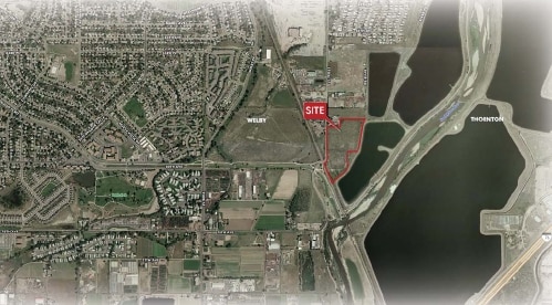

Property Detail
8080 Steele St
1719-25-4-01-001
SUB:STEELE STREET INDUSTRIAL PARK LOT:4
Miscellaneous
ADAMS
I2
Colorado
B and X Area of moderate flood hazard, usually the area between the limits of the 100-year and 500-year floods.
4
2024
2.70 AC
2025
North Denver
015000
Denver
11,221 SF
Denver-Aurora-Centennial, CO
NEARBY LISTINGS FOR SALE OR LEASE
DEMOGRAPHICS near 8080 Steele St
1 mile
3 mile
5 mile
2024 Total Population
7,076
100,380
256,362
2029 Population
7,298
104,154
265,237
Pop Growth 2024-2029
+ 3.14%
+ 3.76%
+ 3.46%
Average Age
37
36
37
2024 Total Households
2,559
33,290
88,423
HH Growth 2024-2029
+ 3.36%
+ 4.07%
+ 3.75%
Median Household Inc
$77,083
$78,436
$82,609
Avg Household Size
2.70
2.90
2.80
2024 Avg HH Vehicles
2.00
2.00
2.00
Median Home Value
$342,925
$408,873
$439,274
Median Year Built
1978
1978
1978
Nearby Places
Map Layers
Map Styles
 Street
 Aerial
Transit
 Traffic
 Biking
Places
Listings with unknown addresses are not visible on the map
- Restaurants
- Banks
- Shops
- Fitness
- Groceries
PUBLIC TRANSPORTATION
COMMUTER RAIL
Original Thornton - 88Th Station Track 1 (Union Station to Eastlake & 124th Station - Regional Transportation District)
Drive
Walk
Distance
Original Thornton - 88Th Station Track 1 (Union Station to Eastlake & 124th Station - Regional Transportation District)
6 min
1.8 mi
Commerce City - 72Nd Station Track 1 (Union Station to Eastlake & 124th Station - Regional Transportation District)
Drive
Walk
Distance
Commerce City - 72Nd Station Track 1 (Union Station to Eastlake & 124th Station - Regional Transportation District)
8 min
3.2 mi
AIRPORT
Denver International
Drive
Walk
Distance
Denver International
34 min
24.0 mi
Freight Ports
Tulsa Port Of Catoosa
Drive
Walk
Distance
Tulsa Port Of Catoosa
731 min
709.5 mi
Nearby Properties
Address
Land Use
TOTAL SIZE
Lot Size
Zoning
Address
Land Use
TOTAL SIZE
Lot Size
Zoning
396,741 SF
8.12 AC
A1
Address
Land Use
TOTAL SIZE
Lot Size
Zoning
271,631 SF
12.84 AC
Address
Land Use
TOTAL SIZE
Lot Size
Zoning
295,558 SF
13.41 AC
Address
Land Use
TOTAL SIZE
Lot Size
Zoning
256,155 SF
3.84 AC
Address
Land Use
TOTAL SIZE
Lot Size
Zoning
106,680 SF
17.39 AC
Address
Land Use
TOTAL SIZE
Lot Size
Zoning
140,430 SF
8.39 AC
Address
Land Use
TOTAL SIZE
Lot Size
Zoning
140,328 SF
6.54 AC
PUD
Address
Land Use
TOTAL SIZE
Lot Size
Zoning
17,063 SF
2.01 AC
Address
Land Use
TOTAL SIZE
Lot Size
Zoning
261,540 SF
19.23 AC
Address
Land Use
TOTAL SIZE
Lot Size
Zoning
649,540 SF
33.65 AC
Address
Land Use
TOTAL SIZE
Lot Size
Zoning
170,210 SF
9 AC
Address
Land Use
TOTAL SIZE
Lot Size
Zoning
134,729 SF
5.57 AC
Address
Land Use
TOTAL SIZE
Lot Size
Zoning
86,816 SF
4.95 AC
Address
Land Use
TOTAL SIZE
Lot Size
Zoning
551,915 SF
25.76 AC
Address
Land Use
TOTAL SIZE
Lot Size
Zoning
74,106 SF
3.95 AC
PUD
Address
Land Use
TOTAL SIZE
Lot Size
Zoning
110,878 SF
4.65 AC
Address
Land Use
TOTAL SIZE
Lot Size
Zoning
296,000 SF
52.44 AC
A3
Address
Land Use
TOTAL SIZE
Lot Size
Zoning
91,326 SF
5.09 AC
Address
Land Use
TOTAL SIZE
Lot Size
Zoning
94,213 SF
3.84 AC
A1
Address
Land Use
TOTAL SIZE
Lot Size
Zoning
419,745 SF
24.75 AC
Address
Land Use
TOTAL SIZE
Lot Size
Zoning
85,738 SF
4.43 AC
Address
Land Use
TOTAL SIZE
Lot Size
Zoning
74,432 SF
4.47 AC
Address
Land Use
TOTAL SIZE
Lot Size
Zoning
282,144 SF
4.01 AC
Address
Land Use
TOTAL SIZE
Lot Size
Zoning
309,126 SF
5.75 AC
Address
Land Use
TOTAL SIZE
Lot Size
Zoning
141,124 SF
22.35 AC
Address
Land Use
TOTAL SIZE
Lot Size
Zoning
13,224 SF
9.72 AC
Address
Land Use
TOTAL SIZE
Lot Size
Zoning
10,883 SF
4.54 AC
Address
Land Use
TOTAL SIZE
Lot Size
Zoning
616,346 SF
30.04 AC
Address
Land Use
TOTAL SIZE
Lot Size
Zoning
516,425 SF
24.42 AC
Address
Land Use
TOTAL SIZE
Lot Size
Zoning
277,869 SF
12.76 AC
The World's #1 Commercial Real Estate Marketplace
Connect with us
© 2026 CoStar Group
The information above has been obtained from sources believed reliable. While we do not doubt its accuracy we have not verified it and make no guarantee, warranty or representation about it. It is your responsibility to independently confirm its accuracy and completeness. Any projections, opinions, assumptions, or estimates used are for example only and do not represent the current or future performance of the property. The value of this transaction to you depends on tax and other factors which should be evaluated by your tax, financial, and legal advisors. You and your advisors should conduct a careful, independent investigation of the property to determine to your satisfaction the suitability of the property for your needs.