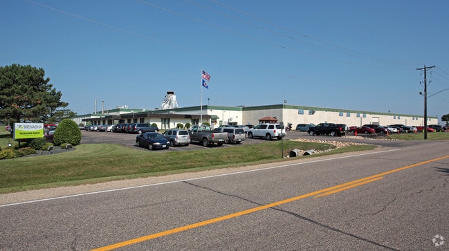
Property Record
8085 220Th St W, Lakeville, MN 55044


NEARBY LISTINGS FOR SALE OR LEASE
Property Detail
8085 220Th St W
Minneapolis-St. Paul-Bloomington, MN-WI
Airlake Ind Pk 1St Add
22-11100-03-050
AIRLAKE IND PK 1ST ADD 5 3
Industrialgeneral
Dakota
X
Minnesota
27037C0213E
50
2024
18.74 AC
2024
South Central
060836
Minneapolis/St Paul
374,622 SF
DEMOGRAPHICS near 8085 220Th St W
1 Mile
3 Mile
5 Mile
2024 Total Population
313
19,357
70,274
2029 Population
334
20,055
72,468
Pop Growth 2024-2029
+ 6.71%
+ 3.61%
+ 3.12%
Average Age
33
36
37
2024 Total Households
103
6,394
23,580
HH Growth 2024-2029
+ 5.83%
+ 3.55%
+ 3.23%
Median Household Inc
$91,666
$116,308
$117,151
Avg Household Size
3.00
3.00
2.90
2024 Avg HH Vehicles
2.00
2.00
2.00
Median Home Value
$394,444
$401,933
$374,874
Median Year Built
2010
2001
1999
Nearby Places
Map Layers
Map Styles
 Street
 Aerial
- Restaurants
- Banks
- Shops
- Fitness
- Groceries
PUBLIC TRANSPORTATION
AIRPORT
Minneapolis-St Paul International/Wold-Chamberlain
DRIVE
WALK
Distance
Minneapolis-St Paul International/Wold-Chamberlain
31 min
19.2 mi
Freight Ports
Port Milwaukee
DRIVE
WALK
Distance
Port Milwaukee
382 min
342.8 mi
Nearby Properties
Address
Land Use
TOTAL SIZE
Lot Size
Zoning
Address
Land Use
TOTAL SIZE
Lot Size
Zoning
749,550 SF
71.74 AC
Address
Land Use
TOTAL SIZE
Lot Size
Zoning
484,566 SF
98.37 AC
Address
Land Use
TOTAL SIZE
Lot Size
Zoning
512,208 SF
90.38 AC
Address
Land Use
TOTAL SIZE
Lot Size
Zoning
355,380 SF
75.32 AC
Address
Land Use
TOTAL SIZE
Lot Size
Zoning
292,384 SF
39.16 AC
Address
Land Use
TOTAL SIZE
Lot Size
Zoning
496,248 SF
28.67 AC
Address
Land Use
TOTAL SIZE
Lot Size
Zoning
342,606 SF
18.21 AC
Address
Land Use
TOTAL SIZE
Lot Size
Zoning
245,486 SF
5.29 AC
Address
Land Use
TOTAL SIZE
Lot Size
Zoning
360,000 SF
22.85 AC
Address
Land Use
TOTAL SIZE
Lot Size
Zoning
286,000 SF
18.85 AC
Address
Land Use
TOTAL SIZE
Lot Size
Zoning
179,859 SF
43.48 AC
Address
Land Use
TOTAL SIZE
Lot Size
Zoning
282,100 SF
18.86 AC
Address
Land Use
TOTAL SIZE
Lot Size
Zoning
359,914 SF
18.86 AC
Address
Land Use
TOTAL SIZE
Lot Size
Zoning
248,545 SF
21.65 AC
Address
Land Use
TOTAL SIZE
Lot Size
Zoning
157,593 SF
11.10 AC
Address
Land Use
TOTAL SIZE
Lot Size
Zoning
168,000 SF
14.31 AC
Address
Land Use
TOTAL SIZE
Lot Size
Zoning
187,993 SF
21.88 AC
Address
Land Use
TOTAL SIZE
Lot Size
Zoning
276,560 SF
20.11 AC
Address
Land Use
TOTAL SIZE
Lot Size
Zoning
121,600 SF
27.55 AC
Address
Land Use
TOTAL SIZE
Lot Size
Zoning
275,666 SF
23.58 AC
Address
Land Use
TOTAL SIZE
Lot Size
Zoning
151,200 SF
17.20 AC
Address
Land Use
TOTAL SIZE
Lot Size
Zoning
158,698 SF
8.59 AC
Address
Land Use
TOTAL SIZE
Lot Size
Zoning
12.51 AC
Address
Land Use
TOTAL SIZE
Lot Size
Zoning
130,180 SF
9.01 AC
Address
Land Use
TOTAL SIZE
Lot Size
Zoning
109,440 SF
8.92 AC
Address
Land Use
TOTAL SIZE
Lot Size
Zoning
93,883 SF
4.17 AC
Address
Land Use
TOTAL SIZE
Lot Size
Zoning
210,012 SF
12.51 AC
Address
Land Use
TOTAL SIZE
Lot Size
Zoning
61,674 SF
10.31 AC
Address
Land Use
TOTAL SIZE
Lot Size
Zoning
78,220 SF
5.96 AC
The World's #1 Commercial Real Estate Marketplace
Connect with us
© 2026 CoStar Group
The information above has been obtained from sources believed reliable. While we do not doubt its accuracy we have not verified it and make no guarantee, warranty or representation about it. It is your responsibility to independently confirm its accuracy and completeness. Any projections, opinions, assumptions, or estimates used are for example only and do not represent the current or future performance of the property. The value of this transaction to you depends on tax and other factors which should be evaluated by your tax, financial, and legal advisors. You and your advisors should conduct a careful, independent investigation of the property to determine to your satisfaction the suitability of the property for your needs.