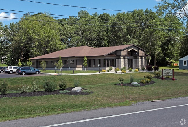
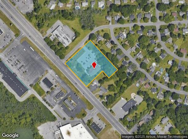
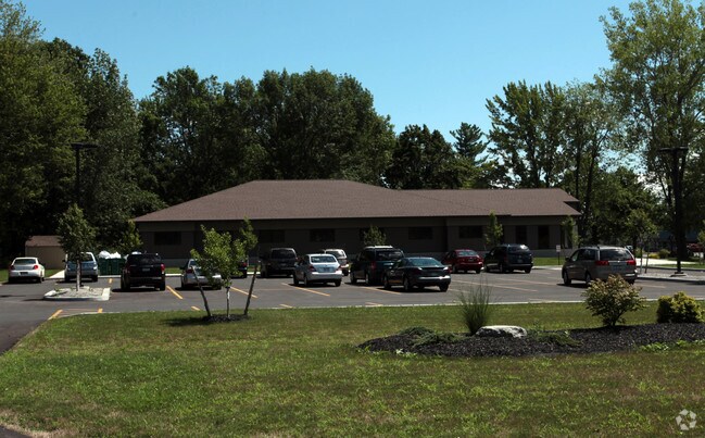
Property Record
8086 Oswego Rd, Liverpool, NY 13090
NEARBY LISTINGS FOR SALE OR LEASE
-
-
View all Liverpool listings for sale on LoopNet.com
Property Detail
8086 Oswego Rd
312489-068-000-0007-017-000-0000
FL 49 1152199
Medicalclinic
Onondaga
X
New York
36067C0086F
17.000
2025
2.36 AC
2024
NE Outer Onondaga County
011231
Syracuse
6,010 SF
Syracuse, NY
DEMOGRAPHICS near 8086 Oswego Rd
1 Mile
3 Mile
5 Mile
2024 Total Population
7,925
37,730
90,094
2029 Population
7,689
36,739
87,680
Pop Growth 2024-2029
(2.98%)
(2.63%)
(2.68%)
Average Age
41
41
42
2024 Total Households
3,055
15,459
38,138
HH Growth 2024-2029
(3.21%)
(2.84%)
(2.88%)
Median Household Inc
$80,348
$78,671
$76,191
Avg Household Size
2.50
2.40
2.30
2024 Avg HH Vehicles
2.00
2.00
2.00
Median Home Value
$172,574
$176,932
$174,067
Median Year Built
1980
1979
1976
Nearby Places
- Restaurants
- Banks
- Shops
- Fitness
- Groceries
PUBLIC TRANSPORTATION
COMMUTER RAIL
DRIVE
WALK
Distance
17 min
7.5 mi
DRIVE
WALK
Distance
17 min
7.5 mi
AIRPORT
Syracuse Hancock International
DRIVE
WALK
Distance
Syracuse Hancock International
21 min
12.6 mi
Nearby Properties
Address
Land Use
TOTAL SIZE
Lot Size
Zoning
Address
Land Use
TOTAL SIZE
Lot Size
Zoning
7,392 SF
14.86 AC
03 - MULTI
Address
Land Use
TOTAL SIZE
Lot Size
Zoning
57,993 SF
18.43 AC
02 - SINGL
Address
Land Use
TOTAL SIZE
Lot Size
Zoning
3,744 SF
10.60 AC
03 - MULTI
Address
Land Use
TOTAL SIZE
Lot Size
Zoning
3,696 SF
10.12 AC
03 - MULTI
Address
Land Use
TOTAL SIZE
Lot Size
Zoning
99,442 SF
11.75 AC
PUD
Address
Land Use
TOTAL SIZE
Lot Size
Zoning
28,800 SF
6.86 AC
R40
Address
Land Use
TOTAL SIZE
Lot Size
Zoning
61,701 SF
15.87 AC
R40
Address
Land Use
TOTAL SIZE
Lot Size
Zoning
28,800 SF
4.72 AC
PUD
Address
Land Use
TOTAL SIZE
Lot Size
Zoning
35,042 SF
4.39 AC
03 - MULTI
Address
Land Use
TOTAL SIZE
Lot Size
Zoning
28,800 SF
3.19 AC
PUD
Address
Land Use
TOTAL SIZE
Lot Size
Zoning
10,330 SF
241.94 AC
PUD
Address
Land Use
TOTAL SIZE
Lot Size
Zoning
309,390 SF
68.49 AC
05 - COMME
Address
Land Use
TOTAL SIZE
Lot Size
Zoning
33,962 SF
12.04 AC
03 - MULTI
Address
Land Use
TOTAL SIZE
Lot Size
Zoning
6,528 SF
27.74 AC
PUD
Address
Land Use
TOTAL SIZE
Lot Size
Zoning
2,920 SF
13.70 AC
PUD
Address
Land Use
TOTAL SIZE
Lot Size
Zoning
6,724 SF
10.05 AC
PUD
Address
Land Use
TOTAL SIZE
Lot Size
Zoning
33,944 SF
3.88 AC
02 - SINGL
Address
Land Use
TOTAL SIZE
Lot Size
Zoning
13,680 SF
4.68 AC
02 - SINGL
Address
Land Use
TOTAL SIZE
Lot Size
Zoning
6,672 SF
4.04 AC
03 - MULTI
Address
Land Use
TOTAL SIZE
Lot Size
Zoning
12,312 SF
40.32 AC
05 - COMME
Address
Land Use
TOTAL SIZE
Lot Size
Zoning
2,164 SF
2.94 AC
02 - SINGL
Address
Land Use
TOTAL SIZE
Lot Size
Zoning
2.10 AC
02 - SINGL
Address
Land Use
TOTAL SIZE
Lot Size
Zoning
62,496 SF
26.34 AC
04 - FARM
Address
Land Use
TOTAL SIZE
Lot Size
Zoning
11,504 SF
2 AC
R40
Address
Land Use
TOTAL SIZE
Lot Size
Zoning
4,428 SF
58.31 AC
Address
Land Use
TOTAL SIZE
Lot Size
Zoning
3,776 SF
1.50 AC
MR
Address
Land Use
TOTAL SIZE
Lot Size
Zoning
8,907 SF
1.40 AC
05 - COMME
Address
Land Use
TOTAL SIZE
Lot Size
Zoning
231.08 AC
R40
Address
Land Use
TOTAL SIZE
Lot Size
Zoning
74,012 SF
58.67 AC
04 - FARM
Address
Land Use
TOTAL SIZE
Lot Size
Zoning
4,650 SF
0.94 AC
02 - SINGL
The World's #1 Commercial Real Estate Marketplace
Connect with us
© 2025 CoStar Group
The information above has been obtained from sources believed reliable. While we do not doubt its accuracy we have not verified it and make no guarantee, warranty or representation about it. It is your responsibility to independently confirm its accuracy and completeness. Any projections, opinions, assumptions, or estimates used are for example only and do not represent the current or future performance of the property. The value of this transaction to you depends on tax and other factors which should be evaluated by your tax, financial, and legal advisors. You and your advisors should conduct a careful, independent investigation of the property to determine to your satisfaction the suitability of the property for your needs.