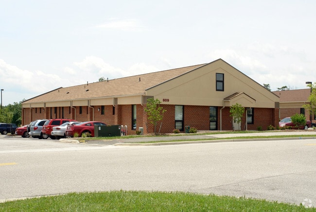
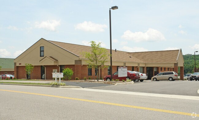
Property Record
809 Davis St, Blacksburg, VA 24060
NEARBY LISTINGS FOR SALE OR LEASE
Property Detail
809 Davis St
Blacksburg-Christiansburg-Radford, VA
Hilltop Medical Office Park
090502
HILLTOP MEDICAL OFFICE PARK LOT 8
Commercialnec
Montgomery
X
Virginia
51121C0141C
8
2025
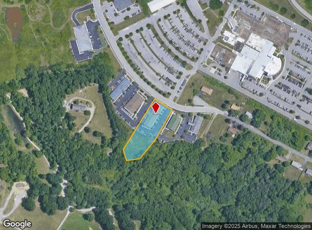
1.12 AC
2025
Blacksburg & Wytheville
020202
Other Market Areas
9,000 SF
DEMOGRAPHICS near 809 Davis St
1 mile
3 mile
5 mile
2024 Total Population
3,459
24,593
65,154
2029 Population
3,474
24,402
64,475
Pop Growth 2024-2029
+ 0.43%
(0.78%)
(1.04%)
Average Age
43
37
36
2024 Total Households
1,590
10,879
28,018
HH Growth 2024-2029
+ 0.38%
(0.76%)
(1.09%)
Median Household Inc
$41,000
$59,130
$51,882
Avg Household Size
1.90
2.20
2.30
2024 Avg HH Vehicles
1.00
2.00
2.00
Median Home Value
$339,655
$281,387
$283,672
Median Year Built
1994
1990
1988
Nearby Places
Map Layers
Map Styles
 Street
 Aerial
Transit
 Traffic
 Biking
Places
Listings with unknown addresses are not visible on the map
- Restaurants
- Banks
- Shops
- Fitness
- Groceries
PUBLIC TRANSPORTATION
AIRPORT
Roanoke/Blacksburg Regional (Woodrum Field)
Drive
Walk
Distance
Roanoke/Blacksburg Regional (Woodrum Field)
54 min
36.9 mi
Nearby Properties
Address
Land Use
TOTAL SIZE
Lot Size
Zoning
Address
Land Use
TOTAL SIZE
Lot Size
Zoning
47,153 SF
30.90 AC
R&D
Address
Land Use
TOTAL SIZE
Lot Size
Zoning
50,000 SF
25.93 AC
R&D
Address
Land Use
TOTAL SIZE
Lot Size
Zoning
230,692 SF
12.90 AC
PR
Address
Land Use
TOTAL SIZE
Lot Size
Zoning
96,768 SF
20.18 AC
RM1
Address
Land Use
TOTAL SIZE
Lot Size
Zoning
212,497 SF
10.75 AC
PR
Address
Land Use
TOTAL SIZE
Lot Size
Zoning
10.06 AC
A
Address
Land Use
TOTAL SIZE
Lot Size
Zoning
189,259 SF
31.06 AC
R&D
Address
Land Use
TOTAL SIZE
Lot Size
Zoning
7.38 AC
R&D
Address
Land Use
TOTAL SIZE
Lot Size
Zoning
197,024 SF
9.86 AC
PR
Address
Land Use
TOTAL SIZE
Lot Size
Zoning
183,569 SF
8.38 AC
PR
Address
Land Use
TOTAL SIZE
Lot Size
Zoning
33,716 SF
15.72 AC
R&D
Address
Land Use
TOTAL SIZE
Lot Size
Zoning
7,820 SF
58.14 AC
R&D
Address
Land Use
TOTAL SIZE
Lot Size
Zoning
150,108 SF
8.19 AC
PR
Address
Land Use
TOTAL SIZE
Lot Size
Zoning
151,388 SF
18.29 AC
B3
Address
Land Use
TOTAL SIZE
Lot Size
Zoning
2,140 SF
0.16 AC
I2
Address
Land Use
TOTAL SIZE
Lot Size
Zoning
148,695 SF
7.97 AC
PR
Address
Land Use
TOTAL SIZE
Lot Size
Zoning
147,862 SF
7.73 AC
PR
Address
Land Use
TOTAL SIZE
Lot Size
Zoning
151,450 SF
13.88 AC
B3
Address
Land Use
TOTAL SIZE
Lot Size
Zoning
538,247 SF
54.60 AC
B3
Address
Land Use
TOTAL SIZE
Lot Size
Zoning
6.48 AC
GC
Address
Land Use
TOTAL SIZE
Lot Size
Zoning
66,896 SF
4 AC
O
Address
Land Use
TOTAL SIZE
Lot Size
Zoning
51,036 SF
14.21 AC
R&D
Address
Land Use
TOTAL SIZE
Lot Size
Zoning
57,936 SF
10.38 AC
R&D
Address
Land Use
TOTAL SIZE
Lot Size
Zoning
200,004 SF
23.11 AC
B3
Address
Land Use
TOTAL SIZE
Lot Size
Zoning
95,793 SF
6.95 AC
PR
Address
Land Use
TOTAL SIZE
Lot Size
Zoning
12,893 SF
13.07 AC
GC
Address
Land Use
TOTAL SIZE
Lot Size
Zoning
1.57 AC
R-4
Address
Land Use
TOTAL SIZE
Lot Size
Zoning
111,796 SF
15.03 AC
IN
Address
Land Use
TOTAL SIZE
Lot Size
Zoning
60,264 SF
7.25 AC
RM-27
The World's #1 Commercial Real Estate Marketplace
Connect with us
© 2026 CoStar Group
The information above has been obtained from sources believed reliable. While we do not doubt its accuracy we have not verified it and make no guarantee, warranty or representation about it. It is your responsibility to independently confirm its accuracy and completeness. Any projections, opinions, assumptions, or estimates used are for example only and do not represent the current or future performance of the property. The value of this transaction to you depends on tax and other factors which should be evaluated by your tax, financial, and legal advisors. You and your advisors should conduct a careful, independent investigation of the property to determine to your satisfaction the suitability of the property for your needs.