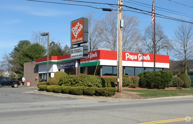
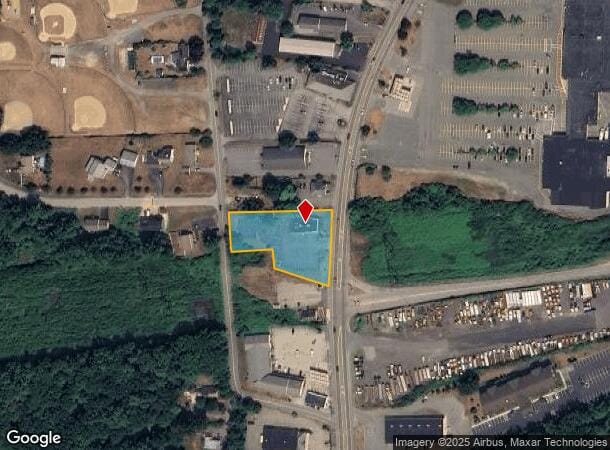
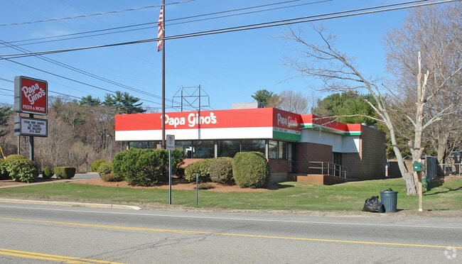
Property Record
809 Lafayette Rd, Seabrook, NH 03874
NEARBY LISTINGS FOR SALE OR LEASE
Property Detail
809 Lafayette Rd
Restaurantbuilding
Rockingham
X
New Hampshire
33015C0438F
1.04 AC
2024
Rockingham
2024
Boston
063001
Boston-Cambridge-Newton, MA-NH
3,229 SF
SEAB-000007-000000-000058
DEMOGRAPHICS near 809 Lafayette Rd
1 Mile
3 Mile
5 Mile
2024 Total Population
3,845
17,821
54,393
2029 Population
4,134
18,856
56,233
Pop Growth 2024-2029
+ 7.52%
+ 5.81%
+ 3.38%
Average Age
45
47
46
2024 Total Households
1,638
7,822
24,317
HH Growth 2024-2029
+ 7.45%
+ 6.05%
+ 3.51%
Median Household Inc
$88,855
$89,371
$94,895
Avg Household Size
2.30
2.20
2.20
2024 Avg HH Vehicles
2.00
2.00
2.00
Median Home Value
$362,807
$435,027
$458,122
Median Year Built
1991
1984
1976
Nearby Places
Map Layers
Map Styles
 Street
 Aerial
- Restaurants
- Banks
- Shops
- Fitness
- Groceries
PUBLIC TRANSPORTATION
COMMUTER RAIL
Exeter (Downeaster - Amtrak)
DRIVE
WALK
Distance
Exeter (Downeaster - Amtrak)
19 min
9.6 mi
AIRPORT
Portsmouth International at Pease
DRIVE
WALK
Distance
Portsmouth International at Pease
23 min
15.8 mi
Manchester Boston Regional
DRIVE
WALK
Distance
Manchester Boston Regional
62 min
44.2 mi
Freight Ports
Port of Boston
DRIVE
WALK
Distance
Port of Boston
60 min
44.9 mi
SALE & LEASE HISTORY
LISTING DATE
SALE/LEASE

Sep 30, 2025
For Lease
Feb 27, 2019
For Sale
Aug 06, 2019
For Lease
Nearby Properties
Address
Land Use
TOTAL SIZE
Lot Size
Zoning
Address
Land Use
TOTAL SIZE
Lot Size
Zoning
4,884 SF
40 AC
RB
Address
Land Use
TOTAL SIZE
Lot Size
Zoning
55,934 SF
35.25 AC
A
Address
Land Use
TOTAL SIZE
Lot Size
Zoning
46,328 SF
49.50 AC
RA
Address
Land Use
TOTAL SIZE
Lot Size
Zoning
504,280 SF
80.02 AC
I3
Address
Land Use
TOTAL SIZE
Lot Size
Zoning
120,362 SF
32.29 AC
LA4
Address
Land Use
TOTAL SIZE
Lot Size
Zoning
112,708 SF
40 AC
50
Address
Land Use
TOTAL SIZE
Lot Size
Zoning
143,335 SF
16.72 AC
LA4
Address
Land Use
TOTAL SIZE
Lot Size
Zoning
179,840 SF
13.46 AC
LA4
Address
Land Use
TOTAL SIZE
Lot Size
Zoning
30,440 SF
17.99 AC
LA4
Address
Land Use
TOTAL SIZE
Lot Size
Zoning
Address
Land Use
TOTAL SIZE
Lot Size
Zoning
79,305 SF
17.18 AC
G
Address
Land Use
TOTAL SIZE
Lot Size
Zoning
134,617 SF
15.89 AC
LA4
Address
Land Use
TOTAL SIZE
Lot Size
Zoning
87,374 SF
21.66 AC
LA3
Address
Land Use
TOTAL SIZE
Lot Size
Zoning
7,936 SF
12.80 AC
A
Address
Land Use
TOTAL SIZE
Lot Size
Zoning
101,044 SF
13.24 AC
LA4
Address
Land Use
TOTAL SIZE
Lot Size
Zoning
25,867 SF
9.17 AC
BS
Address
Land Use
TOTAL SIZE
Lot Size
Zoning
116,650 SF
21.07 AC
LA4
Address
Land Use
TOTAL SIZE
Lot Size
Zoning
3,820 SF
9.15 AC
40
Address
Land Use
TOTAL SIZE
Lot Size
Zoning
20,160 SF
4.81 AC
A
Address
Land Use
TOTAL SIZE
Lot Size
Zoning
577.79 AC
I2
Address
Land Use
TOTAL SIZE
Lot Size
Zoning
78,886 SF
75.81 AC
C2
Address
Land Use
TOTAL SIZE
Lot Size
Zoning
139,877 SF
11.09 AC
LA4
Address
Land Use
TOTAL SIZE
Lot Size
Zoning
11,904 SF
7.83 AC
A
Address
Land Use
TOTAL SIZE
Lot Size
Zoning
34,416 SF
11.50 AC
A
Address
Land Use
TOTAL SIZE
Lot Size
Zoning
1,056 SF
63.40 AC
40
Address
Land Use
TOTAL SIZE
Lot Size
Zoning
136,020 SF
8.03 AC
I5
Address
Land Use
TOTAL SIZE
Lot Size
Zoning
Address
Land Use
TOTAL SIZE
Lot Size
Zoning
57,215 SF
4.40 AC
TOWN C
Address
Land Use
TOTAL SIZE
Lot Size
Zoning
21,375 SF
11.80 AC
LA4
Address
Land Use
TOTAL SIZE
Lot Size
Zoning
39,728 SF
2.25 AC
The World's #1 Commercial Real Estate Marketplace
Connect with us
© 2026 CoStar Group
The information above has been obtained from sources believed reliable. While we do not doubt its accuracy we have not verified it and make no guarantee, warranty or representation about it. It is your responsibility to independently confirm its accuracy and completeness. Any projections, opinions, assumptions, or estimates used are for example only and do not represent the current or future performance of the property. The value of this transaction to you depends on tax and other factors which should be evaluated by your tax, financial, and legal advisors. You and your advisors should conduct a careful, independent investigation of the property to determine to your satisfaction the suitability of the property for your needs.