Property Record
809 N Liberty St, Cherryvale, KS 67335


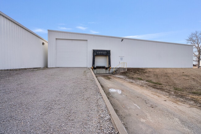

Property Detail
809 N Liberty St
102-09-0-20-04-001.00-0
BELMONT ADD BL 1-2 WHELANS ADD, S09, T32, R17, ACRES 5.2, LTS 1-20 BLK 3; LTS 1-21 BLK 4; & ADJ VAC ALLEYS AND VAC ASH ST;
Lightindustrial
Montgomery
B and X Area of moderate flood hazard, usually the area between the limits of the 100-year and 500-year floods.
Kansas
2025
1-21
2025
5.20 AC
950200
Kansas Area
58,025 SF
Other Market Areas
NEARBY LISTINGS FOR SALE OR LEASE
DEMOGRAPHICS near 809 N Liberty St
1 mile
3 mile
5 mile
2025 Total Population
1,982
2,821
3,095
2030 Population
1,989
2,824
3,079
Pop Growth 2025-2030
+ 0.35%
+ 0.11%
(0.52%)
Average Age
41
41
41
2025 Total Households
792
1,127
1,232
HH Growth 2025-2030
+ 0.25%
0.00%
(0.65%)
Median Household Inc
$49,670
$49,905
$50,621
Avg Household Size
2.50
2.50
2.50
2025 Avg HH Vehicles
2.00
2.00
2.00
Median Home Value
$87,691
$88,864
$92,797
Median Year Built
1953
1953
1954
Nearby Places
Map Layers
Map Styles
 Street
 Aerial
Layers
 Traffic
 Biking
Places
Listings with unknown addresses are not visible on the map
- Restaurants
- Banks
- Shops
- Fitness
- Groceries
SALE & LEASE HISTORY
LISTING DATE
SALE/LEASE

Oct 06, 2021
For Lease
Jun 10, 2025
For Lease
Jun 10, 2025
For Sale
Jul 17, 2024
For Lease
Jul 17, 2024
For Sale
Jul 03, 2023
For Sale
Aug 22, 2022
For Sale
Nearby Properties
Address
Land Use
TOTAL SIZE
Lot Size
Zoning
Address
Land Use
TOTAL SIZE
Lot Size
Zoning
82,733 SF
5.40 AC
Address
Land Use
TOTAL SIZE
Lot Size
Zoning
50,341 SF
1.20 AC
Address
Land Use
TOTAL SIZE
Lot Size
Zoning
7,156 SF
1.70 AC
Address
Land Use
TOTAL SIZE
Lot Size
Zoning
11,700 SF
1 AC
Address
Land Use
TOTAL SIZE
Lot Size
Zoning
9,410 SF
0.40 AC
Address
Land Use
TOTAL SIZE
Lot Size
Zoning
13,572 SF
1.82 AC
Address
Land Use
TOTAL SIZE
Lot Size
Zoning
12,390 SF
0.98 AC
Address
Land Use
TOTAL SIZE
Lot Size
Zoning
12,030 SF
1.50 AC
Address
Land Use
TOTAL SIZE
Lot Size
Zoning
1,500 SF
0.44 AC
Address
Land Use
TOTAL SIZE
Lot Size
Zoning
8,845 SF
0.48 AC
Address
Land Use
TOTAL SIZE
Lot Size
Zoning
16,650 SF
2 AC
336
Address
Land Use
TOTAL SIZE
Lot Size
Zoning
2,464 SF
0.65 AC
Address
Land Use
TOTAL SIZE
Lot Size
Zoning
8,497 SF
0.55 AC
Address
Land Use
TOTAL SIZE
Lot Size
Zoning
8,267 SF
0.42 AC
Address
Land Use
TOTAL SIZE
Lot Size
Zoning
890 SF
1.68 AC
Address
Land Use
TOTAL SIZE
Lot Size
Zoning
32,675 SF
5.70 AC
Address
Land Use
TOTAL SIZE
Lot Size
Zoning
2,220 SF
0.33 AC
Address
Land Use
TOTAL SIZE
Lot Size
Zoning
4,160 SF
0.33 AC
Address
Land Use
TOTAL SIZE
Lot Size
Zoning
3,280 SF
0.39 AC
Address
Land Use
TOTAL SIZE
Lot Size
Zoning
0.41 AC
Address
Land Use
TOTAL SIZE
Lot Size
Zoning
5,000 SF
1 AC
Address
Land Use
TOTAL SIZE
Lot Size
Zoning
12.17 AC
Address
Land Use
TOTAL SIZE
Lot Size
Zoning
2,062 SF
0.33 AC
Address
Land Use
TOTAL SIZE
Lot Size
Zoning
4,080 SF
1.69 AC
Address
Land Use
TOTAL SIZE
Lot Size
Zoning
16,509 SF
0.64 AC
Address
Land Use
TOTAL SIZE
Lot Size
Zoning
4,661 SF
5.93 AC
Address
Land Use
TOTAL SIZE
Lot Size
Zoning
3,432 SF
0.27 AC
Address
Land Use
TOTAL SIZE
Lot Size
Zoning
9,200 SF
0.13 AC
Address
Land Use
TOTAL SIZE
Lot Size
Zoning
3,499 SF
0.58 AC
The World's #1 Commercial Real Estate Marketplace
Connect with us
© 2026 CoStar Group
The information above has been obtained from sources believed reliable. While we do not doubt its accuracy we have not verified it and make no guarantee, warranty or representation about it. It is your responsibility to independently confirm its accuracy and completeness. Any projections, opinions, assumptions, or estimates used are for example only and do not represent the current or future performance of the property. The value of this transaction to you depends on tax and other factors which should be evaluated by your tax, financial, and legal advisors. You and your advisors should conduct a careful, independent investigation of the property to determine to your satisfaction the suitability of the property for your needs.