Property Record
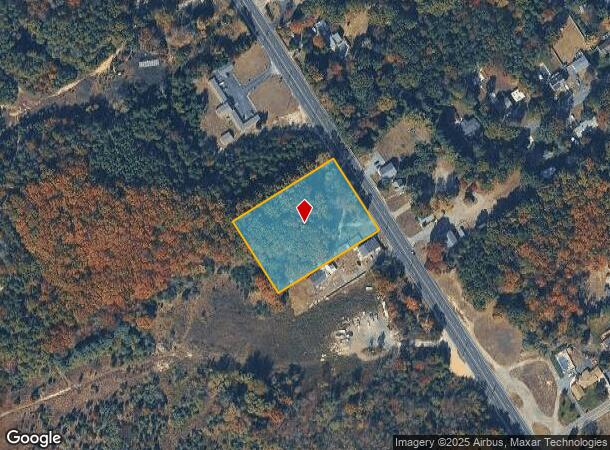
809 N White Horse Pik Pike, Winslow, NJ 08095

NEARBY LISTINGS FOR SALE OR LEASE
Property Detail
809 N White Horse Pik Pike
Philadelphia-Camden-Wilmington, PA-NJ-DE-MD
INC WATERFORD TWP B-2406 L-5
36-03804-0000-00011
Camden
Vacantlandnec
New Jersey
X
11
34007C0207E
1.94 AC
2024
South Camden County
2025
Philadelphia
609205
DEMOGRAPHICS near 809 N White Horse Pik Pike
1 Mile
3 Mile
5 Mile
2024 Total Population
2,028
20,172
44,880
2029 Population
2,025
20,196
45,178
Pop Growth 2024-2029
(0.15%)
+ 0.12%
+ 0.66%
Average Age
43
43
42
2024 Total Households
775
7,561
16,592
HH Growth 2024-2029
(0.13%)
+ 0.16%
+ 0.76%
Median Household Inc
$95,624
$96,122
$89,576
Avg Household Size
2.60
2.60
2.60
2024 Avg HH Vehicles
2.00
2.00
2.00
Median Home Value
$257,476
$255,098
$259,285
Median Year Built
1975
1978
1978
Nearby Places
Map Layers
Map Styles
 Street
 Aerial
- Restaurants
- Banks
- Shops
- Fitness
- Groceries
PUBLIC TRANSPORTATION
COMMUTER RAIL
Atco (Atlantic City Line - NJ Transit Commuter Rail (NJ Transit))
DRIVE
WALK
Distance
Atco (Atlantic City Line - NJ Transit Commuter Rail (NJ Transit))
5 min
3.7 mi
Hammonton (Atlantic City Line - NJ Transit Commuter Rail (NJ Transit))
DRIVE
WALK
Distance
Hammonton (Atlantic City Line - NJ Transit Commuter Rail (NJ Transit))
12 min
9.8 mi
AIRPORT
Philadelphia International
DRIVE
WALK
Distance
Philadelphia International
42 min
28.5 mi
Atlantic City International
DRIVE
WALK
Distance
Atlantic City International
57 min
29.3 mi
Freight Ports
Broadway Terminal - Pier 5
DRIVE
WALK
Distance
Broadway Terminal - Pier 5
26 min
20.0 mi
Nearby Properties
Address
Land Use
TOTAL SIZE
Lot Size
Zoning
Address
Land Use
TOTAL SIZE
Lot Size
Zoning
137.33 AC
PR3
Address
Land Use
TOTAL SIZE
Lot Size
Zoning
88.36 AC
PR4
Address
Land Use
TOTAL SIZE
Lot Size
Zoning
73.95 AC
PI3
Address
Land Use
TOTAL SIZE
Lot Size
Zoning
27.18 AC
PR4
Address
Land Use
TOTAL SIZE
Lot Size
Zoning
20.02 AC
RPF
Address
Land Use
TOTAL SIZE
Lot Size
Zoning
30.01 AC
PR2
Address
Land Use
TOTAL SIZE
Lot Size
Zoning
14.10 AC
RD-1
Address
Land Use
TOTAL SIZE
Lot Size
Zoning
30 AC
PR2
Address
Land Use
TOTAL SIZE
Lot Size
Zoning
5.06 AC
PF
Address
Land Use
TOTAL SIZE
Lot Size
Zoning
15.84 AC
RPF
Address
Land Use
TOTAL SIZE
Lot Size
Zoning
1,718 SF
68.48 AC
PR2
Address
Land Use
TOTAL SIZE
Lot Size
Zoning
23.77 AC
RPF
Address
Land Use
TOTAL SIZE
Lot Size
Zoning
7.07 AC
PF
Address
Land Use
TOTAL SIZE
Lot Size
Zoning
6.20 AC
Address
Land Use
TOTAL SIZE
Lot Size
Zoning
73.95 AC
PI3
Address
Land Use
TOTAL SIZE
Lot Size
Zoning
1,341 SF
1.98 AC
PHB
Address
Land Use
TOTAL SIZE
Lot Size
Zoning
Address
Land Use
TOTAL SIZE
Lot Size
Zoning
38.85 AC
PHB
Address
Land Use
TOTAL SIZE
Lot Size
Zoning
10.72 AC
PI1
Address
Land Use
TOTAL SIZE
Lot Size
Zoning
3,100 SF
1 AC
PA
Address
Land Use
TOTAL SIZE
Lot Size
Zoning
4.67 AC
PC2
Address
Land Use
TOTAL SIZE
Lot Size
Zoning
85.89 AC
PI
Address
Land Use
TOTAL SIZE
Lot Size
Zoning
2.23 AC
Address
Land Use
TOTAL SIZE
Lot Size
Zoning
9,900 SF
154 AC
RPF
Address
Land Use
TOTAL SIZE
Lot Size
Zoning
14,594 SF
1.67 AC
PHB
Address
Land Use
TOTAL SIZE
Lot Size
Zoning
5.76 AC
PHB
Address
Land Use
TOTAL SIZE
Lot Size
Zoning
4,246 SF
10 AC
NB
Address
Land Use
TOTAL SIZE
Lot Size
Zoning
57,854 SF
13.89 AC
PC1
Address
Land Use
TOTAL SIZE
Lot Size
Zoning
12,288 SF
4.67 AC
R2
Address
Land Use
TOTAL SIZE
Lot Size
Zoning
9,170 SF
15.67 AC
PI3
The World's #1 Commercial Real Estate Marketplace
Connect with us
© 2025 CoStar Group
The information above has been obtained from sources believed reliable. While we do not doubt its accuracy we have not verified it and make no guarantee, warranty or representation about it. It is your responsibility to independently confirm its accuracy and completeness. Any projections, opinions, assumptions, or estimates used are for example only and do not represent the current or future performance of the property. The value of this transaction to you depends on tax and other factors which should be evaluated by your tax, financial, and legal advisors. You and your advisors should conduct a careful, independent investigation of the property to determine to your satisfaction the suitability of the property for your needs.