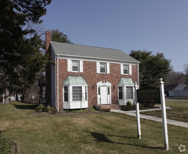
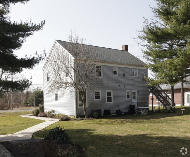
Property Record
809 Route 25A, Rocky Point, NY 11778
NEARBY LISTINGS FOR SALE OR LEASE
Property Detail
809 Route 25A
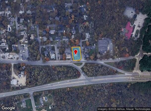
Nassau County-Suffolk County, NY
North Shore Beach
0200-079-00-05-00-021-000
NORTH SHORE BEACH 6 1209 ALL 16397-
Commercialnec
Suffolk
X
New York
36103C0408H
21
2024
0.49 AC
2024
Central Suffolk
158408
Long Island (New York)
DEMOGRAPHICS near 809 Route 25A
1 Mile
3 Mile
5 Mile
2024 Total Population
6,465
27,339
67,193
2029 Population
6,381
27,158
66,643
Pop Growth 2024-2029
(1.30%)
(0.66%)
(0.82%)
Average Age
40
45
43
2024 Total Households
2,209
10,680
25,241
HH Growth 2024-2029
(1.45%)
(0.59%)
(0.87%)
Median Household Inc
$113,271
$93,815
$109,472
Avg Household Size
2.90
2.50
2.60
2024 Avg HH Vehicles
2.00
2.00
2.00
Median Home Value
$439,067
$389,334
$423,047
Median Year Built
1964
1974
1976
Nearby Places
Map Layers
Map Styles
 Street
 Aerial
- Restaurants
- Banks
- Shops
- Fitness
- Groceries
PUBLIC TRANSPORTATION
COMMUTER RAIL
Port Jefferson Station (Port Jefferson Branch - Long Island Rail Road)
DRIVE
WALK
Distance
Port Jefferson Station (Port Jefferson Branch - Long Island Rail Road)
15 min
8.0 mi
AIRPORT
Long Island MacArthur
DRIVE
WALK
Distance
Long Island MacArthur
37 min
22.9 mi
Tweed/New Haven
DRIVE
WALK
Distance
Tweed/New Haven
130 min
49.1 mi
Freight Ports
Port of New Haven
DRIVE
WALK
Distance
Port of New Haven
125 min
46.3 mi
SALE & LEASE HISTORY
LISTING DATE
SALE/LEASE

Sep 24, 2016
For Sale
Nearby Properties
Address
Land Use
TOTAL SIZE
Lot Size
Zoning
Address
Land Use
TOTAL SIZE
Lot Size
Zoning
Address
Land Use
TOTAL SIZE
Lot Size
Zoning
15.70 AC
Address
Land Use
TOTAL SIZE
Lot Size
Zoning
2,842 SF
0.21 AC
VILLA
Address
Land Use
TOTAL SIZE
Lot Size
Zoning
17.70 AC
Address
Land Use
TOTAL SIZE
Lot Size
Zoning
838.32 AC
Address
Land Use
TOTAL SIZE
Lot Size
Zoning
Address
Land Use
TOTAL SIZE
Lot Size
Zoning
19.25 AC
Address
Land Use
TOTAL SIZE
Lot Size
Zoning
2,456 SF
0.88 AC
R15
Address
Land Use
TOTAL SIZE
Lot Size
Zoning
Address
Land Use
TOTAL SIZE
Lot Size
Zoning
18.30 AC
Address
Land Use
TOTAL SIZE
Lot Size
Zoning
3.60 AC
Address
Land Use
TOTAL SIZE
Lot Size
Zoning
149.80 AC
Address
Land Use
TOTAL SIZE
Lot Size
Zoning
149.03 AC
RB80
Address
Land Use
TOTAL SIZE
Lot Size
Zoning
Address
Land Use
TOTAL SIZE
Lot Size
Zoning
571 AC
Address
Land Use
TOTAL SIZE
Lot Size
Zoning
18.67 AC
Address
Land Use
TOTAL SIZE
Lot Size
Zoning
10 AC
Address
Land Use
TOTAL SIZE
Lot Size
Zoning
17.30 AC
Address
Land Use
TOTAL SIZE
Lot Size
Zoning
21.63 AC
Address
Land Use
TOTAL SIZE
Lot Size
Zoning
239.30 AC
Address
Land Use
TOTAL SIZE
Lot Size
Zoning
222.70 AC
Address
Land Use
TOTAL SIZE
Lot Size
Zoning
Address
Land Use
TOTAL SIZE
Lot Size
Zoning
178.18 AC
Address
Land Use
TOTAL SIZE
Lot Size
Zoning
59.84 AC
Address
Land Use
TOTAL SIZE
Lot Size
Zoning
Address
Land Use
TOTAL SIZE
Lot Size
Zoning
3,673 SF
2.60 AC
02
Address
Land Use
TOTAL SIZE
Lot Size
Zoning
11.22 AC
Address
Land Use
TOTAL SIZE
Lot Size
Zoning
26.62 AC
Address
Land Use
TOTAL SIZE
Lot Size
Zoning
Address
Land Use
TOTAL SIZE
Lot Size
Zoning
11.46 AC
The World's #1 Commercial Real Estate Marketplace
Connect with us
© 2025 CoStar Group
The information above has been obtained from sources believed reliable. While we do not doubt its accuracy we have not verified it and make no guarantee, warranty or representation about it. It is your responsibility to independently confirm its accuracy and completeness. Any projections, opinions, assumptions, or estimates used are for example only and do not represent the current or future performance of the property. The value of this transaction to you depends on tax and other factors which should be evaluated by your tax, financial, and legal advisors. You and your advisors should conduct a careful, independent investigation of the property to determine to your satisfaction the suitability of the property for your needs.