Property Record
8091 Burkhalter Rd, Statesboro, GA 30461

NEARBY LISTINGS FOR SALE OR LEASE
-
-
View all Statesboro listings for sale on LoopNet.com
Property Detail
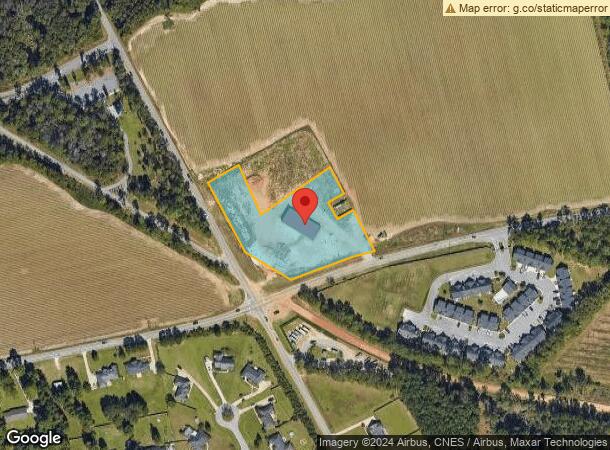
8091 Burkhalter Rd
107-000014-011
2.47 AC/ PAR 8A
Commercialnec
Bulloch
X
Georgia
13031C0240D
2.47 AC
2024
Georgia South Area
2025
Other Market Areas
110603
Statesboro, GA
6,000 SF
DEMOGRAPHICS near 8091 Burkhalter Rd
1 Mile
3 Mile
5 Mile
2024 Total Population
1,147
21,807
47,961
2029 Population
1,256
23,656
52,305
Pop Growth 2024-2029
+ 9.50%
+ 8.48%
+ 9.06%
Average Age
38
30
32
2024 Total Households
454
8,009
17,694
HH Growth 2024-2029
+ 9.91%
+ 9.24%
+ 9.86%
Median Household Inc
$77,579
$50,569
$49,737
Avg Household Size
2.50
2.40
2.40
2024 Avg HH Vehicles
2.00
2.00
2.00
Median Home Value
$185,886
$205,556
$184,059
Median Year Built
2003
1994
1992
Nearby Places
Map Layers
Map Styles
 Street
 Aerial
- Restaurants
- Banks
- Shops
- Fitness
- Groceries
Nearby Properties
Address
Land Use
TOTAL SIZE
Lot Size
Zoning
Address
Land Use
TOTAL SIZE
Lot Size
Zoning
15,334 SF
1.67 AC
CR
Address
Land Use
TOTAL SIZE
Lot Size
Zoning
250,037 SF
30.67 AC
O
Address
Land Use
TOTAL SIZE
Lot Size
Zoning
9,870 SF
46.47 AC
CR/R4
Address
Land Use
TOTAL SIZE
Lot Size
Zoning
5.54 AC
EXPT
Address
Land Use
TOTAL SIZE
Lot Size
Zoning
7,063 SF
22.96 AC
R4
Address
Land Use
TOTAL SIZE
Lot Size
Zoning
41.09 AC
R3/R15
Address
Land Use
TOTAL SIZE
Lot Size
Zoning
146,137 SF
17.78 AC
CR
Address
Land Use
TOTAL SIZE
Lot Size
Zoning
3,659 SF
38.60 AC
R40
Address
Land Use
TOTAL SIZE
Lot Size
Zoning
3,951 SF
20.19 AC
CR
Address
Land Use
TOTAL SIZE
Lot Size
Zoning
54,062 SF
2.20 AC
CR
Address
Land Use
TOTAL SIZE
Lot Size
Zoning
3,552 SF
16.42 AC
PUD/R4/CR
Address
Land Use
TOTAL SIZE
Lot Size
Zoning
153.74 AC
R40
Address
Land Use
TOTAL SIZE
Lot Size
Zoning
22,392 SF
13.97 AC
R4
Address
Land Use
TOTAL SIZE
Lot Size
Zoning
4,450 SF
26.60 AC
R4
Address
Land Use
TOTAL SIZE
Lot Size
Zoning
58,520 SF
2.44 AC
CR
Address
Land Use
TOTAL SIZE
Lot Size
Zoning
61,539 SF
2.50 AC
CR
Address
Land Use
TOTAL SIZE
Lot Size
Zoning
4,969 SF
13.52 AC
PUD/R4
Address
Land Use
TOTAL SIZE
Lot Size
Zoning
4,622 SF
17 AC
R4/CR
Address
Land Use
TOTAL SIZE
Lot Size
Zoning
20.77 AC
R15
Address
Land Use
TOTAL SIZE
Lot Size
Zoning
3,288 SF
18.48 AC
R4
Address
Land Use
TOTAL SIZE
Lot Size
Zoning
1,668 SF
14.51 AC
R4
Address
Land Use
TOTAL SIZE
Lot Size
Zoning
64,614 SF
Address
Land Use
TOTAL SIZE
Lot Size
Zoning
190,382 SF
23.53 AC
CR
Address
Land Use
TOTAL SIZE
Lot Size
Zoning
29,892 SF
2.19 AC
CR
Address
Land Use
TOTAL SIZE
Lot Size
Zoning
64,350 SF
3.31 AC
PUD/CR
Address
Land Use
TOTAL SIZE
Lot Size
Zoning
42,149 SF
5.61 AC
CR
Address
Land Use
TOTAL SIZE
Lot Size
Zoning
3,773 SF
6.90 AC
CR
Address
Land Use
TOTAL SIZE
Lot Size
Zoning
102,529 SF
18.07 AC
CR
Address
Land Use
TOTAL SIZE
Lot Size
Zoning
76,118 SF
12.31 AC
CR
Address
Land Use
TOTAL SIZE
Lot Size
Zoning
22,260 SF
5.49 AC
HC
The World's #1 Commercial Real Estate Marketplace
Connect with us
© 2026 CoStar Group
The information above has been obtained from sources believed reliable. While we do not doubt its accuracy we have not verified it and make no guarantee, warranty or representation about it. It is your responsibility to independently confirm its accuracy and completeness. Any projections, opinions, assumptions, or estimates used are for example only and do not represent the current or future performance of the property. The value of this transaction to you depends on tax and other factors which should be evaluated by your tax, financial, and legal advisors. You and your advisors should conduct a careful, independent investigation of the property to determine to your satisfaction the suitability of the property for your needs.