Property Record
81 Beach Rd, Hampton, VA 23664
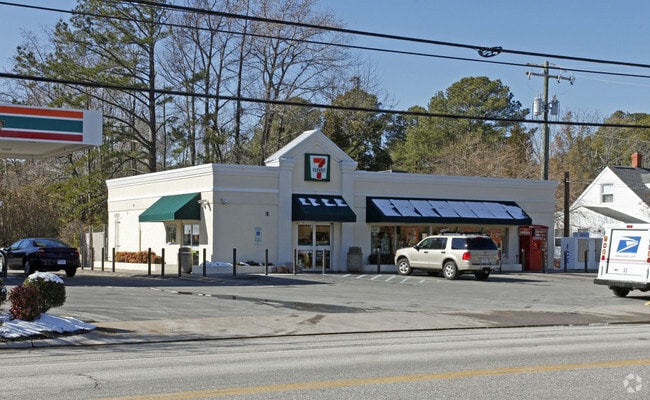

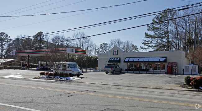
Property Detail
81 Beach Rd
11000621
BEACH RD L1.5. .57AC.
Conveniencestore
Hampton City
13 C-1 NEI
Virginia
AE The base floodplain where base flood elevations are provided. AE Zones are now used on new format FIRMs instead of A1-A30 Zones.
1,5
2025
0.57 AC
2025
Fox Hill
012100
Hampton Roads
2,782 SF
Virginia Beach-Chesapeake-Norfolk, VA-NC
NEARBY LISTINGS FOR SALE OR LEASE
DEMOGRAPHICS near 81 Beach Rd
1 mile
3 mile
5 mile
2025 Total Population
8,797
41,699
79,234
2030 Population
8,649
41,369
79,659
Pop Growth 2025-2030
(1.68%)
(0.79%)
+ 0.54%
Average Age
40
40
39
2025 Total Households
3,415
16,942
32,347
HH Growth 2025-2030
(1.76%)
(0.84%)
+ 0.64%
Median Household Inc
$88,832
$78,081
$72,275
Avg Household Size
2.50
2.40
2.30
2025 Avg HH Vehicles
2.00
2.00
2.00
Median Home Value
$285,923
$259,277
$252,228
Median Year Built
1975
1971
1973
Nearby Places
Map Layers
Map Styles
 Street
 Aerial
Layers
 Traffic
 Biking
Places
Listings with unknown addresses are not visible on the map
- Restaurants
- Banks
- Shops
- Fitness
- Groceries
PUBLIC TRANSPORTATION
AIRPORT
Newport News/Williamsburg International
Drive
Walk
Distance
Newport News/Williamsburg International
28 min
16.3 mi
Norfolk International
Drive
Walk
Distance
Norfolk International
31 min
18.2 mi
Freight Ports
Virginia Port Authority - Newport News
Drive
Walk
Distance
Virginia Port Authority - Newport News
20 min
11.5 mi
SALE & LEASE HISTORY
LISTING DATE
SALE/LEASE

Sep 24, 2016
For Sale
Sep 24, 2016
For Sale
Mar 20, 2019
For Sale
Nearby Properties
Address
Land Use
TOTAL SIZE
Lot Size
Zoning
Address
Land Use
TOTAL SIZE
Lot Size
Zoning
2,500 SF
2,882 AC
5 R-13 ONE
Address
Land Use
TOTAL SIZE
Lot Size
Zoning
204,584 SF
34.79 AC
6 R-11 ONE
Address
Land Use
TOTAL SIZE
Lot Size
Zoning
240,000 SF
30.38 AC
7 R-9 ONE
Address
Land Use
TOTAL SIZE
Lot Size
Zoning
140,649 SF
25.29 AC
7 R-9 ONE
Address
Land Use
TOTAL SIZE
Lot Size
Zoning
123,151 SF
21.81 AC
5 R-13 ONE
Address
Land Use
TOTAL SIZE
Lot Size
Zoning
127,600 SF
27.95 AC
5 R-13 ONE
Address
Land Use
TOTAL SIZE
Lot Size
Zoning
27,710 SF
14.38 AC
0 MD-2 MUL
Address
Land Use
TOTAL SIZE
Lot Size
Zoning
11,772 SF
10.86 AC
0 MD-2 MUL
Address
Land Use
TOTAL SIZE
Lot Size
Zoning
2,204 SF
90.11 AC
19 PO-1 GE
Address
Land Use
TOTAL SIZE
Lot Size
Zoning
148,176 SF
10.20 AC
18 MD-1 TO
Address
Land Use
TOTAL SIZE
Lot Size
Zoning
23,680 SF
4.60 AC
11 MD-4 MU
Address
Land Use
TOTAL SIZE
Lot Size
Zoning
43,404 SF
26.97 AC
13 C-1 NEI
Address
Land Use
TOTAL SIZE
Lot Size
Zoning
20,312 SF
12.36 AC
6 R-11 ONE
Address
Land Use
TOTAL SIZE
Lot Size
Zoning
7,516 SF
6 AC
0 MD-2 MUL
Address
Land Use
TOTAL SIZE
Lot Size
Zoning
25,501 SF
14.50 AC
19 PO-1 GE
Address
Land Use
TOTAL SIZE
Lot Size
Zoning
50,757 SF
16.07 AC
5 R-13 ONE
Address
Land Use
TOTAL SIZE
Lot Size
Zoning
112,540 SF
8.71 AC
0 MD-2 MUL
Address
Land Use
TOTAL SIZE
Lot Size
Zoning
52,420 SF
14.68 AC
6 R-11 ONE
Address
Land Use
TOTAL SIZE
Lot Size
Zoning
47,094 SF
13.62 AC
7 R-9 ONE
Address
Land Use
TOTAL SIZE
Lot Size
Zoning
46,057 SF
14.28 AC
7 R-9 ONE
Address
Land Use
TOTAL SIZE
Lot Size
Zoning
42,200 SF
17.77 AC
7 R-9 ONE
Address
Land Use
TOTAL SIZE
Lot Size
Zoning
42,200 SF
12.86 AC
6 R-11 ONE
Address
Land Use
TOTAL SIZE
Lot Size
Zoning
42,200 SF
12.94 AC
7 R-9 ONE
Address
Land Use
TOTAL SIZE
Lot Size
Zoning
13,890 SF
2.90 AC
14 C-2 LIM
Address
Land Use
TOTAL SIZE
Lot Size
Zoning
82,632 SF
8.87 AC
13 C-1 NEI
Address
Land Use
TOTAL SIZE
Lot Size
Zoning
64,474 SF
7.27 AC
13 C-1 NEI
Address
Land Use
TOTAL SIZE
Lot Size
Zoning
14,668 SF
2.46 AC
13 C-1 NEI
Address
Land Use
TOTAL SIZE
Lot Size
Zoning
68,628 SF
6.02 AC
9 R-M MULT
Address
Land Use
TOTAL SIZE
Lot Size
Zoning
68,404 SF
5.05 AC
9 R-M MULT
Address
Land Use
TOTAL SIZE
Lot Size
Zoning
33,594 SF
4.39 AC
6 R-11 ONE
The World's #1 Commercial Real Estate Marketplace
Connect with us
© 2026 CoStar Group
The information above has been obtained from sources believed reliable. While we do not doubt its accuracy we have not verified it and make no guarantee, warranty or representation about it. It is your responsibility to independently confirm its accuracy and completeness. Any projections, opinions, assumptions, or estimates used are for example only and do not represent the current or future performance of the property. The value of this transaction to you depends on tax and other factors which should be evaluated by your tax, financial, and legal advisors. You and your advisors should conduct a careful, independent investigation of the property to determine to your satisfaction the suitability of the property for your needs.