Property Record
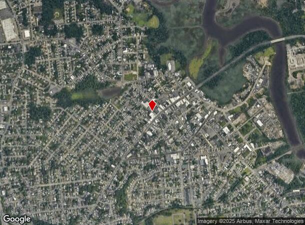
81 Main St, South River, NJ 08882


NEARBY LISTINGS FOR SALE OR LEASE
Property Detail
81 Main St
23-00147-0000-00029
0.294AC
Storemultistory
Middlesex
X
New Jersey
34023C0134F
29
2024
0.29 AC
2025
Brunswick
006800
Northern New Jersey
9,034 SF
New York-Jersey City-White Plains, NY-NJ
DEMOGRAPHICS near 81 Main St
1 Mile
3 Mile
5 Mile
2024 Total Population
15,816
78,198
253,726
2029 Population
15,727
77,812
251,788
Pop Growth 2024-2029
(0.56%)
(0.49%)
(0.76%)
Average Age
39
41
39
2024 Total Households
5,545
27,599
88,648
HH Growth 2024-2029
(0.67%)
(0.55%)
(0.70%)
Median Household Inc
$84,453
$104,840
$92,152
Avg Household Size
2.80
2.80
2.70
2024 Avg HH Vehicles
2.00
2.00
2.00
Median Home Value
$352,083
$406,391
$388,762
Median Year Built
1958
1967
1967
Nearby Places
Map Layers
Map Styles
 Street
 Aerial
- Restaurants
- Banks
- Shops
- Fitness
- Groceries
PUBLIC TRANSPORTATION
COMMUTER RAIL
New Brunswick (Northeast Corridor Line - NJ Transit Commuter Rail (NJ Transit))
DRIVE
WALK
Distance
New Brunswick (Northeast Corridor Line - NJ Transit Commuter Rail (NJ Transit))
12 min
6.5 mi
Jersey Avenue (Northeast Corridor Line - NJ Transit Commuter Rail (NJ Transit))
DRIVE
WALK
Distance
Jersey Avenue (Northeast Corridor Line - NJ Transit Commuter Rail (NJ Transit))
19 min
8.5 mi
AIRPORT
Newark Liberty International
DRIVE
WALK
Distance
Newark Liberty International
40 min
28.6 mi
Trenton Mercer
DRIVE
WALK
Distance
Trenton Mercer
49 min
33.8 mi
Freight Ports
New York Container Terminal
DRIVE
WALK
Distance
New York Container Terminal
33 min
23.7 mi
Nearby Properties
Address
Land Use
TOTAL SIZE
Lot Size
Zoning
Address
Land Use
TOTAL SIZE
Lot Size
Zoning
176.53 AC
G1
Address
Land Use
TOTAL SIZE
Lot Size
Zoning
81,600 SF
49.89 AC
LI
Address
Land Use
TOTAL SIZE
Lot Size
Zoning
Address
Land Use
TOTAL SIZE
Lot Size
Zoning
182.24 AC
ERR
Address
Land Use
TOTAL SIZE
Lot Size
Zoning
2,400 SF
124.08 AC
ERR
Address
Land Use
TOTAL SIZE
Lot Size
Zoning
24.19 AC
R100
Address
Land Use
TOTAL SIZE
Lot Size
Zoning
58.78 AC
LI
Address
Land Use
TOTAL SIZE
Lot Size
Zoning
315,200 SF
22.76 AC
LI
Address
Land Use
TOTAL SIZE
Lot Size
Zoning
7.41 AC
MXD
Address
Land Use
TOTAL SIZE
Lot Size
Zoning
34.63 AC
LR
Address
Land Use
TOTAL SIZE
Lot Size
Zoning
Address
Land Use
TOTAL SIZE
Lot Size
Zoning
52.80 AC
LI
Address
Land Use
TOTAL SIZE
Lot Size
Zoning
41.20 AC
RRRD
Address
Land Use
TOTAL SIZE
Lot Size
Zoning
329.22 AC
I
Address
Land Use
TOTAL SIZE
Lot Size
Zoning
245,980 SF
54.02 AC
OP1
Address
Land Use
TOTAL SIZE
Lot Size
Zoning
169.71 AC
I
Address
Land Use
TOTAL SIZE
Lot Size
Zoning
367,200 SF
34.22 AC
HC2
Address
Land Use
TOTAL SIZE
Lot Size
Zoning
14.34 AC
R100
Address
Land Use
TOTAL SIZE
Lot Size
Zoning
19.97 AC
P
Address
Land Use
TOTAL SIZE
Lot Size
Zoning
4.58 AC
H1
Address
Land Use
TOTAL SIZE
Lot Size
Zoning
47.57 AC
SED
Address
Land Use
TOTAL SIZE
Lot Size
Zoning
5.04 AC
IN-2
Address
Land Use
TOTAL SIZE
Lot Size
Zoning
12.01 AC
Address
Land Use
TOTAL SIZE
Lot Size
Zoning
4.29 AC
H1
Address
Land Use
TOTAL SIZE
Lot Size
Zoning
12.13 AC
R7PRD
Address
Land Use
TOTAL SIZE
Lot Size
Zoning
0.36 AC
R75
Address
Land Use
TOTAL SIZE
Lot Size
Zoning
118,800 SF
8.33 AC
LI
Address
Land Use
TOTAL SIZE
Lot Size
Zoning
26.80 AC
IM
Address
Land Use
TOTAL SIZE
Lot Size
Zoning
32.96 AC
MXD2
Address
Land Use
TOTAL SIZE
Lot Size
Zoning
5,704 SF
1.76 AC
C-5
The World's #1 Commercial Real Estate Marketplace
Connect with us
© 2025 CoStar Group
The information above has been obtained from sources believed reliable. While we do not doubt its accuracy we have not verified it and make no guarantee, warranty or representation about it. It is your responsibility to independently confirm its accuracy and completeness. Any projections, opinions, assumptions, or estimates used are for example only and do not represent the current or future performance of the property. The value of this transaction to you depends on tax and other factors which should be evaluated by your tax, financial, and legal advisors. You and your advisors should conduct a careful, independent investigation of the property to determine to your satisfaction the suitability of the property for your needs.