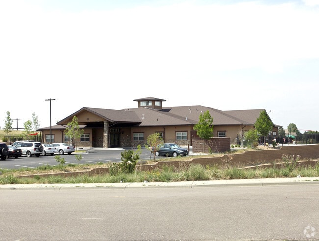
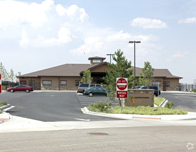
Property Record
81 Max Dr, Castle Pines, CO 80108

Property Detail
81 Max Dr
Denver-Aurora-Centennial, CO
LOT 1 CHARTER OAKS 2 1ST AMD 1.423 AM/L
2351-033-01-003
Douglas
Commercialnec
Colorado
B and X Area of moderate flood hazard, usually the area between the limits of the 100-year and 500-year floods.
1
2024
1.42 AC
2025
South
014125
Denver
11,671 SF
NEARBY LISTINGS FOR SALE OR LEASE
-
-
View all Castle Pines listings for sale on LoopNet.com
DEMOGRAPHICS near 81 Max Dr
1 mile
3 mile
5 mile
2024 Total Population
6,519
20,944
86,103
2029 Population
7,064
22,794
93,275
Pop Growth 2024-2029
+ 8.36%
+ 8.83%
+ 8.33%
Average Age
41
42
39
2024 Total Households
2,384
7,332
30,720
HH Growth 2024-2029
+ 8.81%
+ 9.06%
+ 8.68%
Median Household Inc
$167,824
$197,282
$162,575
Avg Household Size
2.70
2.80
2.80
2024 Avg HH Vehicles
2.00
2.00
2.00
Median Home Value
$817,947
$906,614
$812,000
Median Year Built
1998
2003
2005
Nearby Places
Map Layers
Map Styles
 Street
 Aerial
Transit
 Traffic
 Biking
Places
Listings with unknown addresses are not visible on the map
- Restaurants
- Banks
- Shops
- Fitness
- Groceries
PUBLIC TRANSPORTATION
AIRPORT
Denver International
Drive
Walk
Distance
Denver International
45 min
39.8 mi
Nearby Properties
Address
Land Use
TOTAL SIZE
Lot Size
Zoning
Address
Land Use
TOTAL SIZE
Lot Size
Zoning
389,277 SF
28.08 AC
Address
Land Use
TOTAL SIZE
Lot Size
Zoning
335,336 SF
20.25 AC
Address
Land Use
TOTAL SIZE
Lot Size
Zoning
84,000 SF
6 AC
Address
Land Use
TOTAL SIZE
Lot Size
Zoning
56,868 SF
7.95 AC
Address
Land Use
TOTAL SIZE
Lot Size
Zoning
49,940 SF
8.48 AC
ER
Address
Land Use
TOTAL SIZE
Lot Size
Zoning
210,495 SF
9.85 AC
Address
Land Use
TOTAL SIZE
Lot Size
Zoning
204,239 SF
6.19 AC
Address
Land Use
TOTAL SIZE
Lot Size
Zoning
86,461 SF
8.56 AC
Address
Land Use
TOTAL SIZE
Lot Size
Zoning
51,020 SF
7.33 AC
Address
Land Use
TOTAL SIZE
Lot Size
Zoning
31,007 SF
12.31 AC
Address
Land Use
TOTAL SIZE
Lot Size
Zoning
22,917 SF
159 AC
Address
Land Use
TOTAL SIZE
Lot Size
Zoning
30,871 SF
221.86 AC
A1
Address
Land Use
TOTAL SIZE
Lot Size
Zoning
1,086 SF
960 AC
A1
Address
Land Use
TOTAL SIZE
Lot Size
Zoning
23,066 SF
2.83 AC
Address
Land Use
TOTAL SIZE
Lot Size
Zoning
196,782 SF
6.43 AC
Address
Land Use
TOTAL SIZE
Lot Size
Zoning
67,707 SF
7.79 AC
Address
Land Use
TOTAL SIZE
Lot Size
Zoning
19,460 SF
138.17 AC
Address
Land Use
TOTAL SIZE
Lot Size
Zoning
8,406 SF
6.82 AC
Address
Land Use
TOTAL SIZE
Lot Size
Zoning
18,970 SF
1.36 AC
Address
Land Use
TOTAL SIZE
Lot Size
Zoning
16,592 SF
0.68 AC
Address
Land Use
TOTAL SIZE
Lot Size
Zoning
18,775 SF
4.02 AC
PDU
Address
Land Use
TOTAL SIZE
Lot Size
Zoning
25,476 SF
1.55 AC
Address
Land Use
TOTAL SIZE
Lot Size
Zoning
Address
Land Use
TOTAL SIZE
Lot Size
Zoning
17,120 SF
1.55 AC
Address
Land Use
TOTAL SIZE
Lot Size
Zoning
15,812 SF
0.54 AC
Address
Land Use
TOTAL SIZE
Lot Size
Zoning
14,729 SF
1.87 AC
Address
Land Use
TOTAL SIZE
Lot Size
Zoning
11,769 SF
0.76 AC
Address
Land Use
TOTAL SIZE
Lot Size
Zoning
7,408 SF
1.92 AC
PDU
Address
Land Use
TOTAL SIZE
Lot Size
Zoning
5,977 SF
0.71 AC
The World's #1 Commercial Real Estate Marketplace
Connect with us
© 2026 CoStar Group
The information above has been obtained from sources believed reliable. While we do not doubt its accuracy we have not verified it and make no guarantee, warranty or representation about it. It is your responsibility to independently confirm its accuracy and completeness. Any projections, opinions, assumptions, or estimates used are for example only and do not represent the current or future performance of the property. The value of this transaction to you depends on tax and other factors which should be evaluated by your tax, financial, and legal advisors. You and your advisors should conduct a careful, independent investigation of the property to determine to your satisfaction the suitability of the property for your needs.