Property Record
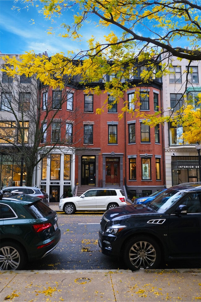
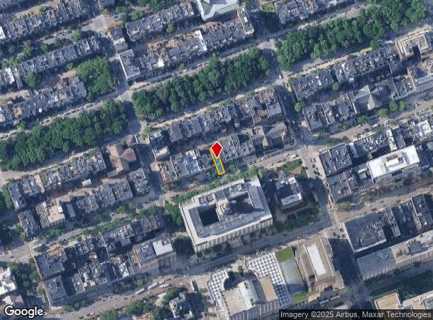
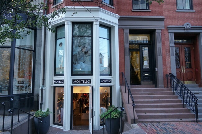
81 Newbury St, Boston, MA 02116

Current Lease Availabilities
NEARBY LISTINGS FOR SALE OR LEASE
Property Detail
81 Newbury St
Storebuilding
Suffolk
X
Massachusetts
25017C0577F
0.06 AC
2025
Back Bay
2025
Boston
010702
Boston-Cambridge-Newton, MA-NH
5,590 SF
CBOS-000000-000005-001286
DEMOGRAPHICS near 81 Newbury St
1 Mile
3 Mile
5 Mile
2024 Total Population
98,074
508,346
940,696
2029 Population
95,487
491,720
905,985
Pop Growth 2024-2029
(2.64%)
(3.27%)
(3.69%)
Average Age
39
36
37
2024 Total Households
49,044
220,009
389,661
HH Growth 2024-2029
(2.96%)
(3.48%)
(3.87%)
Median Household Inc
$97,632
$91,162
$90,579
Avg Household Size
1.80
2.00
2.20
2024 Avg HH Vehicles
1.00
1.00
1.00
Median Home Value
$1,024,355
$860,464
$793,130
Median Year Built
1957
1952
1949
Nearby Places
Map Layers
Map Styles
 Street
 Aerial
- Restaurants
- Banks
- Shops
- Fitness
- Groceries
PUBLIC TRANSPORTATION
TRANSIT/SUBWAY
Copley Station (Green Line - B - Massachusetts Bay Transportation Authority Subway (The T), Green Line - C - Massachusetts Bay Transportation Authority Subway (The T), Green Line - D - Massachusetts Bay Transportation Authority Subway (The T), Green Line - E - Massachusetts Bay Transportation Authority Subway (The T))
DRIVE
WALK
Distance
Copley Station (Green Line - B - Massachusetts Bay Transportation Authority Subway (The T), Green Line - C - Massachusetts Bay Transportation Authority Subway (The T), Green Line - D - Massachusetts Bay Transportation Authority Subway (The T), Green Line - E - Massachusetts Bay Transportation Authority Subway (The T))
2 min
4 min
0.2 mi
Arlington Station (Green Line - B - Massachusetts Bay Transportation Authority Subway (The T), Green Line - C - Massachusetts Bay Transportation Authority Subway (The T), Green Line - D - Massachusetts Bay Transportation Authority Subway (The T), Green Line - E - Massachusetts Bay Transportation Authority Subway (The T))
DRIVE
WALK
Distance
Arlington Station (Green Line - B - Massachusetts Bay Transportation Authority Subway (The T), Green Line - C - Massachusetts Bay Transportation Authority Subway (The T), Green Line - D - Massachusetts Bay Transportation Authority Subway (The T), Green Line - E - Massachusetts Bay Transportation Authority Subway (The T))
1 min
5 min
0.3 mi
Back Bay Station (Orange Line - Massachusetts Bay Transportation Authority Subway (The T))
DRIVE
WALK
Distance
Back Bay Station (Orange Line - Massachusetts Bay Transportation Authority Subway (The T))
3 min
9 min
0.4 mi
Boylston Street Station (Green Line - B - Massachusetts Bay Transportation Authority Subway (The T), Green Line - C - Massachusetts Bay Transportation Authority Subway (The T), Green Line - D - Massachusetts Bay Transportation Authority Subway (The T), Green Line - E - Massachusetts Bay Transportation Authority Subway (The T), Silver Line - Washington Street - Massachusetts Bay Transportation Authority Subway (The T))
DRIVE
WALK
Distance
Boylston Street Station (Green Line - B - Massachusetts Bay Transportation Authority Subway (The T), Green Line - C - Massachusetts Bay Transportation Authority Subway (The T), Green Line - D - Massachusetts Bay Transportation Authority Subway (The T), Green Line - E - Massachusetts Bay Transportation Authority Subway (The T), Silver Line - Washington Street - Massachusetts Bay Transportation Authority Subway (The T))
2 min
11 min
0.6 mi
Prudential Station (Green Line - E - Massachusetts Bay Transportation Authority Subway (The T))
DRIVE
WALK
Distance
Prudential Station (Green Line - E - Massachusetts Bay Transportation Authority Subway (The T))
3 min
12 min
0.6 mi
COMMUTER RAIL
Back Bay Station (Orange Line - Massachusetts Bay Transportation Authority Subway (The T))
DRIVE
WALK
Distance
Back Bay Station (Orange Line - Massachusetts Bay Transportation Authority Subway (The T))
4 min
9 min
0.4 mi
South Station (Fairmount Line - Massachusetts Bay Transportation Authority Commuter Rail (Purple Line), Framingham/Worcester Line - Massachusetts Bay Transportation Authority Commuter Rail (Purple Line), Franklin Line - Massachusetts Bay Transportation Authority Commuter Rail (Purple Line), Greenbush Line - Massachusetts Bay Transportation Authority Commuter Rail (Purple Line), Kingston/Plymouth Line - Massachusetts Bay Transportation Authority Commuter Rail (Purple Line), Middleborough/Lakeville Line - Massachusetts Bay Transportation Authority Commuter Rail (Purple Line), Needham Line - Massachusetts Bay Transportation Authority Commuter Rail (Purple Line), Providence/Stoughton Line - Massachusetts Bay Transportation Authority Commuter Rail (Purple Line))
DRIVE
WALK
Distance
South Station (Fairmount Line - Massachusetts Bay Transportation Authority Commuter Rail (Purple Line), Framingham/Worcester Line - Massachusetts Bay Transportation Authority Commuter Rail (Purple Line), Franklin Line - Massachusetts Bay Transportation Authority Commuter Rail (Purple Line), Greenbush Line - Massachusetts Bay Transportation Authority Commuter Rail (Purple Line), Kingston/Plymouth Line - Massachusetts Bay Transportation Authority Commuter Rail (Purple Line), Middleborough/Lakeville Line - Massachusetts Bay Transportation Authority Commuter Rail (Purple Line), Needham Line - Massachusetts Bay Transportation Authority Commuter Rail (Purple Line), Providence/Stoughton Line - Massachusetts Bay Transportation Authority Commuter Rail (Purple Line))
4 min
1.2 mi
AIRPORT
General Edward Lawrence Logan International
DRIVE
WALK
Distance
General Edward Lawrence Logan International
12 min
5.6 mi
Freight Ports
Port of Boston
DRIVE
WALK
Distance
Port of Boston
10 min
3.0 mi
Nearby Properties
Address
Land Use
TOTAL SIZE
Lot Size
Zoning
Address
Land Use
TOTAL SIZE
Lot Size
Zoning
909,764 SF
25.13 AC
E
Address
Land Use
TOTAL SIZE
Lot Size
Zoning
610,560 SF
4.01 AC
E
Address
Land Use
TOTAL SIZE
Lot Size
Zoning
408,667 SF
3.27 AC
C
Address
Land Use
TOTAL SIZE
Lot Size
Zoning
439,500 SF
9.21 AC
E
Address
Land Use
TOTAL SIZE
Lot Size
Zoning
825,000 SF
5.17 AC
E
Address
Land Use
TOTAL SIZE
Lot Size
Zoning
125,571 SF
3.25 AC
C-3
Address
Land Use
TOTAL SIZE
Lot Size
Zoning
6.39 AC
C
Address
Land Use
TOTAL SIZE
Lot Size
Zoning
596,972 SF
7.32 AC
E
Address
Land Use
TOTAL SIZE
Lot Size
Zoning
171,791 SF
166.88 AC
E
Address
Land Use
TOTAL SIZE
Lot Size
Zoning
530,200 SF
62.08 AC
E
Address
Land Use
TOTAL SIZE
Lot Size
Zoning
173,400 SF
1.14 AC
MXD
Address
Land Use
TOTAL SIZE
Lot Size
Zoning
142,458 SF
1.67 AC
C-3
Address
Land Use
TOTAL SIZE
Lot Size
Zoning
334,522 SF
1.26 AC
C
Address
Land Use
TOTAL SIZE
Lot Size
Zoning
312,269 SF
0.43 AC
C
Address
Land Use
TOTAL SIZE
Lot Size
Zoning
230,394 SF
0.60 AC
MXD
Address
Land Use
TOTAL SIZE
Lot Size
Zoning
46,259 SF
1.05 AC
E
Address
Land Use
TOTAL SIZE
Lot Size
Zoning
118,759 SF
0.92 AC
C
Address
Land Use
TOTAL SIZE
Lot Size
Zoning
304,349 SF
1.72 AC
Address
Land Use
TOTAL SIZE
Lot Size
Zoning
3.52 AC
C-3
Address
Land Use
TOTAL SIZE
Lot Size
Zoning
377,634 SF
4.86 AC
E
Address
Land Use
TOTAL SIZE
Lot Size
Zoning
1.13 AC
C
Address
Land Use
TOTAL SIZE
Lot Size
Zoning
239,377 SF
0.71 AC
MXD
Address
Land Use
TOTAL SIZE
Lot Size
Zoning
419,722 SF
2.03 AC
RC
Address
Land Use
TOTAL SIZE
Lot Size
Zoning
3.75 AC
C
Address
Land Use
TOTAL SIZE
Lot Size
Zoning
227,107 SF
7.70 AC
E
Address
Land Use
TOTAL SIZE
Lot Size
Zoning
2.81 AC
O-2
Address
Land Use
TOTAL SIZE
Lot Size
Zoning
448,796 SF
1.84 AC
C
Address
Land Use
TOTAL SIZE
Lot Size
Zoning
254,208 SF
3.83 AC
E
Address
Land Use
TOTAL SIZE
Lot Size
Zoning
4,355 SF
13.12 AC
E
Address
Land Use
TOTAL SIZE
Lot Size
Zoning
341,500 SF
1.18 AC
RC
The World's #1 Commercial Real Estate Marketplace
Connect with us
© 2025 CoStar Group
The information above has been obtained from sources believed reliable. While we do not doubt its accuracy we have not verified it and make no guarantee, warranty or representation about it. It is your responsibility to independently confirm its accuracy and completeness. Any projections, opinions, assumptions, or estimates used are for example only and do not represent the current or future performance of the property. The value of this transaction to you depends on tax and other factors which should be evaluated by your tax, financial, and legal advisors. You and your advisors should conduct a careful, independent investigation of the property to determine to your satisfaction the suitability of the property for your needs.