Property Record
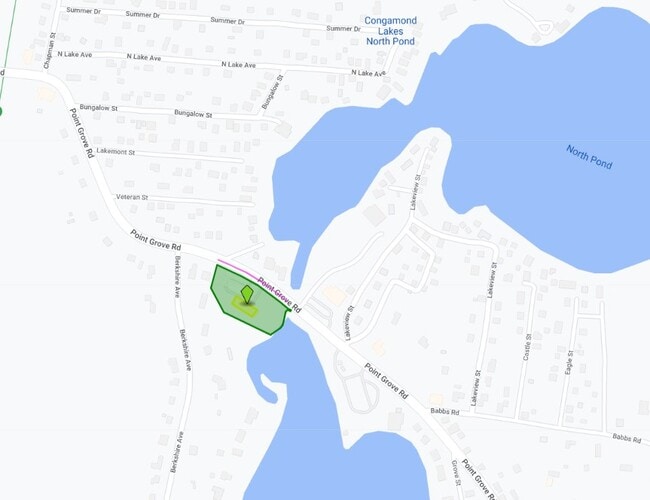
81 Point Grove Rd, Southwick, MA 01077

Property Detail
81 Point Grove Rd
SWIC-000114-000000-000176
Hampden
Restaurantbuilding
Massachusetts
B
176
AE The base floodplain where base flood elevations are provided. AE Zones are now used on new format FIRMs instead of A1-A30 Zones.
1.70 AC
2025
Hampden County
2025
Hartford
813101
Springfield, MA
5,136 SF
NEARBY LISTINGS FOR SALE OR LEASE
DEMOGRAPHICS near 81 Point Grove Rd
1 mile
3 mile
5 mile
2025 Total Population
2,251
9,004
31,096
2030 Population
2,260
9,093
31,240
Pop Growth 2025-2030
+ 0.40%
+ 0.99%
+ 0.46%
Average Age
46
45
44
2025 Total Households
994
3,713
12,376
HH Growth 2025-2030
+ 0.30%
+ 0.94%
+ 0.42%
Median Household Inc
$89,460
$108,815
$107,074
Avg Household Size
2.20
2.40
2.50
2025 Avg HH Vehicles
2.00
2.00
2.00
Median Home Value
$362,660
$403,671
$372,059
Median Year Built
1972
1975
1973
Nearby Places
Map Layers
Map Styles
 Street
 Aerial
Layers
 Traffic
 Biking
Places
Listings with unknown addresses are not visible on the map
- Restaurants
- Banks
- Shops
- Fitness
- Groceries
PUBLIC TRANSPORTATION
AIRPORT
Bradley International
Drive
Walk
Distance
Bradley International
28 min
11.9 mi
Freight Ports
Port of New Haven
Drive
Walk
Distance
Port of New Haven
88 min
62.3 mi
Nearby Properties
Address
Land Use
TOTAL SIZE
Lot Size
Zoning
Address
Land Use
TOTAL SIZE
Lot Size
Zoning
92,866 SF
32 AC
R20A
Address
Land Use
TOTAL SIZE
Lot Size
Zoning
185,556 SF
64.01 AC
R-20A
Address
Land Use
TOTAL SIZE
Lot Size
Zoning
4,628 SF
16.01 AC
R-20
Address
Land Use
TOTAL SIZE
Lot Size
Zoning
27,730 SF
17 AC
BR
Address
Land Use
TOTAL SIZE
Lot Size
Zoning
51,608 SF
6.43 AC
IR
Address
Land Use
TOTAL SIZE
Lot Size
Zoning
63,175 SF
4.39 AC
IR
Address
Land Use
TOTAL SIZE
Lot Size
Zoning
2,684 SF
17.01 AC
BR
Address
Land Use
TOTAL SIZE
Lot Size
Zoning
57,159 SF
7.07 AC
B
Address
Land Use
TOTAL SIZE
Lot Size
Zoning
10,114 SF
33 AC
BR
Address
Land Use
TOTAL SIZE
Lot Size
Zoning
31,216 SF
9.20 AC
I
Address
Land Use
TOTAL SIZE
Lot Size
Zoning
2,183 SF
5.59 AC
BR
Address
Land Use
TOTAL SIZE
Lot Size
Zoning
76.24 AC
IR
Address
Land Use
TOTAL SIZE
Lot Size
Zoning
5,501 SF
7.70 AC
R-20
Address
Land Use
TOTAL SIZE
Lot Size
Zoning
41,885 SF
4.13 AC
IR
Address
Land Use
TOTAL SIZE
Lot Size
Zoning
45,840 SF
3.46 AC
B
Address
Land Use
TOTAL SIZE
Lot Size
Zoning
22,620 SF
5.90 AC
BR
Address
Land Use
TOTAL SIZE
Lot Size
Zoning
40,636 SF
2.40 AC
IR
Address
Land Use
TOTAL SIZE
Lot Size
Zoning
17,016 SF
6.03 AC
BR
Address
Land Use
TOTAL SIZE
Lot Size
Zoning
11,304 SF
0.52 AC
BR
Address
Land Use
TOTAL SIZE
Lot Size
Zoning
12,847 SF
2.25 AC
B
Address
Land Use
TOTAL SIZE
Lot Size
Zoning
9,574 SF
5.80 AC
R-40
Address
Land Use
TOTAL SIZE
Lot Size
Zoning
21,200 SF
3 AC
BR
Address
Land Use
TOTAL SIZE
Lot Size
Zoning
7,200 SF
5.69 AC
IR
Address
Land Use
TOTAL SIZE
Lot Size
Zoning
1,819 SF
3.45 AC
B
Address
Land Use
TOTAL SIZE
Lot Size
Zoning
10,655 SF
1.43 AC
BR
Address
Land Use
TOTAL SIZE
Lot Size
Zoning
10,900 SF
6.97 AC
NC
Address
Land Use
TOTAL SIZE
Lot Size
Zoning
3,058 SF
244 AC
R-40
Address
Land Use
TOTAL SIZE
Lot Size
Zoning
160.37 AC
FP
Address
Land Use
TOTAL SIZE
Lot Size
Zoning
35,478 SF
3.10 AC
BR
Address
Land Use
TOTAL SIZE
Lot Size
Zoning
9,992 SF
31.41 AC
R-40
The World's #1 Commercial Real Estate Marketplace
Connect with us
© 2026 CoStar Group
The information above has been obtained from sources believed reliable. While we do not doubt its accuracy we have not verified it and make no guarantee, warranty or representation about it. It is your responsibility to independently confirm its accuracy and completeness. Any projections, opinions, assumptions, or estimates used are for example only and do not represent the current or future performance of the property. The value of this transaction to you depends on tax and other factors which should be evaluated by your tax, financial, and legal advisors. You and your advisors should conduct a careful, independent investigation of the property to determine to your satisfaction the suitability of the property for your needs.