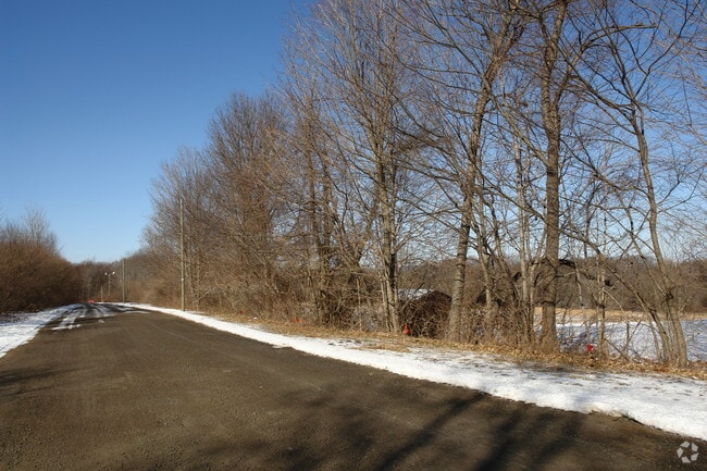
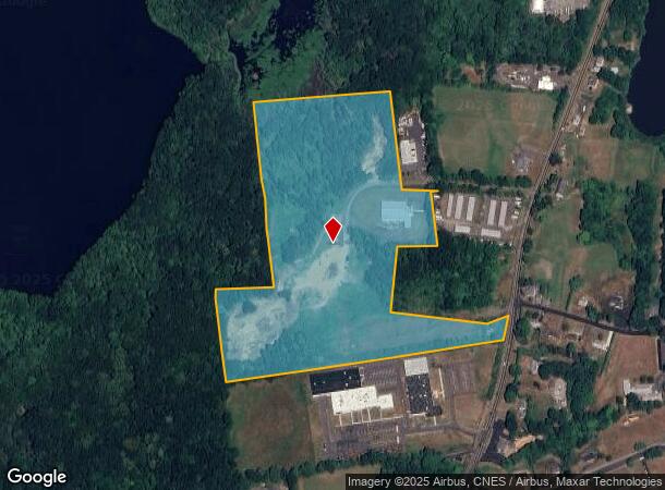
Property Record
60 Trigo Dr, Middletown, CT 06457

NEARBY LISTINGS FOR SALE OR LEASE
Property Detail
60 Trigo Dr
MTWN-000017-000000-000028-R015247
Middlesex
Industrialgeneral
Connecticut
X
28
09003C0650F
2.70 AC
2024
NW Middlesex/Middletown
2025
Hartford
542200
Hartford-West Hartford-East Hartford, CT
13,950 SF
DEMOGRAPHICS near 60 Trigo Dr
1 mile
3 mile
5 mile
2024 Total Population
1,061
16,197
52,632
2029 Population
1,057
16,108
52,286
Pop Growth 2024-2029
(0.38%)
(0.55%)
(0.66%)
Average Age
45
44
42
2024 Total Households
456
6,699
21,390
HH Growth 2024-2029
(0.44%)
(0.67%)
(0.57%)
Median Household Inc
$98,780
$95,224
$81,305
Avg Household Size
2.30
2.30
2.20
2024 Avg HH Vehicles
2.00
2.00
2.00
Median Home Value
$274,213
$279,237
$271,440
Median Year Built
1978
1968
1965
Nearby Places
Map Layers
Map Styles
 Street
 Aerial
Transit
 Traffic
 Biking
Places
Listings with unknown addresses are not visible on the map
- Restaurants
- Banks
- Shops
- Fitness
- Groceries
PUBLIC TRANSPORTATION
AIRPORT
Tweed/New Haven
Drive
Walk
Distance
Tweed/New Haven
43 min
26.6 mi
Bradley International
Drive
Walk
Distance
Bradley International
60 min
37.6 mi
Freight Ports
Port of New Haven
Drive
Walk
Distance
Port of New Haven
38 min
24.3 mi
Nearby Properties
Address
Land Use
TOTAL SIZE
Lot Size
Zoning
Address
Land Use
TOTAL SIZE
Lot Size
Zoning
12.12 AC
RPZ
Address
Land Use
TOTAL SIZE
Lot Size
Zoning
197,789 SF
31.92 AC
R-15
Address
Land Use
TOTAL SIZE
Lot Size
Zoning
108,540 SF
22.99 AC
R-15
Address
Land Use
TOTAL SIZE
Lot Size
Zoning
23.01 AC
M
Address
Land Use
TOTAL SIZE
Lot Size
Zoning
91.69 AC
R-15
Address
Land Use
TOTAL SIZE
Lot Size
Zoning
67,405 SF
25 AC
R-15
Address
Land Use
TOTAL SIZE
Lot Size
Zoning
10.10 AC
M
Address
Land Use
TOTAL SIZE
Lot Size
Zoning
61,042 SF
4.40 AC
RPZ
Address
Land Use
TOTAL SIZE
Lot Size
Zoning
54,264 SF
15 AC
PRD
Address
Land Use
TOTAL SIZE
Lot Size
Zoning
124,940 SF
49.46 AC
FARM -
Address
Land Use
TOTAL SIZE
Lot Size
Zoning
54.70 AC
R-15
Address
Land Use
TOTAL SIZE
Lot Size
Zoning
92,968 SF
20.35 AC
R-15
Address
Land Use
TOTAL SIZE
Lot Size
Zoning
49,706 SF
6.82 AC
MXI
Address
Land Use
TOTAL SIZE
Lot Size
Zoning
20.60 AC
I-4
Address
Land Use
TOTAL SIZE
Lot Size
Zoning
23,933 SF
8 AC
R-15
Address
Land Use
TOTAL SIZE
Lot Size
Zoning
13.57 AC
IPD1
Address
Land Use
TOTAL SIZE
Lot Size
Zoning
6.12 AC
B-2
Address
Land Use
TOTAL SIZE
Lot Size
Zoning
5.25 AC
RPZ
Address
Land Use
TOTAL SIZE
Lot Size
Zoning
12,491 SF
1.01 AC
RPZ
Address
Land Use
TOTAL SIZE
Lot Size
Zoning
49,299 SF
19.98 AC
IPD1
Address
Land Use
TOTAL SIZE
Lot Size
Zoning
85,279 SF
1.90 AC
RPZ
Address
Land Use
TOTAL SIZE
Lot Size
Zoning
19,186 SF
103.50 AC
R-15
Address
Land Use
TOTAL SIZE
Lot Size
Zoning
40,938 SF
14.53 AC
FARM -
Address
Land Use
TOTAL SIZE
Lot Size
Zoning
36,106 SF
14.73 AC
MD
Address
Land Use
TOTAL SIZE
Lot Size
Zoning
32.52 AC
AG2
Address
Land Use
TOTAL SIZE
Lot Size
Zoning
62,967 SF
9.40 AC
MAIN S
Address
Land Use
TOTAL SIZE
Lot Size
Zoning
59,557 SF
12.24 AC
I-4
Address
Land Use
TOTAL SIZE
Lot Size
Zoning
30.51 AC
MAIN S
Address
Land Use
TOTAL SIZE
Lot Size
Zoning
32,375 SF
18.94 AC
FARM -
Address
Land Use
TOTAL SIZE
Lot Size
Zoning
5.57 AC
RPZ
The World's #1 Commercial Real Estate Marketplace
Connect with us
© 2026 CoStar Group
The information above has been obtained from sources believed reliable. While we do not doubt its accuracy we have not verified it and make no guarantee, warranty or representation about it. It is your responsibility to independently confirm its accuracy and completeness. Any projections, opinions, assumptions, or estimates used are for example only and do not represent the current or future performance of the property. The value of this transaction to you depends on tax and other factors which should be evaluated by your tax, financial, and legal advisors. You and your advisors should conduct a careful, independent investigation of the property to determine to your satisfaction the suitability of the property for your needs.