Property Record
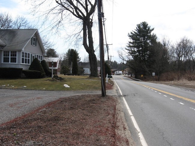
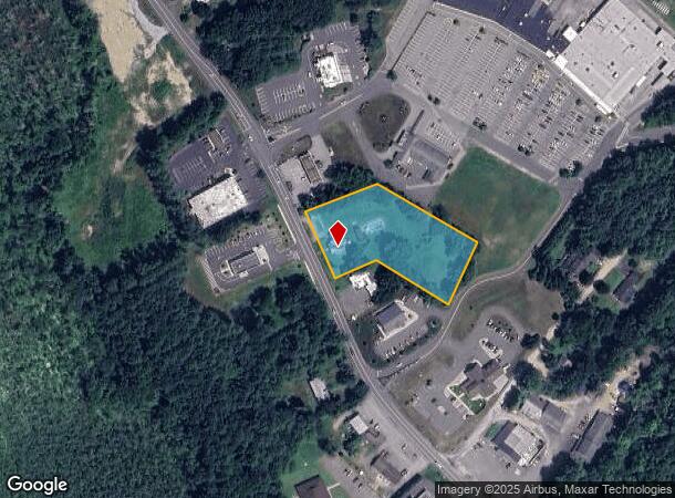
81 W Stafford Rd, Stafford Springs, CT 06076

NEARBY LISTINGS FOR SALE OR LEASE
Property Detail
81 W Stafford Rd
Hartford
Tolland
Hartford-West Hartford-East Hartford, CT
Connecticut
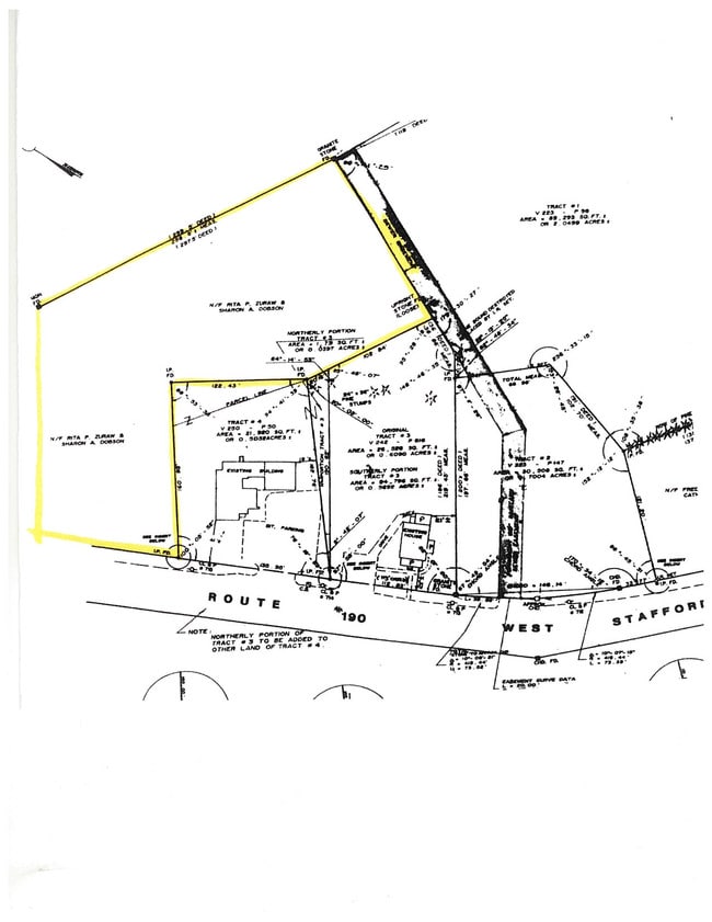
STAF-000036-000070
1.79 AC
Sfr
Tolland County
1,446 SF
DEMOGRAPHICS near 81 W Stafford Rd
1 Mile
3 Mile
5 Mile
2024 Total Population
915
9,029
18,165
2029 Population
923
9,078
18,199
Pop Growth 2024-2029
+ 0.87%
+ 0.54%
+ 0.19%
Average Age
44
43
43
2024 Total Households
371
3,805
7,261
HH Growth 2024-2029
+ 0.81%
+ 0.45%
+ 0.17%
Median Household Inc
$82,500
$77,227
$93,031
Avg Household Size
2.40
2.30
2.40
2024 Avg HH Vehicles
2.00
2.00
2.00
Median Home Value
$234,091
$235,188
$265,794
Median Year Built
1971
1965
1971
Nearby Places
Map Layers
Map Styles
 Street
 Aerial
- Restaurants
- Banks
- Shops
- Fitness
- Groceries
PUBLIC TRANSPORTATION
AIRPORT
Bradley International
DRIVE
WALK
Distance
Bradley International
45 min
21.3 mi
Worcester Regional
DRIVE
WALK
Distance
Worcester Regional
64 min
41.4 mi
Freight Ports
Port of New Haven
DRIVE
WALK
Distance
Port of New Haven
86 min
63.4 mi
SALE & LEASE HISTORY
LISTING DATE
SALE/LEASE

Nov 28, 2018
For Sale
Nearby Properties
Address
Land Use
TOTAL SIZE
Lot Size
Zoning
Address
Land Use
TOTAL SIZE
Lot Size
Zoning
134,031 SF
63 AC
AA
Address
Land Use
TOTAL SIZE
Lot Size
Zoning
91,347 SF
20.34 AC
AA
Address
Land Use
TOTAL SIZE
Lot Size
Zoning
85,912 SF
37.59 AC
A
Address
Land Use
TOTAL SIZE
Lot Size
Zoning
40.52 AC
HB
Address
Land Use
TOTAL SIZE
Lot Size
Zoning
32.85 AC
HB
Address
Land Use
TOTAL SIZE
Lot Size
Zoning
17,452 SF
39 AC
A
Address
Land Use
TOTAL SIZE
Lot Size
Zoning
15.26 AC
AA
Address
Land Use
TOTAL SIZE
Lot Size
Zoning
35,378 SF
23.33 AC
AAA
Address
Land Use
TOTAL SIZE
Lot Size
Zoning
10.60 AC
IN
Address
Land Use
TOTAL SIZE
Lot Size
Zoning
2.22 AC
C
Address
Land Use
TOTAL SIZE
Lot Size
Zoning
13,284 SF
2.23 AC
LB
Address
Land Use
TOTAL SIZE
Lot Size
Zoning
19,125 SF
16.37 AC
HB
Address
Land Use
TOTAL SIZE
Lot Size
Zoning
177,074 SF
7.54 AC
IN
Address
Land Use
TOTAL SIZE
Lot Size
Zoning
12,000 SF
7.98 AC
IN
Address
Land Use
TOTAL SIZE
Lot Size
Zoning
47,409 SF
5.54 AC
HI
Address
Land Use
TOTAL SIZE
Lot Size
Zoning
1.49 AC
HB
Address
Land Use
TOTAL SIZE
Lot Size
Zoning
53,328 SF
17.04 AC
IN
Address
Land Use
TOTAL SIZE
Lot Size
Zoning
71,016 SF
5.90 AC
IN
Address
Land Use
TOTAL SIZE
Lot Size
Zoning
Address
Land Use
TOTAL SIZE
Lot Size
Zoning
21,251 SF
8.02 AC
IN
Address
Land Use
TOTAL SIZE
Lot Size
Zoning
40,000 SF
6.36 AC
IN
Address
Land Use
TOTAL SIZE
Lot Size
Zoning
4.05 AC
HI
Address
Land Use
TOTAL SIZE
Lot Size
Zoning
4,391 SF
1.56 AC
C+LB
Address
Land Use
TOTAL SIZE
Lot Size
Zoning
40 AC
IN
Address
Land Use
TOTAL SIZE
Lot Size
Zoning
5.36 AC
IN
Address
Land Use
TOTAL SIZE
Lot Size
Zoning
10,000 SF
1.40 AC
HB
Address
Land Use
TOTAL SIZE
Lot Size
Zoning
2.09 AC
IN
Address
Land Use
TOTAL SIZE
Lot Size
Zoning
44,498 SF
8.80 AC
OS
Address
Land Use
TOTAL SIZE
Lot Size
Zoning
3.39 AC
B
Address
Land Use
TOTAL SIZE
Lot Size
Zoning
51.75 AC
AAA
The World's #1 Commercial Real Estate Marketplace
Connect with us
© 2025 CoStar Group
The information above has been obtained from sources believed reliable. While we do not doubt its accuracy we have not verified it and make no guarantee, warranty or representation about it. It is your responsibility to independently confirm its accuracy and completeness. Any projections, opinions, assumptions, or estimates used are for example only and do not represent the current or future performance of the property. The value of this transaction to you depends on tax and other factors which should be evaluated by your tax, financial, and legal advisors. You and your advisors should conduct a careful, independent investigation of the property to determine to your satisfaction the suitability of the property for your needs.