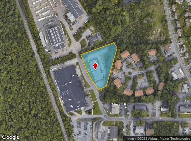
Property Record
81 Welby Rd, New Bedford, MA 02745

Current Lease Availabilities
NEARBY LISTINGS FOR SALE OR LEASE
Property Detail
81 Welby Rd
NEWB-000132-000000-000818
Bristol
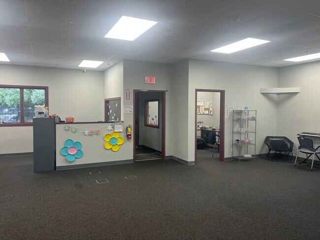
Daycare
Massachusetts
A
818
25005C0379G
1.90 AC
2025
Attleboro/New Bedford
2025
Boston
650102
Providence-Warwick, RI-MA
13,210 SF
DEMOGRAPHICS near 81 Welby Rd
1 Mile
3 Mile
5 Mile
2024 Total Population
5,119
33,789
89,301
2029 Population
5,102
33,320
87,732
Pop Growth 2024-2029
(0.33%)
(1.39%)
(1.76%)
Average Age
41
42
41
2024 Total Households
2,081
13,892
36,253
HH Growth 2024-2029
(0.38%)
(1.47%)
(1.82%)
Median Household Inc
$73,025
$72,576
$60,471
Avg Household Size
2.40
2.40
2.40
2024 Avg HH Vehicles
2.00
2.00
2.00
Median Home Value
$333,333
$326,014
$335,013
Median Year Built
1982
1962
1955
Nearby Places
Map Layers
Map Styles
 Street
 Aerial
- Restaurants
- Banks
- Shops
- Fitness
- Groceries
PUBLIC TRANSPORTATION
AIRPORT
Rhode Island Tf Green International
DRIVE
WALK
Distance
Rhode Island Tf Green International
55 min
39.2 mi
Freight Ports
Port of New Bedford Harbor
DRIVE
WALK
Distance
Port of New Bedford Harbor
12 min
6.2 mi
Nearby Properties
Address
Land Use
TOTAL SIZE
Lot Size
Zoning
Address
Land Use
TOTAL SIZE
Lot Size
Zoning
23.22 AC
RB
Address
Land Use
TOTAL SIZE
Lot Size
Zoning
243,052 SF
9.66 AC
RB
Address
Land Use
TOTAL SIZE
Lot Size
Zoning
102,826 SF
15.15 AC
OI
Address
Land Use
TOTAL SIZE
Lot Size
Zoning
157,346 SF
5.68 AC
RA
Address
Land Use
TOTAL SIZE
Lot Size
Zoning
54.60 AC
Address
Land Use
TOTAL SIZE
Lot Size
Zoning
24.95 AC
PB
Address
Land Use
TOTAL SIZE
Lot Size
Zoning
44,156 SF
5.18 AC
GI
Address
Land Use
TOTAL SIZE
Lot Size
Zoning
492.70 AC
IC
Address
Land Use
TOTAL SIZE
Lot Size
Zoning
59,778 SF
14.95 AC
OI
Address
Land Use
TOTAL SIZE
Lot Size
Zoning
225,292 SF
29.27 AC
IC
Address
Land Use
TOTAL SIZE
Lot Size
Zoning
239,765 SF
31.86 AC
IC
Address
Land Use
TOTAL SIZE
Lot Size
Zoning
306.30 AC
IC
Address
Land Use
TOTAL SIZE
Lot Size
Zoning
6.46 AC
MUB
Address
Land Use
TOTAL SIZE
Lot Size
Zoning
165,183 SF
11.29 AC
PB
Address
Land Use
TOTAL SIZE
Lot Size
Zoning
199,978 SF
31.41 AC
IC
Address
Land Use
TOTAL SIZE
Lot Size
Zoning
169,928 SF
31.88 AC
GI
Address
Land Use
TOTAL SIZE
Lot Size
Zoning
5.49 AC
RB
Address
Land Use
TOTAL SIZE
Lot Size
Zoning
85.25 AC
MUB
Address
Land Use
TOTAL SIZE
Lot Size
Zoning
5,208 SF
152.06 AC
GI
Address
Land Use
TOTAL SIZE
Lot Size
Zoning
39,910 SF
2.29 AC
RB
Address
Land Use
TOTAL SIZE
Lot Size
Zoning
9.79 AC
IA
Address
Land Use
TOTAL SIZE
Lot Size
Zoning
71.14 AC
RA
Address
Land Use
TOTAL SIZE
Lot Size
Zoning
118,757 SF
61.52 AC
IC
Address
Land Use
TOTAL SIZE
Lot Size
Zoning
6.34 AC
RA
Address
Land Use
TOTAL SIZE
Lot Size
Zoning
62,408 SF
12.60 AC
RA
Address
Land Use
TOTAL SIZE
Lot Size
Zoning
95,972 SF
9.40 AC
IC
Address
Land Use
TOTAL SIZE
Lot Size
Zoning
5.64 AC
MUB
Address
Land Use
TOTAL SIZE
Lot Size
Zoning
4,041 SF
31.91 AC
Address
Land Use
TOTAL SIZE
Lot Size
Zoning
51,243 SF
8.51 AC
RA
Address
Land Use
TOTAL SIZE
Lot Size
Zoning
203.05 AC
IB
The World's #1 Commercial Real Estate Marketplace
Connect with us
© 2025 CoStar Group
The information above has been obtained from sources believed reliable. While we do not doubt its accuracy we have not verified it and make no guarantee, warranty or representation about it. It is your responsibility to independently confirm its accuracy and completeness. Any projections, opinions, assumptions, or estimates used are for example only and do not represent the current or future performance of the property. The value of this transaction to you depends on tax and other factors which should be evaluated by your tax, financial, and legal advisors. You and your advisors should conduct a careful, independent investigation of the property to determine to your satisfaction the suitability of the property for your needs.