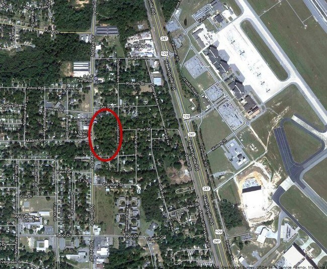
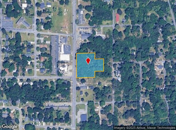
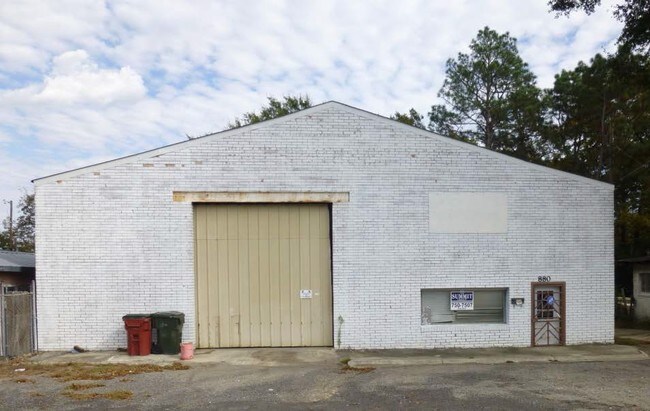
Property Record
810 N Davis Dr, Warner Robins, GA 31093

NEARBY LISTINGS FOR SALE OR LEASE
Property Detail
810 N Davis Dr
Warner Robins, GA
N Davis 250 Ff
0W18AB003000
LOTS 5,6,7,8 & PT 18 & 19 BLK I PAULA GARDEN
Commercialacreage
Houston
X
Georgia
13021C0265G
5-8
2024
1.35 AC
2024
Perry/Warner Robins
020301
Other Market Areas
DEMOGRAPHICS near 810 N Davis Dr
1 Mile
3 Mile
5 Mile
2024 Total Population
6,441
32,669
66,295
2029 Population
7,183
35,957
72,778
Pop Growth 2024-2029
+ 11.52%
+ 10.06%
+ 9.78%
Average Age
36
37
37
2024 Total Households
2,551
12,872
26,607
HH Growth 2024-2029
+ 11.56%
+ 9.90%
+ 9.63%
Median Household Inc
$26,824
$46,722
$53,477
Avg Household Size
2.40
2.40
2.40
2024 Avg HH Vehicles
1.00
2.00
2.00
Median Home Value
$58,587
$94,335
$121,256
Median Year Built
1966
1972
1978
Nearby Places
Map Layers
Map Styles
 Street
 Aerial
- Restaurants
- Banks
- Shops
- Fitness
- Groceries
SALE & LEASE HISTORY
LISTING DATE
SALE/LEASE

Sep 24, 2016
For Sale
Nearby Properties
Address
Land Use
TOTAL SIZE
Lot Size
Zoning
Address
Land Use
TOTAL SIZE
Lot Size
Zoning
88,965 SF
18.72 AC
R2
Address
Land Use
TOTAL SIZE
Lot Size
Zoning
11,658 SF
30.23 AC
R2
Address
Land Use
TOTAL SIZE
Lot Size
Zoning
304,246 SF
23.11 AC
C2
Address
Land Use
TOTAL SIZE
Lot Size
Zoning
11,200 SF
7.60 AC
R4
Address
Land Use
TOTAL SIZE
Lot Size
Zoning
6,336 SF
27.16 AC
R4
Address
Land Use
TOTAL SIZE
Lot Size
Zoning
128,540 SF
32.26 AC
R2
Address
Land Use
TOTAL SIZE
Lot Size
Zoning
90,000 SF
12 AC
R1
Address
Land Use
TOTAL SIZE
Lot Size
Zoning
61,628 SF
45 AC
C2
Address
Land Use
TOTAL SIZE
Lot Size
Zoning
120,000 SF
19.03 AC
R3
Address
Land Use
TOTAL SIZE
Lot Size
Zoning
121,500 SF
10 AC
R2
Address
Land Use
TOTAL SIZE
Lot Size
Zoning
93,450 SF
11.16 AC
R2
Address
Land Use
TOTAL SIZE
Lot Size
Zoning
60,000 SF
8.95 AC
C3
Address
Land Use
TOTAL SIZE
Lot Size
Zoning
25,062 SF
R4
Address
Land Use
TOTAL SIZE
Lot Size
Zoning
1,512 SF
309.01 AC
M2
Address
Land Use
TOTAL SIZE
Lot Size
Zoning
71,434 SF
10.58 AC
R2
Address
Land Use
TOTAL SIZE
Lot Size
Zoning
5,400 SF
16.21 AC
R4
Address
Land Use
TOTAL SIZE
Lot Size
Zoning
75,613 SF
11.51 AC
C1
Address
Land Use
TOTAL SIZE
Lot Size
Zoning
4,720 SF
12.53 AC
C2
Address
Land Use
TOTAL SIZE
Lot Size
Zoning
22,500 SF
9.80 AC
R2
Address
Land Use
TOTAL SIZE
Lot Size
Zoning
85,000 SF
12.61 AC
R2
Address
Land Use
TOTAL SIZE
Lot Size
Zoning
72,688 SF
9.47 AC
R1
Address
Land Use
TOTAL SIZE
Lot Size
Zoning
4,720 SF
8.66 AC
C2
Address
Land Use
TOTAL SIZE
Lot Size
Zoning
24,864 SF
9.13 AC
R2
Address
Land Use
TOTAL SIZE
Lot Size
Zoning
2,880 SF
16.49 AC
PUD
Address
Land Use
TOTAL SIZE
Lot Size
Zoning
65,700 SF
5.48 AC
C3
Address
Land Use
TOTAL SIZE
Lot Size
Zoning
3,200 SF
17.67 AC
R2
Address
Land Use
TOTAL SIZE
Lot Size
Zoning
3,264 SF
18.35 AC
R4
Address
Land Use
TOTAL SIZE
Lot Size
Zoning
3,139 SF
10.85 AC
R4
Address
Land Use
TOTAL SIZE
Lot Size
Zoning
45,978 SF
6.97 AC
C3
Address
Land Use
TOTAL SIZE
Lot Size
Zoning
15,944 SF
32.92 AC
R2
The World's #1 Commercial Real Estate Marketplace
Connect with us
© 2025 CoStar Group
The information above has been obtained from sources believed reliable. While we do not doubt its accuracy we have not verified it and make no guarantee, warranty or representation about it. It is your responsibility to independently confirm its accuracy and completeness. Any projections, opinions, assumptions, or estimates used are for example only and do not represent the current or future performance of the property. The value of this transaction to you depends on tax and other factors which should be evaluated by your tax, financial, and legal advisors. You and your advisors should conduct a careful, independent investigation of the property to determine to your satisfaction the suitability of the property for your needs.