Property Record
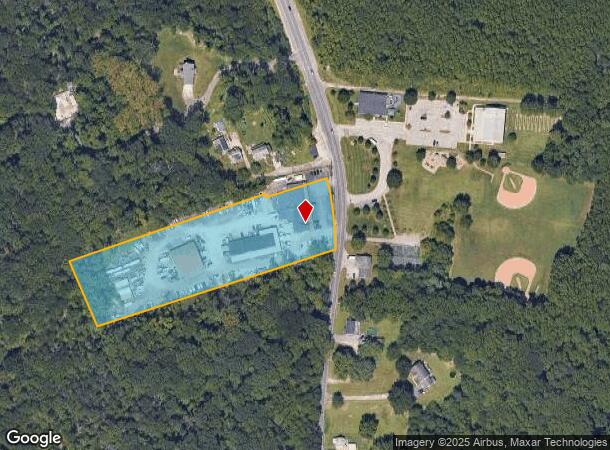
810 Back River Neck Rd, Essex, MD 21221

NEARBY LISTINGS FOR SALE OR LEASE
Property Detail
810 Back River Neck Rd
15-2300004470
4.316 AC
Storebuilding
Baltimore
AE
Maryland
2400100445G
4.31 AC
2024
Baltimore County East
2025
Baltimore
451000
Baltimore-Columbia-Towson, MD
18,519 SF
DEMOGRAPHICS near 810 Back River Neck Rd
1 Mile
3 Mile
5 Mile
2024 Total Population
3,305
45,569
134,743
2029 Population
3,257
45,006
133,069
Pop Growth 2024-2029
(1.45%)
(1.24%)
(1.24%)
Average Age
44
40
40
2024 Total Households
1,271
17,968
51,598
HH Growth 2024-2029
(1.49%)
(1.35%)
(1.32%)
Median Household Inc
$103,935
$63,976
$64,805
Avg Household Size
2.60
2.50
2.50
2024 Avg HH Vehicles
2.00
2.00
2.00
Median Home Value
$377,945
$265,835
$232,966
Median Year Built
1982
1963
1961
Nearby Places
Map Layers
Map Styles
 Street
 Aerial
- Restaurants
- Banks
- Shops
- Fitness
- Groceries
PUBLIC TRANSPORTATION
COMMUTER RAIL
Martin State Airport (Penn Line - Maryland Area Regional Commuter Trains (The MARC))
DRIVE
WALK
Distance
Martin State Airport (Penn Line - Maryland Area Regional Commuter Trains (The MARC))
12 min
5.2 mi
AIRPORT
Baltimore/Washington International Thurgood Marshall
DRIVE
WALK
Distance
Baltimore/Washington International Thurgood Marshall
39 min
24.5 mi
Freight Ports
Port of Baltimore
DRIVE
WALK
Distance
Port of Baltimore
27 min
13.1 mi
Nearby Properties
Address
Land Use
TOTAL SIZE
Lot Size
Zoning
Address
Land Use
TOTAL SIZE
Lot Size
Zoning
159,728 SF
0.02 AC
MH
Address
Land Use
TOTAL SIZE
Lot Size
Zoning
23.40 AC
DR16
Address
Land Use
TOTAL SIZE
Lot Size
Zoning
19 AC
DR16
Address
Land Use
TOTAL SIZE
Lot Size
Zoning
24.95 AC
DR16
Address
Land Use
TOTAL SIZE
Lot Size
Zoning
126,096 SF
14.68 AC
DR105
Address
Land Use
TOTAL SIZE
Lot Size
Zoning
10.48 AC
DR16
Address
Land Use
TOTAL SIZE
Lot Size
Zoning
130,797 SF
18.11 AC
DR105
Address
Land Use
TOTAL SIZE
Lot Size
Zoning
237,925 SF
28.28 AC
Address
Land Use
TOTAL SIZE
Lot Size
Zoning
12.25 AC
DR16
Address
Land Use
TOTAL SIZE
Lot Size
Zoning
14.14 AC
DR16
Address
Land Use
TOTAL SIZE
Lot Size
Zoning
21.53 AC
DR16
Address
Land Use
TOTAL SIZE
Lot Size
Zoning
14.13 AC
DR16
Address
Land Use
TOTAL SIZE
Lot Size
Zoning
16.15 AC
DR16
Address
Land Use
TOTAL SIZE
Lot Size
Zoning
288,938 SF
15.27 AC
MH-IM
Address
Land Use
TOTAL SIZE
Lot Size
Zoning
72,118 SF
10.10 AC
DR5.5
Address
Land Use
TOTAL SIZE
Lot Size
Zoning
196,204 SF
49 AC
DR5.5
Address
Land Use
TOTAL SIZE
Lot Size
Zoning
70,130 SF
15.72 AC
DR5.5
Address
Land Use
TOTAL SIZE
Lot Size
Zoning
6.06 AC
DR16
Address
Land Use
TOTAL SIZE
Lot Size
Zoning
13.28 AC
DR16
Address
Land Use
TOTAL SIZE
Lot Size
Zoning
3 AC
BMCCC
Address
Land Use
TOTAL SIZE
Lot Size
Zoning
48,388 SF
4.05 AC
DR16
Address
Land Use
TOTAL SIZE
Lot Size
Zoning
257,695 SF
16.78 AC
MH-IM
Address
Land Use
TOTAL SIZE
Lot Size
Zoning
77,073 SF
10.23 AC
DR10.
Address
Land Use
TOTAL SIZE
Lot Size
Zoning
56,105 SF
19.76 AC
DR5.5
Address
Land Use
TOTAL SIZE
Lot Size
Zoning
8 AC
DR16
Address
Land Use
TOTAL SIZE
Lot Size
Zoning
48,388 SF
2.81 AC
DR105
Address
Land Use
TOTAL SIZE
Lot Size
Zoning
7.31 AC
DR16
Address
Land Use
TOTAL SIZE
Lot Size
Zoning
77,628 SF
4.63 AC
DR10
Address
Land Use
TOTAL SIZE
Lot Size
Zoning
4.63 AC
DR16
Address
Land Use
TOTAL SIZE
Lot Size
Zoning
49,559 SF
20.79 AC
DR5.5
The World's #1 Commercial Real Estate Marketplace
Connect with us
© 2026 CoStar Group
The information above has been obtained from sources believed reliable. While we do not doubt its accuracy we have not verified it and make no guarantee, warranty or representation about it. It is your responsibility to independently confirm its accuracy and completeness. Any projections, opinions, assumptions, or estimates used are for example only and do not represent the current or future performance of the property. The value of this transaction to you depends on tax and other factors which should be evaluated by your tax, financial, and legal advisors. You and your advisors should conduct a careful, independent investigation of the property to determine to your satisfaction the suitability of the property for your needs.