Property Record
810 Flat Rock Rd, Stockbridge, GA 30281


Property Detail
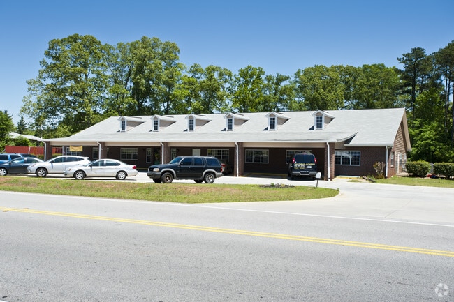
810 Flat Rock Rd
066A-01-001-006
LAND LOT: 96 LAND DISTRICT: 1
Daycare
Henry
C1
Georgia
B and X Area of moderate flood hazard, usually the area between the limits of the 100-year and 500-year floods.
96
2025
1.75 AC
2025
Forest Park/Morrow
070117
Atlanta
12,216 SF
Atlanta-Sandy Springs-Roswell, GA
NEARBY LISTINGS FOR SALE OR LEASE
DEMOGRAPHICS near 810 Flat Rock Rd
1 mile
3 mile
5 mile
2025 Total Population
2,431
26,773
91,100
2030 Population
2,572
28,511
95,364
Pop Growth 2025-2030
+ 5.80%
+ 6.49%
+ 4.68%
Average Age
40
40
39
2025 Total Households
847
9,545
32,678
HH Growth 2025-2030
+ 5.90%
+ 6.61%
+ 4.75%
Median Household Inc
$74,944
$73,482
$73,908
Avg Household Size
2.80
2.70
2.70
2025 Avg HH Vehicles
2.00
2.00
2.00
Median Home Value
$248,497
$288,593
$292,754
Median Year Built
1987
1991
1995
Nearby Places
Map Layers
Map Styles
 Street
 Aerial
Layers
 Traffic
 Biking
Places
Listings with unknown addresses are not visible on the map
- Restaurants
- Banks
- Shops
- Fitness
- Groceries
PUBLIC TRANSPORTATION
AIRPORT
Hartsfield - Jackson Atlanta International
Drive
Walk
Distance
Hartsfield - Jackson Atlanta International
32 min
18.9 mi
Nearby Properties
Address
Land Use
TOTAL SIZE
Lot Size
Zoning
Address
Land Use
TOTAL SIZE
Lot Size
Zoning
21,678 SF
26.44 AC
RM
Address
Land Use
TOTAL SIZE
Lot Size
Zoning
8,590 SF
11.09 AC
R3
Address
Land Use
TOTAL SIZE
Lot Size
Zoning
466,048 SF
6.51 AC
RA
Address
Land Use
TOTAL SIZE
Lot Size
Zoning
25,020 SF
169.25 AC
RA
Address
Land Use
TOTAL SIZE
Lot Size
Zoning
72,808 SF
13.66 AC
C2
Address
Land Use
TOTAL SIZE
Lot Size
Zoning
206,400 SF
16.20 AC
M1
Address
Land Use
TOTAL SIZE
Lot Size
Zoning
45,169 SF
6.12 AC
Address
Land Use
TOTAL SIZE
Lot Size
Zoning
100,546 SF
25.18 AC
RA
Address
Land Use
TOTAL SIZE
Lot Size
Zoning
137,858 SF
39.87 AC
C1
Address
Land Use
TOTAL SIZE
Lot Size
Zoning
30,285 SF
600.44 AC
M1
Address
Land Use
TOTAL SIZE
Lot Size
Zoning
43,192 SF
40.02 AC
C1
Address
Land Use
TOTAL SIZE
Lot Size
Zoning
22,638 SF
14.63 AC
Address
Land Use
TOTAL SIZE
Lot Size
Zoning
85,418 SF
51.58 AC
RA
Address
Land Use
TOTAL SIZE
Lot Size
Zoning
33,960 SF
7.79 AC
Address
Land Use
TOTAL SIZE
Lot Size
Zoning
183,104 SF
54.20 AC
RA
Address
Land Use
TOTAL SIZE
Lot Size
Zoning
16.58 AC
Address
Land Use
TOTAL SIZE
Lot Size
Zoning
62,398 SF
5.53 AC
M1
Address
Land Use
TOTAL SIZE
Lot Size
Zoning
81,489 SF
10.33 AC
C2
Address
Land Use
TOTAL SIZE
Lot Size
Zoning
48,048 SF
8.46 AC
C2
Address
Land Use
TOTAL SIZE
Lot Size
Zoning
141,576 SF
5.13 AC
C2
Address
Land Use
TOTAL SIZE
Lot Size
Zoning
172,554 SF
3.86 AC
C2
Address
Land Use
TOTAL SIZE
Lot Size
Zoning
54,856 SF
29.03 AC
M1
Address
Land Use
TOTAL SIZE
Lot Size
Zoning
66,798 SF
2.11 AC
OI
Address
Land Use
TOTAL SIZE
Lot Size
Zoning
139,260 SF
13.93 AC
Address
Land Use
TOTAL SIZE
Lot Size
Zoning
29,040 SF
2 AC
C1
Address
Land Use
TOTAL SIZE
Lot Size
Zoning
1.33 AC
Address
Land Use
TOTAL SIZE
Lot Size
Zoning
56,625 SF
9.87 AC
C1
Address
Land Use
TOTAL SIZE
Lot Size
Zoning
1.55 AC
Address
Land Use
TOTAL SIZE
Lot Size
Zoning
8,056 SF
11.30 AC
M1
Address
Land Use
TOTAL SIZE
Lot Size
Zoning
15,080 SF
1.74 AC
C2
The World's #1 Commercial Real Estate Marketplace
Connect with us
© 2026 CoStar Group
The information above has been obtained from sources believed reliable. While we do not doubt its accuracy we have not verified it and make no guarantee, warranty or representation about it. It is your responsibility to independently confirm its accuracy and completeness. Any projections, opinions, assumptions, or estimates used are for example only and do not represent the current or future performance of the property. The value of this transaction to you depends on tax and other factors which should be evaluated by your tax, financial, and legal advisors. You and your advisors should conduct a careful, independent investigation of the property to determine to your satisfaction the suitability of the property for your needs.