Property Record
810 N Perry Park Rd, Sedalia, CO 80135


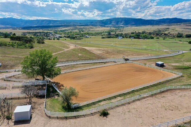
This Property Is For Sale
Property Detail
810 N Perry Park Rd
2503-120-00-056
TR IN N1/2 12-8-68 48.86 AM/L
Agriculturalland
Douglas
LRR
Colorado
B and X Area of moderate flood hazard, usually the area between the limits of the 100-year and 500-year floods.
56
2024
48.86 AC
2026
Parker/Castle Rock
014409
Denver
4,284 SF
Denver-Aurora-Centennial, CO
NEARBY LISTINGS FOR SALE OR LEASE
-
-
View all Sedalia listings for sale on LoopNet.com
DEMOGRAPHICS near 810 N Perry Park Rd
1 mile
3 mile
5 mile
2025 Total Population
232
10,593
39,586
2030 Population
247
11,283
42,728
Pop Growth 2025-2030
+ 6.47%
+ 6.51%
+ 7.94%
Average Age
42
38
39
2025 Total Households
76
3,376
14,070
HH Growth 2025-2030
+ 6.58%
+ 6.78%
+ 8.33%
Median Household Inc
$192,187
$171,313
$134,879
Avg Household Size
3.00
3.10
2.80
2025 Avg HH Vehicles
3.00
3.00
2.00
Median Home Value
$907,894
$789,955
$770,582
Median Year Built
2004
2005
2006
Nearby Places
Map Layers
Map Styles
 Street
 Aerial
Layers
 Traffic
 Biking
Places
Listings with unknown addresses are not visible on the map
- Restaurants
- Banks
- Shops
- Fitness
- Groceries
Nearby Properties
Address
Land Use
TOTAL SIZE
Lot Size
Zoning
Address
Land Use
TOTAL SIZE
Lot Size
Zoning
53,560 SF
32.09 AC
Address
Land Use
TOTAL SIZE
Lot Size
Zoning
73,146 SF
10.25 AC
Address
Land Use
TOTAL SIZE
Lot Size
Zoning
56,822 SF
10.01 AC
Address
Land Use
TOTAL SIZE
Lot Size
Zoning
24,157 SF
5.56 AC
Address
Land Use
TOTAL SIZE
Lot Size
Zoning
35 AC
A1
Address
Land Use
TOTAL SIZE
Lot Size
Zoning
5,086 SF
37.51 AC
A1
Address
Land Use
TOTAL SIZE
Lot Size
Zoning
3,715 SF
178.07 AC
A1
Address
Land Use
TOTAL SIZE
Lot Size
Zoning
9,384 SF
35.66 AC
A1
Address
Land Use
TOTAL SIZE
Lot Size
Zoning
1.64 AC
Address
Land Use
TOTAL SIZE
Lot Size
Zoning
8,340 SF
35.24 AC
A1
Address
Land Use
TOTAL SIZE
Lot Size
Zoning
Address
Land Use
TOTAL SIZE
Lot Size
Zoning
8,557 SF
35.30 AC
A1
Address
Land Use
TOTAL SIZE
Lot Size
Zoning
6,968 SF
37.18 AC
A1
Address
Land Use
TOTAL SIZE
Lot Size
Zoning
11,842 SF
36.17 AC
A1
Address
Land Use
TOTAL SIZE
Lot Size
Zoning
7,823 SF
35.53 AC
A1
Address
Land Use
TOTAL SIZE
Lot Size
Zoning
7,332 SF
35.62 AC
A1
Address
Land Use
TOTAL SIZE
Lot Size
Zoning
9,703 SF
35.02 AC
A1
Address
Land Use
TOTAL SIZE
Lot Size
Zoning
6,206 SF
11.54 AC
Address
Land Use
TOTAL SIZE
Lot Size
Zoning
8,343 SF
36.27 AC
A1
Address
Land Use
TOTAL SIZE
Lot Size
Zoning
7,281 SF
21.91 AC
A1
Address
Land Use
TOTAL SIZE
Lot Size
Zoning
7,239 SF
37.65 AC
Address
Land Use
TOTAL SIZE
Lot Size
Zoning
1,302 SF
0.09 AC
Address
Land Use
TOTAL SIZE
Lot Size
Zoning
687 SF
19.07 AC
Address
Land Use
TOTAL SIZE
Lot Size
Zoning
9,591 SF
50 AC
A1
Address
Land Use
TOTAL SIZE
Lot Size
Zoning
7,496 SF
35.11 AC
A1
Address
Land Use
TOTAL SIZE
Lot Size
Zoning
10 AC
RR
Address
Land Use
TOTAL SIZE
Lot Size
Zoning
3 AC
ER
Address
Land Use
TOTAL SIZE
Lot Size
Zoning
5.77 AC
RR
Address
Land Use
TOTAL SIZE
Lot Size
Zoning
5.01 AC
RR
The World's #1 Commercial Real Estate Marketplace
Connect with us
© 2026 CoStar Group
The information above has been obtained from sources believed reliable. While we do not doubt its accuracy we have not verified it and make no guarantee, warranty or representation about it. It is your responsibility to independently confirm its accuracy and completeness. Any projections, opinions, assumptions, or estimates used are for example only and do not represent the current or future performance of the property. The value of this transaction to you depends on tax and other factors which should be evaluated by your tax, financial, and legal advisors. You and your advisors should conduct a careful, independent investigation of the property to determine to your satisfaction the suitability of the property for your needs.