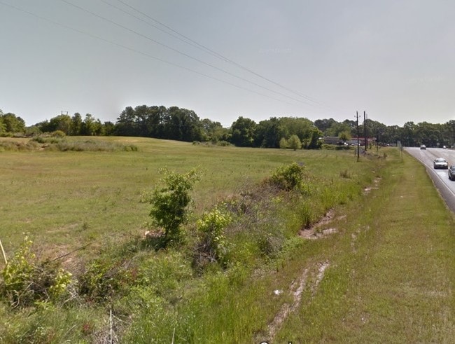
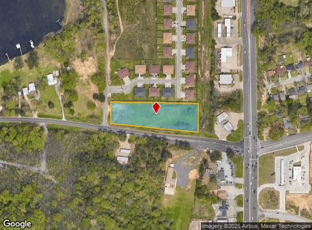
Property Record
8100 N Henpeck Rd N, Quinton, VA 23141

NEARBY LISTINGS FOR SALE OR LEASE
Property Detail
8100 N Henpeck Rd N
Tyler, TX
Lake Park Duplexes
1-50000-1238-02-033000
LAKE PARK DUPLEXESBLOCK 1238-B LOT 33
Commercialnec
Smith
AE
Texas
48423C0355D
33
2024
2.18 AC
2025
Tyler & Longview
001606
Other Market Areas
DEMOGRAPHICS near 8100 N Henpeck Rd N
1 Mile
3 Mile
5 Mile
2024 Total Population
3,926
31,983
70,831
2029 Population
4,200
34,924
77,078
Pop Growth 2024-2029
+ 6.98%
+ 9.20%
+ 8.82%
Average Age
35
36
37
2024 Total Households
1,269
10,776
25,060
HH Growth 2024-2029
+ 6.38%
+ 8.72%
+ 8.26%
Median Household Inc
$52,973
$45,651
$49,434
Avg Household Size
3.00
2.80
2.60
2024 Avg HH Vehicles
2.00
2.00
2.00
Median Home Value
$79,784
$91,032
$137,611
Median Year Built
1964
1965
1967
Nearby Places
Map Layers
Map Styles
 Street
 Aerial
- Restaurants
- Banks
- Shops
- Fitness
- Groceries
PUBLIC TRANSPORTATION
AIRPORT
Tyler Pounds Regional
DRIVE
WALK
Distance
Tyler Pounds Regional
13 min
6.4 mi
Freight Ports
Port of Shreveport
DRIVE
WALK
Distance
Port of Shreveport
123 min
107.9 mi
SALE & LEASE HISTORY
LISTING DATE
SALE/LEASE

Oct 13, 2022
For Sale
Jun 20, 2023
For Sale
Jun 04, 2019
For Sale
Aug 26, 2021
For Sale
Nearby Properties
Address
Land Use
TOTAL SIZE
Lot Size
Zoning
Address
Land Use
TOTAL SIZE
Lot Size
Zoning
24.83 AC
Address
Land Use
TOTAL SIZE
Lot Size
Zoning
39.16 AC
C2
Address
Land Use
TOTAL SIZE
Lot Size
Zoning
31.74 AC
Address
Land Use
TOTAL SIZE
Lot Size
Zoning
84,560 SF
15.70 AC
M1
Address
Land Use
TOTAL SIZE
Lot Size
Zoning
Address
Land Use
TOTAL SIZE
Lot Size
Zoning
187.64 AC
R1A
Address
Land Use
TOTAL SIZE
Lot Size
Zoning
63 AC
R1A
Address
Land Use
TOTAL SIZE
Lot Size
Zoning
207,919 SF
1.90 AC
DBAC
Address
Land Use
TOTAL SIZE
Lot Size
Zoning
22.85 AC
Address
Land Use
TOTAL SIZE
Lot Size
Zoning
2,802 SF
14 AC
RMF
Address
Land Use
TOTAL SIZE
Lot Size
Zoning
25.54 AC
INT
Address
Land Use
TOTAL SIZE
Lot Size
Zoning
181,260 SF
2.06 AC
DBAC
Address
Land Use
TOTAL SIZE
Lot Size
Zoning
14.16 AC
Address
Land Use
TOTAL SIZE
Lot Size
Zoning
129,070 SF
3.75 AC
Address
Land Use
TOTAL SIZE
Lot Size
Zoning
80,070 SF
9.04 AC
Address
Land Use
TOTAL SIZE
Lot Size
Zoning
43,300 SF
2.17 AC
DBAC
Address
Land Use
TOTAL SIZE
Lot Size
Zoning
205,196 SF
25.19 AC
C2
Address
Land Use
TOTAL SIZE
Lot Size
Zoning
85,804 SF
8.69 AC
M1
Address
Land Use
TOTAL SIZE
Lot Size
Zoning
14.02 AC
R2
Address
Land Use
TOTAL SIZE
Lot Size
Zoning
Address
Land Use
TOTAL SIZE
Lot Size
Zoning
2.38 AC
DBAC
Address
Land Use
TOTAL SIZE
Lot Size
Zoning
3,222 SF
7.43 AC
RMF
Address
Land Use
TOTAL SIZE
Lot Size
Zoning
60,956 SF
8.31 AC
M1
Address
Land Use
TOTAL SIZE
Lot Size
Zoning
302,618 SF
27.95 AC
M1
Address
Land Use
TOTAL SIZE
Lot Size
Zoning
60,328 SF
8 AC
M1
Address
Land Use
TOTAL SIZE
Lot Size
Zoning
1.25 AC
Address
Land Use
TOTAL SIZE
Lot Size
Zoning
80,000 SF
2.30 AC
DBAC
Address
Land Use
TOTAL SIZE
Lot Size
Zoning
3,490 SF
12.92 AC
RMF
Address
Land Use
TOTAL SIZE
Lot Size
Zoning
111,048 SF
10 AC
RMF
Address
Land Use
TOTAL SIZE
Lot Size
Zoning
1,375 SF
8.50 AC
RMF
The World's #1 Commercial Real Estate Marketplace
Connect with us
© 2025 CoStar Group
The information above has been obtained from sources believed reliable. While we do not doubt its accuracy we have not verified it and make no guarantee, warranty or representation about it. It is your responsibility to independently confirm its accuracy and completeness. Any projections, opinions, assumptions, or estimates used are for example only and do not represent the current or future performance of the property. The value of this transaction to you depends on tax and other factors which should be evaluated by your tax, financial, and legal advisors. You and your advisors should conduct a careful, independent investigation of the property to determine to your satisfaction the suitability of the property for your needs.