Property Record
8100 N Interstate 45 Rd, Palmer, TX 75152

Property Detail
8100 N Interstate 45 Rd
Dallas-Fort Worth-Arlington, TX
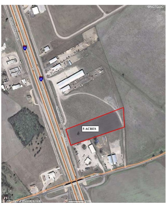
LOT 2 SEANLY ADDN REV 5.883 AC
221637
ELLIS
Commercialnec
Texas
B and X Area of moderate flood hazard, usually the area between the limits of the 100-year and 500-year floods.
2
2024
5.88 AC
2025
Ellis County
060106
Dallas/Ft Worth
9,600 SF
NEARBY LISTINGS FOR SALE OR LEASE
DEMOGRAPHICS near 8100 N Interstate 45 Rd
1 mile
3 mile
5 mile
2025 Total Population
1,690
4,733
8,484
2030 Population
1,976
5,523
9,878
Pop Growth 2025-2030
+ 16.92%
+ 16.69%
+ 16.43%
Average Age
35
36
37
2025 Total Households
533
1,501
2,730
HH Growth 2025-2030
+ 17.07%
+ 16.79%
+ 16.52%
Median Household Inc
$75,725
$79,101
$81,092
Avg Household Size
3.10
3.10
3.10
2025 Avg HH Vehicles
2.00
3.00
3.00
Median Home Value
$177,058
$213,928
$256,594
Median Year Built
1996
1996
1996
Nearby Places
Map Layers
Map Styles
 Street
 Aerial
Transit
 Traffic
 Biking
Places
Listings with unknown addresses are not visible on the map
- Restaurants
- Banks
- Shops
- Fitness
- Groceries
PUBLIC TRANSPORTATION
AIRPORT
Dallas Love Field
Drive
Walk
Distance
Dallas Love Field
43 min
32.2 mi
SALE & LEASE HISTORY
LISTING DATE
SALE/LEASE

Sep 25, 2016
For Lease
Nearby Properties
Address
Land Use
TOTAL SIZE
Lot Size
Zoning
Address
Land Use
TOTAL SIZE
Lot Size
Zoning
200,440 SF
50.78 AC
Address
Land Use
TOTAL SIZE
Lot Size
Zoning
61,425 SF
20 AC
Address
Land Use
TOTAL SIZE
Lot Size
Zoning
37,348 SF
10.08 AC
Address
Land Use
TOTAL SIZE
Lot Size
Zoning
36,000 SF
6.19 AC
Address
Land Use
TOTAL SIZE
Lot Size
Zoning
48,400 SF
4.32 AC
Address
Land Use
TOTAL SIZE
Lot Size
Zoning
35.11 AC
Address
Land Use
TOTAL SIZE
Lot Size
Zoning
10,452 SF
192.08 AC
Address
Land Use
TOTAL SIZE
Lot Size
Zoning
40,561 SF
9.48 AC
Address
Land Use
TOTAL SIZE
Lot Size
Zoning
15,000 SF
3.56 AC
Address
Land Use
TOTAL SIZE
Lot Size
Zoning
39,600 SF
19.86 AC
Address
Land Use
TOTAL SIZE
Lot Size
Zoning
12,600 SF
6.97 AC
Address
Land Use
TOTAL SIZE
Lot Size
Zoning
8,480 SF
0.87 AC
Address
Land Use
TOTAL SIZE
Lot Size
Zoning
8,259 SF
48.37 AC
Address
Land Use
TOTAL SIZE
Lot Size
Zoning
5,635 SF
1.51 AC
Address
Land Use
TOTAL SIZE
Lot Size
Zoning
10,580 SF
4.13 AC
Address
Land Use
TOTAL SIZE
Lot Size
Zoning
9,000 SF
3 AC
Address
Land Use
TOTAL SIZE
Lot Size
Zoning
107.63 AC
Address
Land Use
TOTAL SIZE
Lot Size
Zoning
22,400 SF
15.36 AC
Address
Land Use
TOTAL SIZE
Lot Size
Zoning
3,200 SF
14.98 AC
Address
Land Use
TOTAL SIZE
Lot Size
Zoning
9,760 SF
5.42 AC
Address
Land Use
TOTAL SIZE
Lot Size
Zoning
9,600 SF
0.76 AC
Address
Land Use
TOTAL SIZE
Lot Size
Zoning
14,431 SF
0.86 AC
Address
Land Use
TOTAL SIZE
Lot Size
Zoning
4,600 SF
20 AC
Address
Land Use
TOTAL SIZE
Lot Size
Zoning
6,491 SF
6.47 AC
Address
Land Use
TOTAL SIZE
Lot Size
Zoning
118.91 AC
Address
Land Use
TOTAL SIZE
Lot Size
Zoning
11,879 SF
2.22 AC
Address
Land Use
TOTAL SIZE
Lot Size
Zoning
54 AC
Address
Land Use
TOTAL SIZE
Lot Size
Zoning
8,131 SF
2.77 AC
Address
Land Use
TOTAL SIZE
Lot Size
Zoning
6,380 SF
5.60 AC
The World's #1 Commercial Real Estate Marketplace
Connect with us
© 2026 CoStar Group
The information above has been obtained from sources believed reliable. While we do not doubt its accuracy we have not verified it and make no guarantee, warranty or representation about it. It is your responsibility to independently confirm its accuracy and completeness. Any projections, opinions, assumptions, or estimates used are for example only and do not represent the current or future performance of the property. The value of this transaction to you depends on tax and other factors which should be evaluated by your tax, financial, and legal advisors. You and your advisors should conduct a careful, independent investigation of the property to determine to your satisfaction the suitability of the property for your needs.