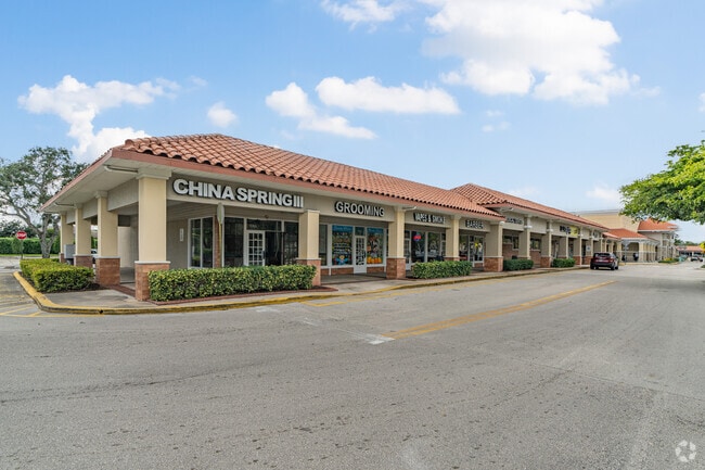
Property Record
8100 Wiles Rd, Coral Springs, FL 33067


NEARBY LISTINGS FOR SALE OR LEASE
Property Detail
8100 Wiles Rd
Fort Lauderdale-Pompano Beach-Sunrise, FL
Royal Land Second Add 131-33 B
48-41-15-14-0020
ROYAL LAND SECOND ADD 131-33 B TR 3 LESS COMM AT NE COR SEC 15-48-41,W 92.12,S 72,W 300,NW 162.51 TO POB,S 138.89,W 180.95 N 142.13,E 142.88,SE 38.21 TO POB,LESS COMM NE COR OF SEC 15- 48-41,W 92.12,S 72 TO POB,SE 48.82,SE 10.21 TO P/C;SLY & SELY ARC
Regionalshoppingcenterormallwithanchorstore
Broward
X
Florida
12099C1175F
3
2024
11.54 AC
2025
NW Broward/Coral Springs
020302
South Florida
68,540 SF
DEMOGRAPHICS near 8100 Wiles Rd
1 Mile
3 Mile
5 Mile
2024 Total Population
18,714
132,029
328,872
2029 Population
18,401
129,713
325,851
Pop Growth 2024-2029
(1.67%)
(1.75%)
(0.92%)
Average Age
37
39
40
2024 Total Households
6,165
46,098
116,414
HH Growth 2024-2029
(2.24%)
(2.30%)
(1.34%)
Median Household Inc
$68,558
$80,921
$76,006
Avg Household Size
2.90
2.70
2.70
2024 Avg HH Vehicles
2.00
2.00
2.00
Median Home Value
$422,676
$391,794
$362,521
Median Year Built
1980
1985
1985
Nearby Places
Map Layers
Map Styles
 Street
 Aerial
- Restaurants
- Banks
- Shops
- Fitness
- Groceries
PUBLIC TRANSPORTATION
COMMUTER RAIL
Pompano Beach (Tri-County Commuter - South Florida Regional Transportation Authority (Tri-Rail))
DRIVE
WALK
Distance
Pompano Beach (Tri-County Commuter - South Florida Regional Transportation Authority (Tri-Rail))
15 min
7.5 mi
Deerfield Beach (Tri-County Commuter - South Florida Regional Transportation Authority (Tri-Rail))
DRIVE
WALK
Distance
Deerfield Beach (Tri-County Commuter - South Florida Regional Transportation Authority (Tri-Rail))
16 min
9.2 mi
AIRPORT
Fort Lauderdale/Hollywood International
DRIVE
WALK
Distance
Fort Lauderdale/Hollywood International
37 min
23.8 mi
Palm Beach International
DRIVE
WALK
Distance
Palm Beach International
49 min
36.6 mi
Freight Ports
Port Everglades
DRIVE
WALK
Distance
Port Everglades
36 min
22.5 mi
SALE & LEASE HISTORY
LISTING DATE
SALE/LEASE

Sep 25, 2016
For Lease
Jan 08, 2018
For Lease
Dec 21, 2017
For Lease
Aug 01, 2017
For Lease
Nearby Properties
Address
Land Use
TOTAL SIZE
Lot Size
Zoning
Address
Land Use
TOTAL SIZE
Lot Size
Zoning
447,756 SF
45.30 AC
BCRM-5
Address
Land Use
TOTAL SIZE
Lot Size
Zoning
457,406 SF
21.26 AC
MC
Address
Land Use
TOTAL SIZE
Lot Size
Zoning
640,399 SF
2.41 AC
Address
Land Use
TOTAL SIZE
Lot Size
Zoning
641,010 SF
29.99 AC
RM-20
Address
Land Use
TOTAL SIZE
Lot Size
Zoning
405,715 SF
20.11 AC
PUD
Address
Land Use
TOTAL SIZE
Lot Size
Zoning
399,296 SF
20.23 AC
RM-40
Address
Land Use
TOTAL SIZE
Lot Size
Zoning
451,337 SF
33.01 AC
R-3A
Address
Land Use
TOTAL SIZE
Lot Size
Zoning
356,704 SF
11.84 AC
PCD
Address
Land Use
TOTAL SIZE
Lot Size
Zoning
294,865 SF
14.49 AC
PUD
Address
Land Use
TOTAL SIZE
Lot Size
Zoning
344,358 SF
23.27 AC
RM-20
Address
Land Use
TOTAL SIZE
Lot Size
Zoning
572,683 SF
38.41 AC
IRD
Address
Land Use
TOTAL SIZE
Lot Size
Zoning
500,974 SF
16.20 AC
CF-1
Address
Land Use
TOTAL SIZE
Lot Size
Zoning
276,412 SF
10.40 AC
TOC-G
Address
Land Use
TOTAL SIZE
Lot Size
Zoning
390,795 SF
16.83 AC
PUD
Address
Land Use
TOTAL SIZE
Lot Size
Zoning
278,336 SF
15.85 AC
RM-20
Address
Land Use
TOTAL SIZE
Lot Size
Zoning
354,535 SF
33.95 AC
RM-15
Address
Land Use
TOTAL SIZE
Lot Size
Zoning
345,189 SF
9.66 AC
RM-30
Address
Land Use
TOTAL SIZE
Lot Size
Zoning
421,001 SF
44.62 AC
CF
Address
Land Use
TOTAL SIZE
Lot Size
Zoning
293,096 SF
11.84 AC
RM-20
Address
Land Use
TOTAL SIZE
Lot Size
Zoning
260,897 SF
12.62 AC
RM-20
Address
Land Use
TOTAL SIZE
Lot Size
Zoning
325,343 SF
21.10 AC
PUD
Address
Land Use
TOTAL SIZE
Lot Size
Zoning
384,131 SF
17.84 AC
PMDD
Address
Land Use
TOTAL SIZE
Lot Size
Zoning
311,836 SF
13.92 AC
RM-30
Address
Land Use
TOTAL SIZE
Lot Size
Zoning
157,914 SF
15.11 AC
B-3
Address
Land Use
TOTAL SIZE
Lot Size
Zoning
271,043 SF
19.02 AC
RM-20
Address
Land Use
TOTAL SIZE
Lot Size
Zoning
275,724 SF
26.67 AC
TOC-G
Address
Land Use
TOTAL SIZE
Lot Size
Zoning
349,250 SF
19.90 AC
CF
Address
Land Use
TOTAL SIZE
Lot Size
Zoning
269,508 SF
38.46 AC
A-1
Address
Land Use
TOTAL SIZE
Lot Size
Zoning
254,235 SF
25.40 AC
RM-10
Address
Land Use
TOTAL SIZE
Lot Size
Zoning
242,692 SF
17.25 AC
RM-20
The World's #1 Commercial Real Estate Marketplace
Connect with us
© 2026 CoStar Group
The information above has been obtained from sources believed reliable. While we do not doubt its accuracy we have not verified it and make no guarantee, warranty or representation about it. It is your responsibility to independently confirm its accuracy and completeness. Any projections, opinions, assumptions, or estimates used are for example only and do not represent the current or future performance of the property. The value of this transaction to you depends on tax and other factors which should be evaluated by your tax, financial, and legal advisors. You and your advisors should conduct a careful, independent investigation of the property to determine to your satisfaction the suitability of the property for your needs.