Property Record
8101 Highway 100, Nashville, TN 37221


NEARBY LISTINGS FOR SALE OR LEASE
Property Detail
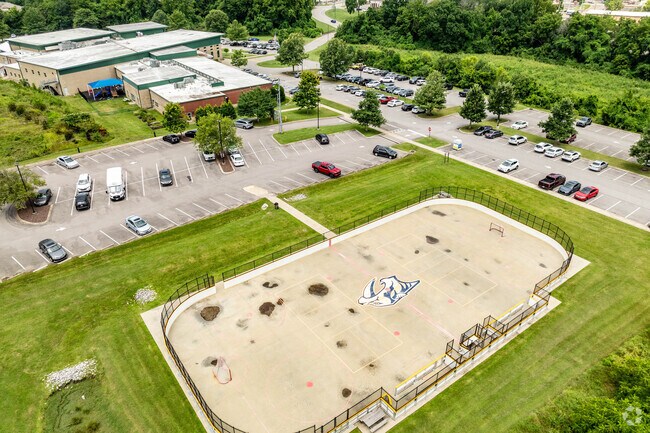
8101 Highway 100
Nashville-Davidson--Murfreesboro--Franklin, TN
J C Sutterfields Farm
155-00-0-128
E OF HIGHWAY 100 N OF UNION BRIDGE RD
Institutionalgeneral
Davidson
AE
Tennessee
47037C0337J
20.24 AC
0
Brentwood
2025
Nashville
018405
DEMOGRAPHICS near 8101 Highway 100
1 Mile
3 Mile
5 Mile
2024 Total Population
5,054
29,682
53,348
2029 Population
5,010
29,773
53,909
Pop Growth 2024-2029
(0.87%)
+ 0.31%
+ 1.05%
Average Age
43
43
41
2024 Total Households
1,756
12,561
22,583
HH Growth 2024-2029
(1.31%)
(0.90%)
(0.14%)
Median Household Inc
$133,361
$99,270
$98,510
Avg Household Size
2.70
2.30
2.30
2024 Avg HH Vehicles
2.00
2.00
2.00
Median Home Value
$437,805
$383,867
$415,002
Median Year Built
1994
1991
1990
Nearby Places
Map Layers
Map Styles
 Street
 Aerial
- Restaurants
- Banks
- Shops
- Fitness
- Groceries
PUBLIC TRANSPORTATION
AIRPORT
Nashville International
DRIVE
WALK
Distance
Nashville International
33 min
20.7 mi
Freight Ports
Port of Mobile
DRIVE
WALK
Distance
Port of Mobile
490 min
446.9 mi
Nearby Properties
Address
Land Use
TOTAL SIZE
Lot Size
Zoning
Address
Land Use
TOTAL SIZE
Lot Size
Zoning
46,528 SF
45.95 AC
SCR
Address
Land Use
TOTAL SIZE
Lot Size
Zoning
22,986 SF
16.04 AC
SCR
Address
Land Use
TOTAL SIZE
Lot Size
Zoning
2,193 SF
27.08 AC
RM4
Address
Land Use
TOTAL SIZE
Lot Size
Zoning
224,590 SF
5.66 AC
MULTIZONE
Address
Land Use
TOTAL SIZE
Lot Size
Zoning
2,704 SF
30.75 AC
RM9
Address
Land Use
TOTAL SIZE
Lot Size
Zoning
8,156 SF
27.77 AC
RM9
Address
Land Use
TOTAL SIZE
Lot Size
Zoning
189,503 SF
8.50 AC
AR2A
Address
Land Use
TOTAL SIZE
Lot Size
Zoning
26,145 SF
24.18 AC
RM4
Address
Land Use
TOTAL SIZE
Lot Size
Zoning
32,987 SF
10.77 AC
RM20
Address
Land Use
TOTAL SIZE
Lot Size
Zoning
139,993 SF
17.39 AC
SP
Address
Land Use
TOTAL SIZE
Lot Size
Zoning
8.38 AC
MULTIZONE
Address
Land Use
TOTAL SIZE
Lot Size
Zoning
2,850 SF
16.84 AC
R15
Address
Land Use
TOTAL SIZE
Lot Size
Zoning
14,040 SF
24.73 AC
R15
Address
Land Use
TOTAL SIZE
Lot Size
Zoning
11,544 SF
15.88 AC
RM9
Address
Land Use
TOTAL SIZE
Lot Size
Zoning
55,156 SF
6.50 AC
RM9
Address
Land Use
TOTAL SIZE
Lot Size
Zoning
17,264 SF
15.39 AC
RM9
Address
Land Use
TOTAL SIZE
Lot Size
Zoning
2,295 SF
5.69 AC
RS15
Address
Land Use
TOTAL SIZE
Lot Size
Zoning
46,672 SF
7.45 AC
AR2A
Address
Land Use
TOTAL SIZE
Lot Size
Zoning
46,936 SF
6.11 AC
RS15
Address
Land Use
TOTAL SIZE
Lot Size
Zoning
67,063 SF
6.79 AC
MULTI-ZONE
Address
Land Use
TOTAL SIZE
Lot Size
Zoning
27,002 SF
3.68 AC
SCC
Address
Land Use
TOTAL SIZE
Lot Size
Zoning
37,790 SF
273.34 AC
R40
Address
Land Use
TOTAL SIZE
Lot Size
Zoning
64,125 SF
6.88 AC
SCC
Address
Land Use
TOTAL SIZE
Lot Size
Zoning
33,804 SF
2.87 AC
SCR
Address
Land Use
TOTAL SIZE
Lot Size
Zoning
23,961 SF
10.12 AC
SCR
Address
Land Use
TOTAL SIZE
Lot Size
Zoning
62,595 SF
5.98 AC
SCC
Address
Land Use
TOTAL SIZE
Lot Size
Zoning
47,172 SF
8.10 AC
CL
Address
Land Use
TOTAL SIZE
Lot Size
Zoning
64,773 SF
8.45 AC
SCR
Address
Land Use
TOTAL SIZE
Lot Size
Zoning
14.67 AC
SCR
Address
Land Use
TOTAL SIZE
Lot Size
Zoning
75,764 SF
6.38 AC
SCC
The World's #1 Commercial Real Estate Marketplace
Connect with us
© 2026 CoStar Group
The information above has been obtained from sources believed reliable. While we do not doubt its accuracy we have not verified it and make no guarantee, warranty or representation about it. It is your responsibility to independently confirm its accuracy and completeness. Any projections, opinions, assumptions, or estimates used are for example only and do not represent the current or future performance of the property. The value of this transaction to you depends on tax and other factors which should be evaluated by your tax, financial, and legal advisors. You and your advisors should conduct a careful, independent investigation of the property to determine to your satisfaction the suitability of the property for your needs.