Property Record
8107 N Dort Hwy, Mount Morris, MI 48458
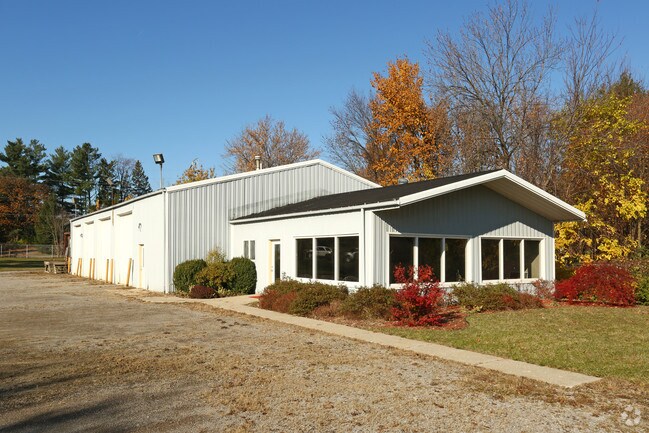
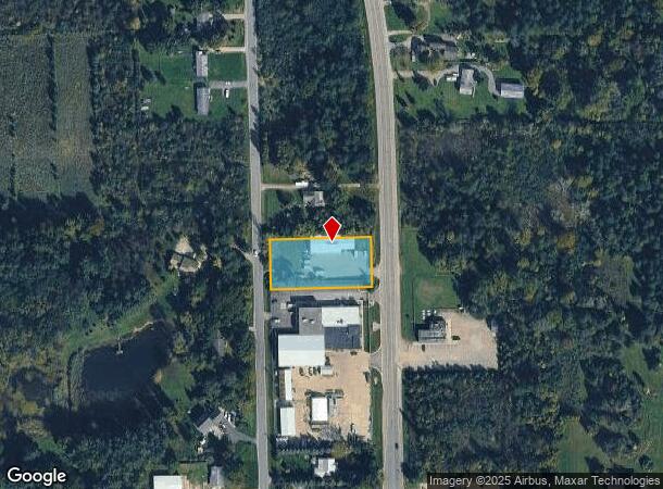
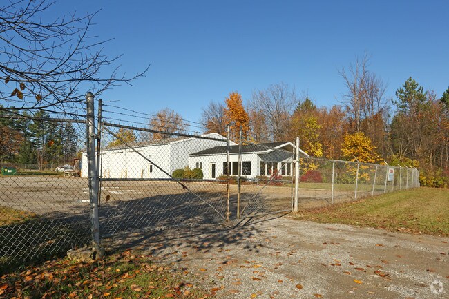
This Property Is For Sale
NEARBY LISTINGS FOR SALE OR LEASE
Property Detail
8107 N Dort Hwy
11-05-300-007
N 8 RDS OF S 64 RDS OF THAT PART OF W 1/2 OF SW 1/4 LYING W OF DORT HIGHWAY SEC 5 T8N R7E 1 A
Commercialnec
Genesee
X
Michigan
26049C0181D
1 AC
2024
Flint
2025
Detroit
012201
Flint, MI
5,280 SF
DEMOGRAPHICS near 8107 N Dort Hwy
1 Mile
3 Mile
5 Mile
2024 Total Population
3,938
19,269
60,018
2029 Population
3,884
19,111
60,226
Pop Growth 2024-2029
(1.37%)
(0.82%)
+ 0.35%
Average Age
42
40
40
2024 Total Households
1,810
7,909
24,669
HH Growth 2024-2029
(1.27%)
(0.83%)
+ 0.33%
Median Household Inc
$41,514
$40,730
$39,423
Avg Household Size
2.20
2.40
2.40
2024 Avg HH Vehicles
2.00
2.00
2.00
Median Home Value
$78,368
$84,603
$87,194
Median Year Built
1970
1965
1965
Nearby Places
Map Layers
Map Styles
 Street
 Aerial
- Restaurants
- Banks
- Shops
- Fitness
- Groceries
PUBLIC TRANSPORTATION
COMMUTER RAIL
Flint Amtrak Station (Blue Water - Amtrak)
DRIVE
WALK
Distance
Flint Amtrak Station (Blue Water - Amtrak)
13 min
8.2 mi
AIRPORT
Bishop International
DRIVE
WALK
Distance
Bishop International
31 min
16.3 mi
Freight Ports
Port of Toledo
DRIVE
WALK
Distance
Port of Toledo
146 min
122.1 mi
Nearby Properties
Address
Land Use
TOTAL SIZE
Lot Size
Zoning
Address
Land Use
TOTAL SIZE
Lot Size
Zoning
2,629 SF
119.59 AC
R-4 MANUF
Address
Land Use
TOTAL SIZE
Lot Size
Zoning
46,808 SF
32.06 AC
I-2 HVY IN
Address
Land Use
TOTAL SIZE
Lot Size
Zoning
114,888 SF
11.86 AC
I-2 HVY IN
Address
Land Use
TOTAL SIZE
Lot Size
Zoning
70,789 SF
7.83 AC
C-2 HWY CO
Address
Land Use
TOTAL SIZE
Lot Size
Zoning
94,719 SF
7.55 AC
R-1 SF PUD
Address
Land Use
TOTAL SIZE
Lot Size
Zoning
97,998 SF
11.30 AC
R-1 SF PUD
Address
Land Use
TOTAL SIZE
Lot Size
Zoning
7.33 AC
Address
Land Use
TOTAL SIZE
Lot Size
Zoning
77,994 SF
5.68 AC
RU-2
Address
Land Use
TOTAL SIZE
Lot Size
Zoning
9,934 SF
9.70 AC
I-2 HVY IN
Address
Land Use
TOTAL SIZE
Lot Size
Zoning
76,051 SF
8.31 AC
C-2 HWY CO
Address
Land Use
TOTAL SIZE
Lot Size
Zoning
Address
Land Use
TOTAL SIZE
Lot Size
Zoning
9,238 SF
84.53 AC
MHP
Address
Land Use
TOTAL SIZE
Lot Size
Zoning
3,434 SF
5.63 AC
I-1 LHGT I
Address
Land Use
TOTAL SIZE
Lot Size
Zoning
Address
Land Use
TOTAL SIZE
Lot Size
Zoning
10.15 AC
Address
Land Use
TOTAL SIZE
Lot Size
Zoning
54,648 SF
4.68 AC
RU-2
Address
Land Use
TOTAL SIZE
Lot Size
Zoning
1.70 AC
Address
Land Use
TOTAL SIZE
Lot Size
Zoning
2.31 AC
Address
Land Use
TOTAL SIZE
Lot Size
Zoning
49,900 SF
10.17 AC
C-2
Address
Land Use
TOTAL SIZE
Lot Size
Zoning
1,912 SF
64.42 AC
MHP
Address
Land Use
TOTAL SIZE
Lot Size
Zoning
25,800 SF
4.94 AC
I-2 HVY IN
Address
Land Use
TOTAL SIZE
Lot Size
Zoning
1,430 SF
71.54 AC
R-4 MANUF
Address
Land Use
TOTAL SIZE
Lot Size
Zoning
1,732 SF
0.87 AC
R-1 SF PUD
Address
Land Use
TOTAL SIZE
Lot Size
Zoning
29,632 SF
4.32 AC
R-3 MULTI
Address
Land Use
TOTAL SIZE
Lot Size
Zoning
33,200 SF
3.24 AC
I-1 LHGT I
Address
Land Use
TOTAL SIZE
Lot Size
Zoning
Address
Land Use
TOTAL SIZE
Lot Size
Zoning
339 SF
26.24 AC
R-4 MANUF
Address
Land Use
TOTAL SIZE
Lot Size
Zoning
Address
Land Use
TOTAL SIZE
Lot Size
Zoning
9,105 SF
2.29 AC
C-2 HWY CO
Address
Land Use
TOTAL SIZE
Lot Size
Zoning
16,676 SF
31.01 AC
C-2 HWY CO
The World's #1 Commercial Real Estate Marketplace
Connect with us
© 2025 CoStar Group
The information above has been obtained from sources believed reliable. While we do not doubt its accuracy we have not verified it and make no guarantee, warranty or representation about it. It is your responsibility to independently confirm its accuracy and completeness. Any projections, opinions, assumptions, or estimates used are for example only and do not represent the current or future performance of the property. The value of this transaction to you depends on tax and other factors which should be evaluated by your tax, financial, and legal advisors. You and your advisors should conduct a careful, independent investigation of the property to determine to your satisfaction the suitability of the property for your needs.