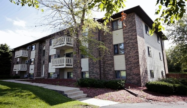
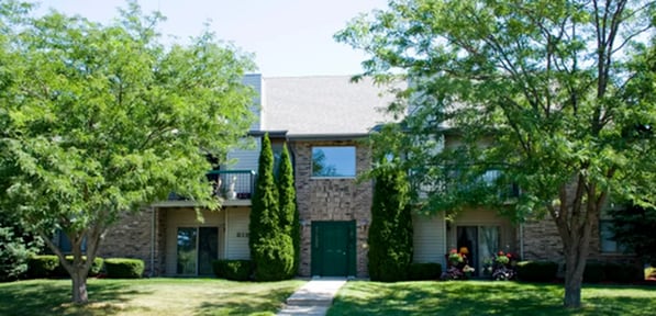
Property Record
811 Cheshire Ct, Freeport, IL 61032
NEARBY LISTINGS FOR SALE OR LEASE
Property Detail
811 Cheshire Ct
18-13-35-304-002
LOT 6 TERRA WEST
Apartment
Stephenson
X
Illinois
17177C0316D
6
2024
0.46 AC
2024
Illinois North Area
001000
Other Market Areas
8,312 SF
Freeport, IL
DEMOGRAPHICS near 811 Cheshire Ct
1 Mile
3 Mile
5 Mile
2024 Total Population
4,555
23,141
28,503
2029 Population
4,437
22,756
27,987
Pop Growth 2024-2029
(2.59%)
(1.66%)
(1.81%)
Average Age
50
43
43
2024 Total Households
2,088
10,214
12,469
HH Growth 2024-2029
(2.63%)
(1.76%)
(1.90%)
Median Household Inc
$65,107
$45,826
$46,296
Avg Household Size
2.00
2.10
2.20
2024 Avg HH Vehicles
2.00
1.00
2.00
Median Home Value
$134,765
$85,310
$85,504
Median Year Built
1980
1960
1959
Nearby Places
Map Layers
Map Styles
 Street
 Aerial
- Restaurants
- Banks
- Shops
- Fitness
- Groceries
PUBLIC TRANSPORTATION
AIRPORT
Chicago/Rockford International
DRIVE
WALK
Distance
Chicago/Rockford International
54 min
36.6 mi
Nearby Properties
Address
Land Use
TOTAL SIZE
Lot Size
Zoning
Address
Land Use
TOTAL SIZE
Lot Size
Zoning
16.04 AC
Address
Land Use
TOTAL SIZE
Lot Size
Zoning
21.95 AC
Address
Land Use
TOTAL SIZE
Lot Size
Zoning
4.31 AC
Address
Land Use
TOTAL SIZE
Lot Size
Zoning
3.51 AC
Address
Land Use
TOTAL SIZE
Lot Size
Zoning
10.52 AC
Address
Land Use
TOTAL SIZE
Lot Size
Zoning
77,686 SF
4.39 AC
Address
Land Use
TOTAL SIZE
Lot Size
Zoning
46.61 AC
Address
Land Use
TOTAL SIZE
Lot Size
Zoning
2.85 AC
Address
Land Use
TOTAL SIZE
Lot Size
Zoning
7.62 AC
Address
Land Use
TOTAL SIZE
Lot Size
Zoning
1.44 AC
Address
Land Use
TOTAL SIZE
Lot Size
Zoning
8.13 AC
Address
Land Use
TOTAL SIZE
Lot Size
Zoning
Address
Land Use
TOTAL SIZE
Lot Size
Zoning
13.20 AC
Address
Land Use
TOTAL SIZE
Lot Size
Zoning
Address
Land Use
TOTAL SIZE
Lot Size
Zoning
2.02 AC
Address
Land Use
TOTAL SIZE
Lot Size
Zoning
4.21 AC
Address
Land Use
TOTAL SIZE
Lot Size
Zoning
5.14 AC
Address
Land Use
TOTAL SIZE
Lot Size
Zoning
5.30 AC
Address
Land Use
TOTAL SIZE
Lot Size
Zoning
38.59 AC
Address
Land Use
TOTAL SIZE
Lot Size
Zoning
4.66 AC
Address
Land Use
TOTAL SIZE
Lot Size
Zoning
1.39 AC
Address
Land Use
TOTAL SIZE
Lot Size
Zoning
7,754 SF
0.61 AC
Address
Land Use
TOTAL SIZE
Lot Size
Zoning
5.43 AC
Address
Land Use
TOTAL SIZE
Lot Size
Zoning
9,917 SF
5.50 AC
Address
Land Use
TOTAL SIZE
Lot Size
Zoning
18,145 SF
1.43 AC
Address
Land Use
TOTAL SIZE
Lot Size
Zoning
3.36 AC
Address
Land Use
TOTAL SIZE
Lot Size
Zoning
8,525 SF
3.02 AC
Address
Land Use
TOTAL SIZE
Lot Size
Zoning
0.78 AC
Address
Land Use
TOTAL SIZE
Lot Size
Zoning
1.77 AC
Address
Land Use
TOTAL SIZE
Lot Size
Zoning
23,153 SF
6.41 AC
The World's #1 Commercial Real Estate Marketplace
Connect with us
© 2025 CoStar Group
The information above has been obtained from sources believed reliable. While we do not doubt its accuracy we have not verified it and make no guarantee, warranty or representation about it. It is your responsibility to independently confirm its accuracy and completeness. Any projections, opinions, assumptions, or estimates used are for example only and do not represent the current or future performance of the property. The value of this transaction to you depends on tax and other factors which should be evaluated by your tax, financial, and legal advisors. You and your advisors should conduct a careful, independent investigation of the property to determine to your satisfaction the suitability of the property for your needs.