Property Record
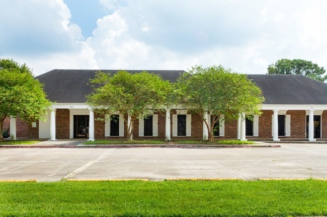
811 Paul Maillard Rd, Luling, LA 70070


Property Detail
811 Paul Maillard Rd
New Orleans-Metairie, LA
LOTS A-2, A-3, A-4, A-5, A-6, A-7; ELLINGTON ADDITION TO THE TOWN OF LULING, BEING THE ORIGINAL SQ. 5 OF ELLINGTON PLANTATION
252200500A-2
Saint Charles
Storebuilding
Louisiana
2025
a-2,a-3
2025
1 AC
062900
St Charles Parish
5,674 SF
New Orleans/Metairie/Kenner
NEARBY LISTINGS FOR SALE OR LEASE
DEMOGRAPHICS near 811 Paul Maillard Rd
1 mile
3 mile
5 mile
2025 Total Population
3,818
22,335
37,166
2030 Population
3,657
21,454
35,694
Pop Growth 2025-2030
(4.22%)
(3.94%)
(3.96%)
Average Age
38
39
40
2025 Total Households
1,353
8,091
13,653
HH Growth 2025-2030
(4.43%)
(3.96%)
(3.96%)
Median Household Inc
$62,944
$79,794
$78,543
Avg Household Size
2.70
2.70
2.70
2025 Avg HH Vehicles
2.00
2.00
2.00
Median Home Value
$244,980
$285,843
$278,696
Median Year Built
1986
1985
1984
Nearby Places
Map Layers
Map Styles
 Street
 Aerial
Layers
 Traffic
 Biking
Places
Listings with unknown addresses are not visible on the map
- Restaurants
- Banks
- Shops
- Fitness
- Groceries
PUBLIC TRANSPORTATION
AIRPORT
Louis Armstrong New Orleans International
Drive
Walk
Distance
Louis Armstrong New Orleans International
18 min
11.8 mi
SALE & LEASE HISTORY
LISTING DATE
SALE/LEASE

Oct 12, 2017
For Sale
Mar 05, 2018
For Lease
Mar 05, 2018
For Sale
Nearby Properties
Address
Land Use
TOTAL SIZE
Lot Size
Zoning
Address
Land Use
TOTAL SIZE
Lot Size
Zoning
Address
Land Use
TOTAL SIZE
Lot Size
Zoning
Address
Land Use
TOTAL SIZE
Lot Size
Zoning
34.08 AC
Address
Land Use
TOTAL SIZE
Lot Size
Zoning
1,425.06 AC
Address
Land Use
TOTAL SIZE
Lot Size
Zoning
3.17 AC
Address
Land Use
TOTAL SIZE
Lot Size
Zoning
Address
Land Use
TOTAL SIZE
Lot Size
Zoning
Address
Land Use
TOTAL SIZE
Lot Size
Zoning
20.49 AC
Address
Land Use
TOTAL SIZE
Lot Size
Zoning
71,024 SF
28.36 AC
Address
Land Use
TOTAL SIZE
Lot Size
Zoning
62.34 AC
Address
Land Use
TOTAL SIZE
Lot Size
Zoning
62.34 AC
Address
Land Use
TOTAL SIZE
Lot Size
Zoning
10.50 AC
Address
Land Use
TOTAL SIZE
Lot Size
Zoning
26,000 SF
565.67 AC
Address
Land Use
TOTAL SIZE
Lot Size
Zoning
Address
Land Use
TOTAL SIZE
Lot Size
Zoning
57,894 SF
4.43 AC
Address
Land Use
TOTAL SIZE
Lot Size
Zoning
57,894 SF
4.43 AC
Address
Land Use
TOTAL SIZE
Lot Size
Zoning
4.60 AC
Address
Land Use
TOTAL SIZE
Lot Size
Zoning
Address
Land Use
TOTAL SIZE
Lot Size
Zoning
28,711 SF
24.90 AC
Address
Land Use
TOTAL SIZE
Lot Size
Zoning
158,268 SF
16.50 AC
Address
Land Use
TOTAL SIZE
Lot Size
Zoning
Address
Land Use
TOTAL SIZE
Lot Size
Zoning
Address
Land Use
TOTAL SIZE
Lot Size
Zoning
5.97 AC
Address
Land Use
TOTAL SIZE
Lot Size
Zoning
11.70 AC
Address
Land Use
TOTAL SIZE
Lot Size
Zoning
55,814 SF
6.76 AC
Address
Land Use
TOTAL SIZE
Lot Size
Zoning
Address
Land Use
TOTAL SIZE
Lot Size
Zoning
Address
Land Use
TOTAL SIZE
Lot Size
Zoning
11.70 AC
Address
Land Use
TOTAL SIZE
Lot Size
Zoning
Address
Land Use
TOTAL SIZE
Lot Size
Zoning
The World's #1 Commercial Real Estate Marketplace
Connect with us
© 2026 CoStar Group
The information above has been obtained from sources believed reliable. While we do not doubt its accuracy we have not verified it and make no guarantee, warranty or representation about it. It is your responsibility to independently confirm its accuracy and completeness. Any projections, opinions, assumptions, or estimates used are for example only and do not represent the current or future performance of the property. The value of this transaction to you depends on tax and other factors which should be evaluated by your tax, financial, and legal advisors. You and your advisors should conduct a careful, independent investigation of the property to determine to your satisfaction the suitability of the property for your needs.