Property Record
811 Pendleton St, Greenville, SC 29601


Property Detail
811 Pendleton St
Greenville-Anderson-Greer, SC
MAP 0078.00; 1
0078.00-04-020.00
GREENVILLE
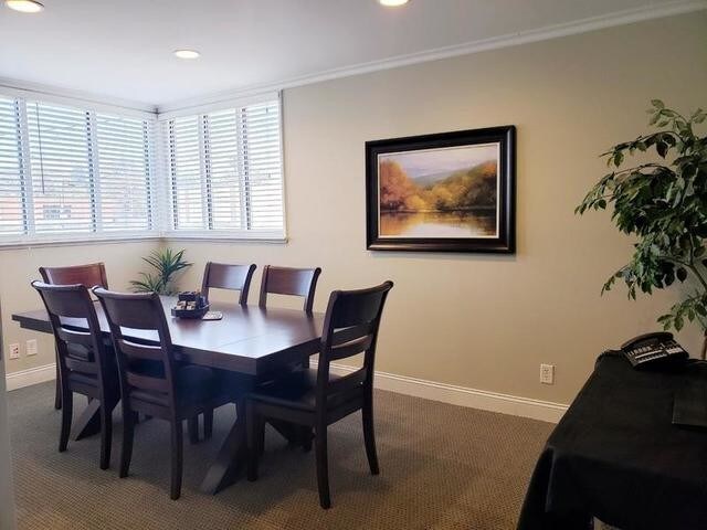
Officebuilding
South Carolina
C3
020.00
B and X Area of moderate flood hazard, usually the area between the limits of the 100-year and 500-year floods.
0.19 AC
2025
West End
2025
Greenville/Spartanburg
000500
NEARBY LISTINGS FOR SALE OR LEASE
DEMOGRAPHICS near 811 Pendleton St
1 mile
3 mile
5 mile
2025 Total Population
14,749
85,559
171,241
2030 Population
16,395
93,199
185,440
Pop Growth 2025-2030
+ 11.16%
+ 8.93%
+ 8.29%
Average Age
39
38
38
2025 Total Households
7,108
36,479
72,529
HH Growth 2025-2030
+ 11.76%
+ 9.36%
+ 8.64%
Median Household Inc
$66,928
$58,045
$60,992
Avg Household Size
2.00
2.20
2.30
2025 Avg HH Vehicles
1.00
2.00
2.00
Median Home Value
$412,500
$360,398
$311,432
Median Year Built
2006
1977
1979
Nearby Places
Map Layers
Map Styles
 Street
 Aerial
Transit
 Traffic
 Biking
Places
Listings with unknown addresses are not visible on the map
- Restaurants
- Banks
- Shops
- Fitness
- Groceries
PUBLIC TRANSPORTATION
COMMUTER RAIL
Greenville Amtrak Station (Crescent - Amtrak)
Drive
Walk
Distance
Greenville Amtrak Station (Crescent - Amtrak)
5 min
1.6 mi
AIRPORT
Greenville Spartanburg International
Drive
Walk
Distance
Greenville Spartanburg International
26 min
15.5 mi
Freight Ports
North Charleston Terminal
Drive
Walk
Distance
North Charleston Terminal
233 min
206.1 mi
SALE & LEASE HISTORY
LISTING DATE
SALE/LEASE

Apr 23, 2019
For Lease
Nearby Properties
Address
Land Use
TOTAL SIZE
Lot Size
Zoning
Address
Land Use
TOTAL SIZE
Lot Size
Zoning
114.75 AC
0D
Address
Land Use
TOTAL SIZE
Lot Size
Zoning
6.30 AC
C3
Address
Land Use
TOTAL SIZE
Lot Size
Zoning
2,945 SF
1.83 AC
S1
Address
Land Use
TOTAL SIZE
Lot Size
Zoning
47.63 AC
R6
Address
Land Use
TOTAL SIZE
Lot Size
Zoning
14.85 AC
S1
Address
Land Use
TOTAL SIZE
Lot Size
Zoning
29.53 AC
RM1
Address
Land Use
TOTAL SIZE
Lot Size
Zoning
123.10 AC
0D
Address
Land Use
TOTAL SIZE
Lot Size
Zoning
0.45 AC
OD
Address
Land Use
TOTAL SIZE
Lot Size
Zoning
20.21 AC
Address
Land Use
TOTAL SIZE
Lot Size
Zoning
11.13 AC
OD
Address
Land Use
TOTAL SIZE
Lot Size
Zoning
1.89 AC
OD
Address
Land Use
TOTAL SIZE
Lot Size
Zoning
14.21 AC
RM2
Address
Land Use
TOTAL SIZE
Lot Size
Zoning
18.65 AC
R6
Address
Land Use
TOTAL SIZE
Lot Size
Zoning
9.91 AC
C3
Address
Land Use
TOTAL SIZE
Lot Size
Zoning
1 AC
C4
Address
Land Use
TOTAL SIZE
Lot Size
Zoning
15 AC
OD
Address
Land Use
TOTAL SIZE
Lot Size
Zoning
0.47 AC
OD
Address
Land Use
TOTAL SIZE
Lot Size
Zoning
9.57 AC
C3
Address
Land Use
TOTAL SIZE
Lot Size
Zoning
20.04 AC
RM
Address
Land Use
TOTAL SIZE
Lot Size
Zoning
6.21 AC
C3
Address
Land Use
TOTAL SIZE
Lot Size
Zoning
6.03 AC
OD
Address
Land Use
TOTAL SIZE
Lot Size
Zoning
1.92 AC
C4
Address
Land Use
TOTAL SIZE
Lot Size
Zoning
Address
Land Use
TOTAL SIZE
Lot Size
Zoning
15.46 AC
Address
Land Use
TOTAL SIZE
Lot Size
Zoning
0.39 AC
C4
Address
Land Use
TOTAL SIZE
Lot Size
Zoning
10.10 AC
RM
Address
Land Use
TOTAL SIZE
Lot Size
Zoning
7.03 AC
OD
Address
Land Use
TOTAL SIZE
Lot Size
Zoning
4.19 AC
C3
Address
Land Use
TOTAL SIZE
Lot Size
Zoning
2.75 AC
RM3
Address
Land Use
TOTAL SIZE
Lot Size
Zoning
3,328 SF
7.61 AC
OD
The World's #1 Commercial Real Estate Marketplace
Connect with us
© 2026 CoStar Group
The information above has been obtained from sources believed reliable. While we do not doubt its accuracy we have not verified it and make no guarantee, warranty or representation about it. It is your responsibility to independently confirm its accuracy and completeness. Any projections, opinions, assumptions, or estimates used are for example only and do not represent the current or future performance of the property. The value of this transaction to you depends on tax and other factors which should be evaluated by your tax, financial, and legal advisors. You and your advisors should conduct a careful, independent investigation of the property to determine to your satisfaction the suitability of the property for your needs.