Property Record
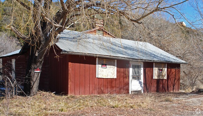
811 Us Highway 82, High Rolls Mountain Park, NM 88325


Property Detail
811 Us Highway 82
Alamogordo, NM
S: 5 T: 16 R: 11 TR IN LTS 13, 20
R027508
OTERO
Realpropertynec
New Mexico
B and X Area of moderate flood hazard, usually the area between the limits of the 100-year and 500-year floods.
13,20
2025
4.85 AC
2025
Las Cruces/Alamogordo
000901
Other Market Areas
1,736 SF
NEARBY LISTINGS FOR SALE OR LEASE
-
-
View all High Rolls Mountain Park listings for sale on LoopNet.com
DEMOGRAPHICS near 811 Us Highway 82
1 mile
3 mile
5 mile
2025 Total Population
358
886
1,667
2030 Population
363
915
1,706
Pop Growth 2025-2030
+ 1.40%
+ 3.27%
+ 2.34%
Average Age
49
48
48
2025 Total Households
152
383
723
HH Growth 2025-2030
+ 1.97%
+ 3.66%
+ 2.49%
Median Household Inc
$73,749
$73,364
$73,004
Avg Household Size
2.20
2.20
2.20
2025 Avg HH Vehicles
2.00
2.00
2.00
Median Home Value
$290,908
$275,780
$259,848
Median Year Built
1989
1987
1986
Nearby Places
Map Layers
Map Styles
 Street
 Aerial
Layers
 Traffic
 Biking
Places
Listings with unknown addresses are not visible on the map
- Restaurants
- Banks
- Shops
- Fitness
- Groceries
Nearby Properties
Address
Land Use
TOTAL SIZE
Lot Size
Zoning
Address
Land Use
TOTAL SIZE
Lot Size
Zoning
15,177.20 AC
Address
Land Use
TOTAL SIZE
Lot Size
Zoning
4,275 SF
0.83 AC
Address
Land Use
TOTAL SIZE
Lot Size
Zoning
6,000 SF
0.50 AC
Address
Land Use
TOTAL SIZE
Lot Size
Zoning
16,950 SF
42.18 AC
Address
Land Use
TOTAL SIZE
Lot Size
Zoning
4,188 SF
1.14 AC
Address
Land Use
TOTAL SIZE
Lot Size
Zoning
960 SF
1.05 AC
Address
Land Use
TOTAL SIZE
Lot Size
Zoning
5,865 SF
27.71 AC
Address
Land Use
TOTAL SIZE
Lot Size
Zoning
2,671 SF
0.54 AC
Address
Land Use
TOTAL SIZE
Lot Size
Zoning
6,240 SF
2 AC
Address
Land Use
TOTAL SIZE
Lot Size
Zoning
888 SF
6.20 AC
Address
Land Use
TOTAL SIZE
Lot Size
Zoning
894 SF
9.52 AC
Address
Land Use
TOTAL SIZE
Lot Size
Zoning
Address
Land Use
TOTAL SIZE
Lot Size
Zoning
1,860 SF
0.46 AC
Address
Land Use
TOTAL SIZE
Lot Size
Zoning
5,470 SF
0.53 AC
Address
Land Use
TOTAL SIZE
Lot Size
Zoning
9,188 SF
0.50 AC
Address
Land Use
TOTAL SIZE
Lot Size
Zoning
180 SF
10.13 AC
Address
Land Use
TOTAL SIZE
Lot Size
Zoning
4,800 SF
0.53 AC
Address
Land Use
TOTAL SIZE
Lot Size
Zoning
1,188 SF
2.66 AC
Address
Land Use
TOTAL SIZE
Lot Size
Zoning
312 SF
36 AC
Address
Land Use
TOTAL SIZE
Lot Size
Zoning
Address
Land Use
TOTAL SIZE
Lot Size
Zoning
3,495 SF
7.19 AC
Address
Land Use
TOTAL SIZE
Lot Size
Zoning
1,040 SF
2.47 AC
Address
Land Use
TOTAL SIZE
Lot Size
Zoning
1,200 SF
0.81 AC
Address
Land Use
TOTAL SIZE
Lot Size
Zoning
1,516 SF
3.90 AC
Address
Land Use
TOTAL SIZE
Lot Size
Zoning
2,904 SF
0.30 AC
Address
Land Use
TOTAL SIZE
Lot Size
Zoning
2,080 SF
2.88 AC
Address
Land Use
TOTAL SIZE
Lot Size
Zoning
2,100 SF
0.30 AC
Address
Land Use
TOTAL SIZE
Lot Size
Zoning
864 SF
6.69 AC
Address
Land Use
TOTAL SIZE
Lot Size
Zoning
100 SF
1.30 AC
The World's #1 Commercial Real Estate Marketplace
Connect with us
© 2026 CoStar Group
The information above has been obtained from sources believed reliable. While we do not doubt its accuracy we have not verified it and make no guarantee, warranty or representation about it. It is your responsibility to independently confirm its accuracy and completeness. Any projections, opinions, assumptions, or estimates used are for example only and do not represent the current or future performance of the property. The value of this transaction to you depends on tax and other factors which should be evaluated by your tax, financial, and legal advisors. You and your advisors should conduct a careful, independent investigation of the property to determine to your satisfaction the suitability of the property for your needs.